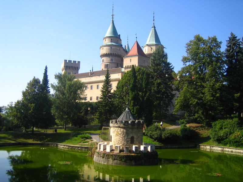
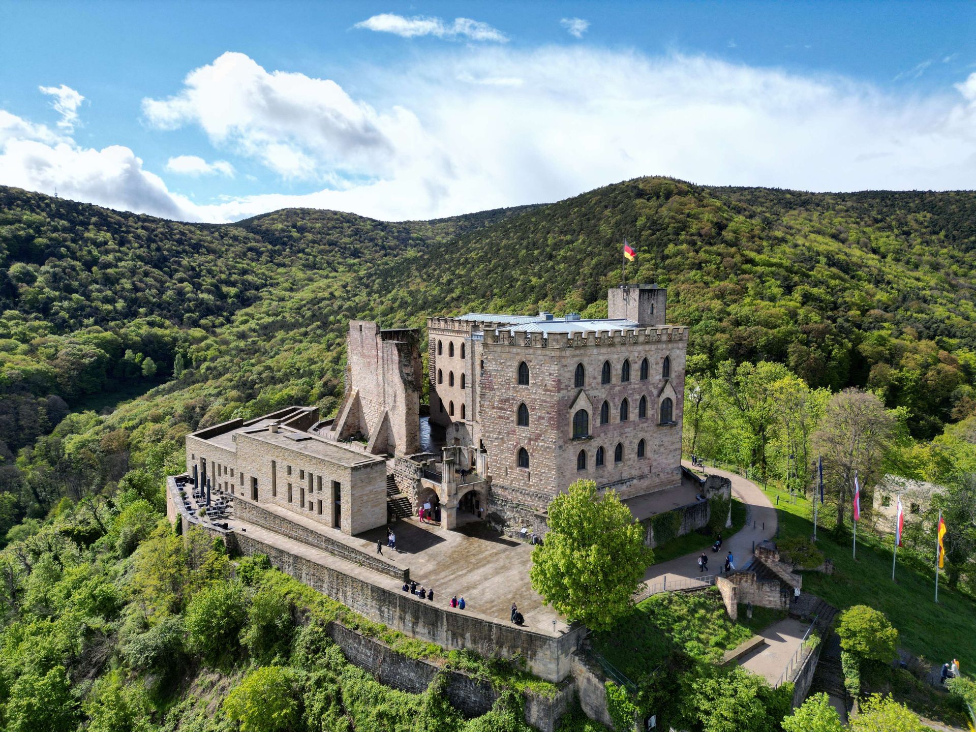
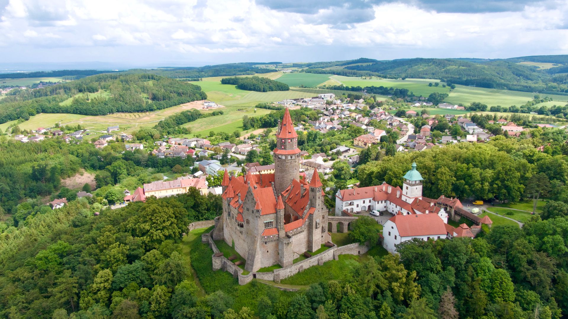
@Heritage Places, Castles & Architecture
18-Jul-2026 12 am
18-Jul-2026 12 am
This article uses text information from the Wikipedia article – Hambach_Castle – [Wikipedia-Article-Link: https://en.wikipedia.org/wiki/Hambach_Castle ] which is released under the -- Creative Commons Attribution-ShareAlike 4.0 License – [License-Link: https://creativecommons.org/licenses/by-sa/4.0/deed.en ( https://en.wikipedia.org/wiki/Wikipedia:Text_of_the_Creative_Commons_Attribution-ShareAlike_4.0_International_License )] and additional terms may apply. [List of Principal Authors (5 or less) of the Wikipedia-Article on the date of this Article being Created in this Website: - Wiki-SZ, Morningstar1814, Hugh16, 91.3.70.1, Lmao222] [Use the following Authorship tool to find out the author contributions:- https://xtools.wmcloud.org/authorship ] [The Current Article on this Website has been paraphrased from the above linked corresponding Wikipedia-Article and You may redistribute this, verbatim or modified, provided that you comply with the terms of the Creative Commons Attribution-ShareAlike 4.0 License] [License-Link: https://creativecommons.org/licenses/by-sa/4.0/deed.en ( https://en.wikipedia.org/wiki/Wikipedia:Text_of_the_Creative_Commons_Attribution-ShareAlike_4.0_International_License )]
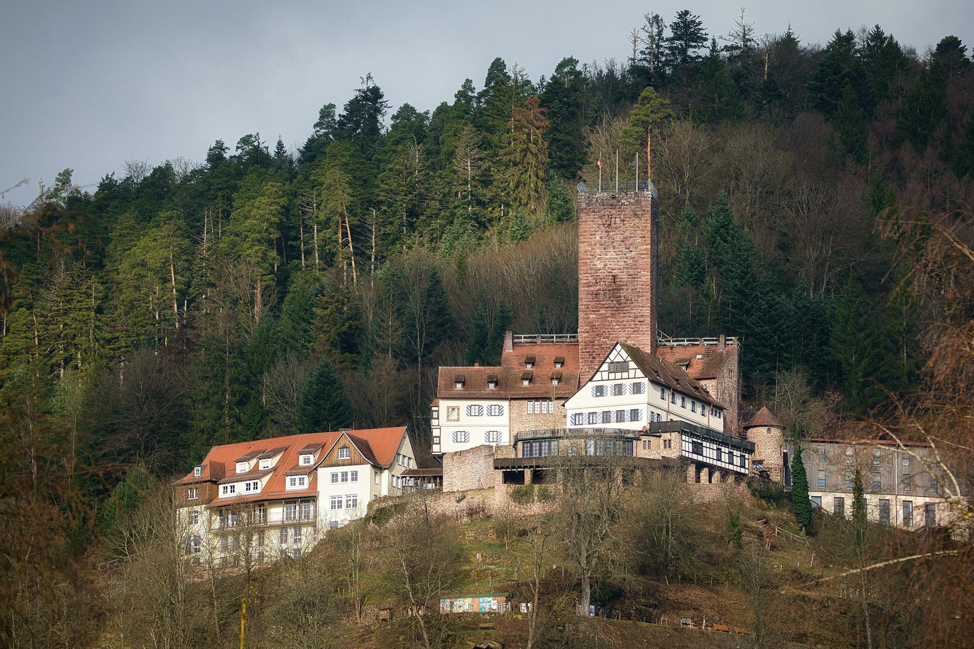
[Image: Explore the historic Hambach Castle set against a lush, scenic landscape in Germany; Image-Author: Reinhard Bruckner] [Image-Source-Link: https://www.pexels.com/photo/hambacher-schloss-27664462/ ] [License-Link: https://www.pexels.com/license/ ] [Please Also Relate to Original Individual Text and Image URLs for More Usage Property and Sharing, Remixing or Attributing the Contents] [Contents on Wikipedia is covered by – Disclaimer – [Wikipedia-Disclaimer-Link: https://en.wikipedia.org/wiki/Wikipedia:General_disclaimer ]] [Contents in this Website is also covered by Disclaimer linked at the bottom of the Page] [This website article means no intellectual appropriation by any way and only wishes to contribute in sharing of knowledge]
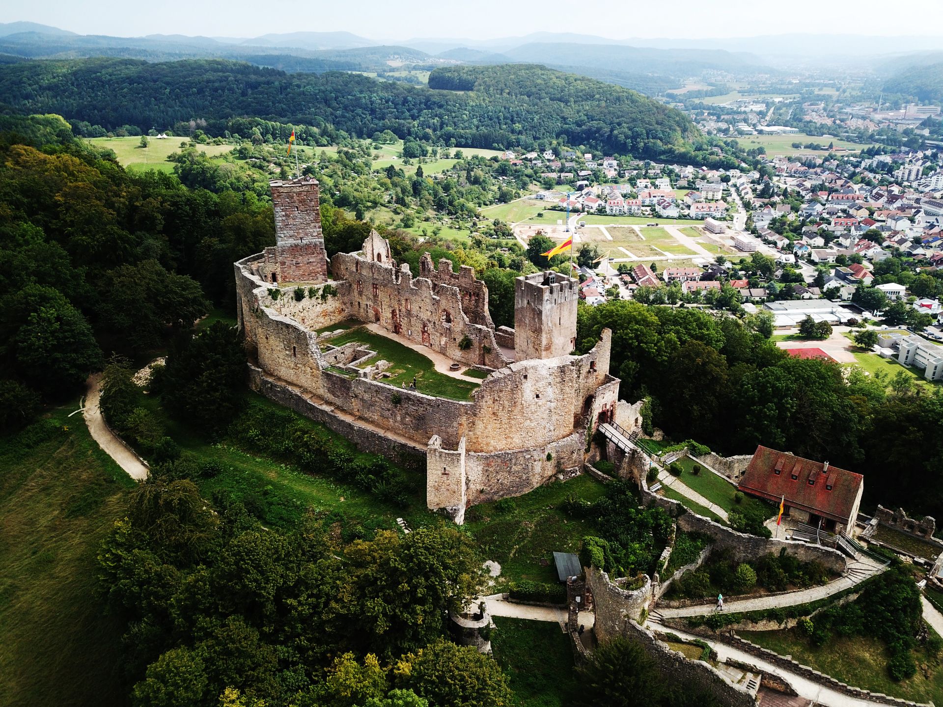
@Heritage Places, Castles & Architecture
16-Jul-2026 06 pm
16-Jul-2026 06 pm
This article uses text information from the Wikipedia article – Rötteln_Castle – [Wikipedia-Article-Link: https://en.wikipedia.org/wiki/R%C3%B6tteln_Castle ] which is released under the -- Creative Commons Attribution-ShareAlike 4.0 License – [License-Link: https://creativecommons.org/licenses/by-sa/4.0/deed.en ( https://en.wikipedia.org/wiki/Wikipedia:Text_of_the_Creative_Commons_Attribution-ShareAlike_4.0_International_License )] and additional terms may apply. [List of Principal Authors (5 or less) of the Wikipedia-Article on the date of this Article being Created in this Website: - Zieglhar, TeIemachos, Amwyll Rwden, PopularOutcast, Codrinb] [Use the following Authorship tool to find out the author contributions:- https://xtools.wmcloud.org/authorship ] [The Current Article on this Website has been paraphrased from the above linked corresponding Wikipedia-Article and You may redistribute this, verbatim or modified, provided that you comply with the terms of the Creative Commons Attribution-ShareAlike 4.0 License] [License-Link: https://creativecommons.org/licenses/by-sa/4.0/deed.en ( https://en.wikipedia.org/wiki/Wikipedia:Text_of_the_Creative_Commons_Attribution-ShareAlike_4.0_International_License )]
[Image: Explore the stunning aerial view of Lörrach Castle ruins with scenic green landscapes; Image-Author: Peter Huber] [Image-Source-Link: https://www.pexels.com/photo/aerial-view-of-castle-surrounded-by-green-trees-11384863/ ] [License-Link: https://www.pexels.com/license/ ] [Please Also Relate to Original Individual Text and Image URLs for More Usage Property and Sharing, Remixing or Attributing the Contents] [Contents on Wikipedia is covered by – Disclaimer – [Wikipedia-Disclaimer-Link: https://en.wikipedia.org/wiki/Wikipedia:General_disclaimer ]] [Contents in this Website is also covered by Disclaimer linked at the bottom of the Page] [This website article means no intellectual appropriation by any way and only wishes to contribute in sharing of knowledge]
@Heritage Places, Castles & Architecture
15-Jul-2026 05 pm
15-Jul-2026 05 pm
This article uses text information from the Wikipedia article – Bouzov_Castle – [Wikipedia-Article-Link: https://en.wikipedia.org/wiki/Bouzov_Castle ] which is released under the -- Creative Commons Attribution-ShareAlike 4.0 License – [License-Link: https://creativecommons.org/licenses/by-sa/4.0/deed.en ( https://en.wikipedia.org/wiki/Wikipedia:Text_of_the_Creative_Commons_Attribution-ShareAlike_4.0_International_License )] and additional terms may apply. [List of Principal Authors (5 or less) of the Wikipedia-Article on the date of this Article being Created in this Website: - Krenakarore, FromCzech, Jllm06, 178.221.222.142, Ekem] [Use the following Authorship tool to find out the author contributions:- https://xtools.wmcloud.org/authorship ] [The Current Article on this Website has been paraphrased from the above linked corresponding Wikipedia-Article and You may redistribute this, verbatim or modified, provided that you comply with the terms of the Creative Commons Attribution-ShareAlike 4.0 License] [License-Link: https://creativecommons.org/licenses/by-sa/4.0/deed.en ( https://en.wikipedia.org/wiki/Wikipedia:Text_of_the_Creative_Commons_Attribution-ShareAlike_4.0_International_License )]
[Image: Explore the picturesque aerial view of historic Bouzov Castle surrounded by lush countryside in the Czech Republic; Image-Author: Erico Felliny] [Image-Source-Link: https://www.pexels.com/photo/aerial-view-of-the-castle-on-a-hill-above-the-village-of-bouzov-in-the-czech-republic-25451594/ ] [License-Link: https://www.pexels.com/license/ ] [Please Also Relate to Original Individual Text and Image URLs for More Usage Property and Sharing, Remixing or Attributing the Contents] [Contents on Wikipedia is covered by – Disclaimer – [Wikipedia-Disclaimer-Link: https://en.wikipedia.org/wiki/Wikipedia:General_disclaimer ]] [Contents in this Website is also covered by Disclaimer linked at the bottom of the Page] [This website article means no intellectual appropriation by any way and only wishes to contribute in sharing of knowledge]
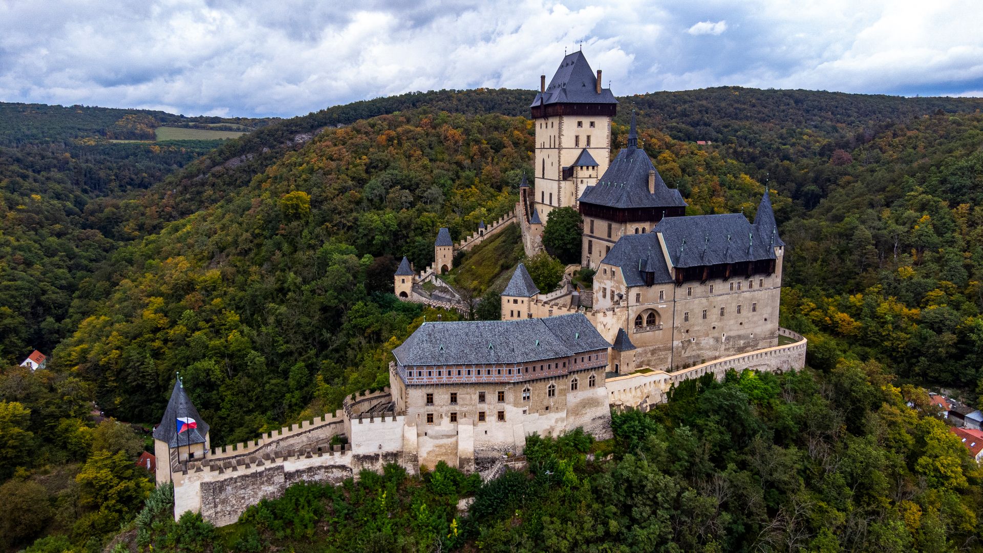
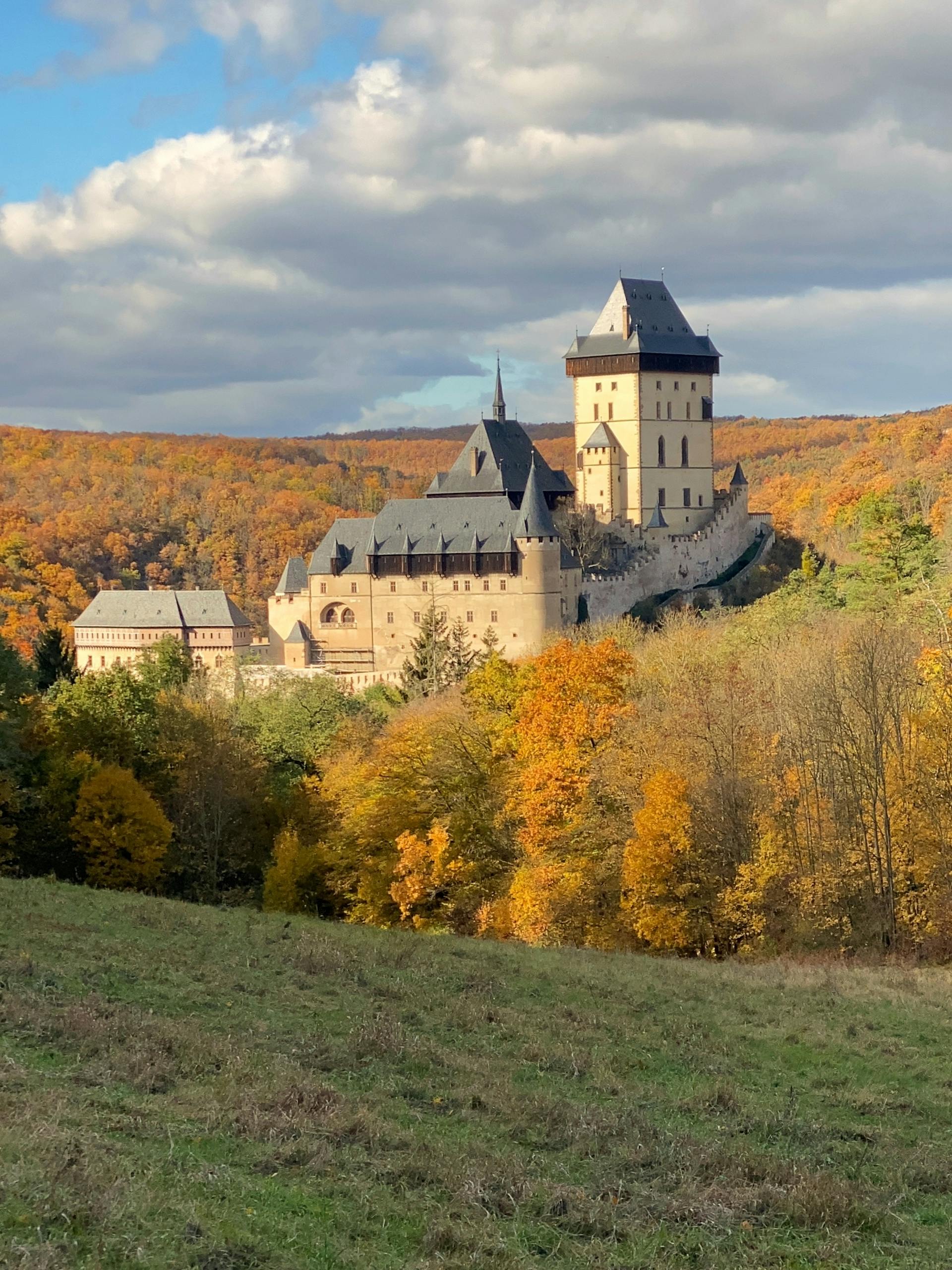
@Heritage Places, Castles & Architecture
14-Jul-2026 01 am
14-Jul-2026 01 am
This article uses text information from the Wikipedia article – Karlštejn – [Wikipedia-Article-Link: https://en.wikipedia.org/wiki/Karl%C5%A1tejn ] which is released under the -- Creative Commons Attribution-ShareAlike 4.0 License – [License-Link: https://creativecommons.org/licenses/by-sa/4.0/deed.en ( https://en.wikipedia.org/wiki/Wikipedia:Text_of_the_Creative_Commons_Attribution-ShareAlike_4.0_International_License )] and additional terms may apply. [List of Principal Authors (5 or less) of the Wikipedia-Article on the date of this Article being Created in this Website: - Krenakarore, Matthead, FromCzech, Revirvlkodlaku, Scope creep] [Use the following Authorship tool to find out the author contributions:- https://xtools.wmcloud.org/authorship ] [The Current Article on this Website has been paraphrased from the above linked corresponding Wikipedia-Article and You may redistribute this, verbatim or modified, provided that you comply with the terms of the Creative Commons Attribution-ShareAlike 4.0 License] [License-Link: https://creativecommons.org/licenses/by-sa/4.0/deed.en ( https://en.wikipedia.org/wiki/Wikipedia:Text_of_the_Creative_Commons_Attribution-ShareAlike_4.0_International_License )]
[Image: Stunning aerial photograph of Karlštejn Castle surrounded by lush forests in Czechia; Image-Author: Frank van Dijk] [Image-Source-Link: https://www.pexels.com/photo/aerial-view-of-historic-karlstejn-castle-in-czechia-37918876/ ] [License-Link: https://www.pexels.com/license/ ] [Please Also Relate to Original Individual Text and Image URLs for More Usage Property and Sharing, Remixing or Attributing the Contents] [Contents on Wikipedia is covered by – Disclaimer – [Wikipedia-Disclaimer-Link: https://en.wikipedia.org/wiki/Wikipedia:General_disclaimer ] [Contents in this Website is also covered by Disclaimer linked at the bottom of the Page] [This website article means no intellectual appropriation by any way and only wishes to contribute in sharing of knowledge]
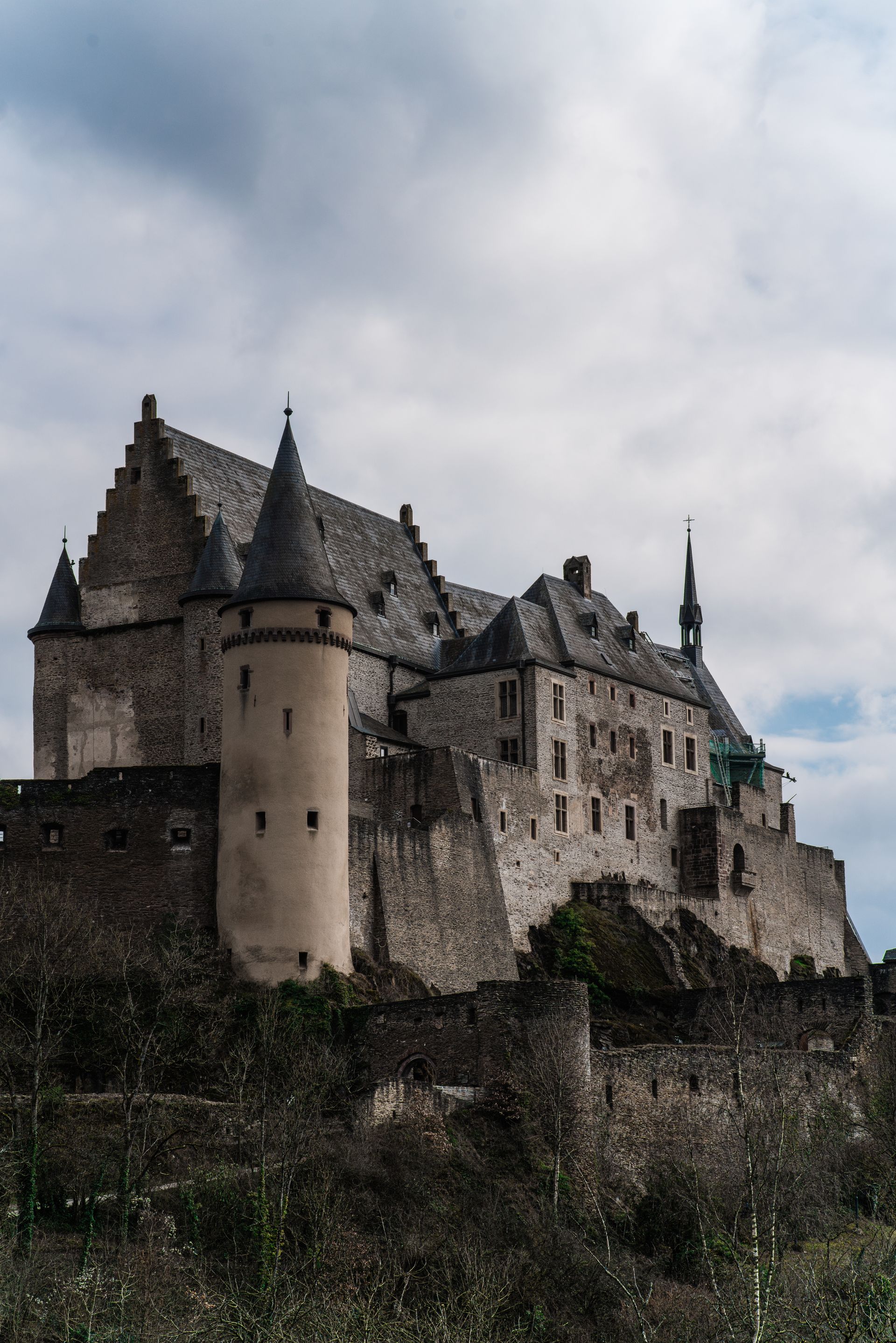
@Heritage Places, Castles & Architecture
11-Jul-2026 03 am
11-Jul-2026 03 am
This article uses text information from the Wikipedia article – Vianden_Castle – [Wikipedia-Article-Link: https://en.wikipedia.org/wiki/Vianden_Castle ] which is released under the -- Creative Commons Attribution-ShareAlike 4.0 License – [License-Link: https://creativecommons.org/licenses/by-sa/4.0/deed.en ( https://en.wikipedia.org/wiki/Wikipedia:Text_of_the_Creative_Commons_Attribution-ShareAlike_4.0_International_License )] and additional terms may apply. [List of Principal Authors (5 or less) of the Wikipedia-Article on the date of this Article being Created in this Website: - Ipigott, Ckoerper, Ilovetotravel12345, Andreas Kaganov, Ymblanter] [Use the following Authorship tool to find out the author contributions:- https://xtools.wmcloud.org/authorship ] [The Current Article on this Website has been paraphrased from the above linked corresponding Wikipedia-Article and You may redistribute this, verbatim or modified, provided that you comply with the terms of the Creative Commons Attribution-ShareAlike 4.0 License] [License-Link: https://creativecommons.org/licenses/by-sa/4.0/deed.en ( https://en.wikipedia.org/wiki/Wikipedia:Text_of_the_Creative_Commons_Attribution-ShareAlike_4.0_International_License )]
[Image: Explore the historic Vianden Castle in Luxembourg framed by a cloudy sky. Perfect for travel enthusiasts; Image-Author: KNKO Photography] [Image-Source-Link: https://www.pexels.com/photo/exterior-of-a-castle-18705895/ ] [License-Link: https://www.pexels.com/license/ ] [Please Also Relate to Original Individual Text and Image URLs for More Usage Property and Sharing, Remixing or Attributing the Contents] [Contents on Wikipedia is covered by – Disclaimer – [Wikipedia-Disclaimer-Link: https://en.wikipedia.org/wiki/Wikipedia:General_disclaimer ] [Contents in this Website is also covered by Disclaimer linked at the bottom of the Page] [This website article means no intellectual appropriation by any way and only wishes to contribute in sharing of knowledge]
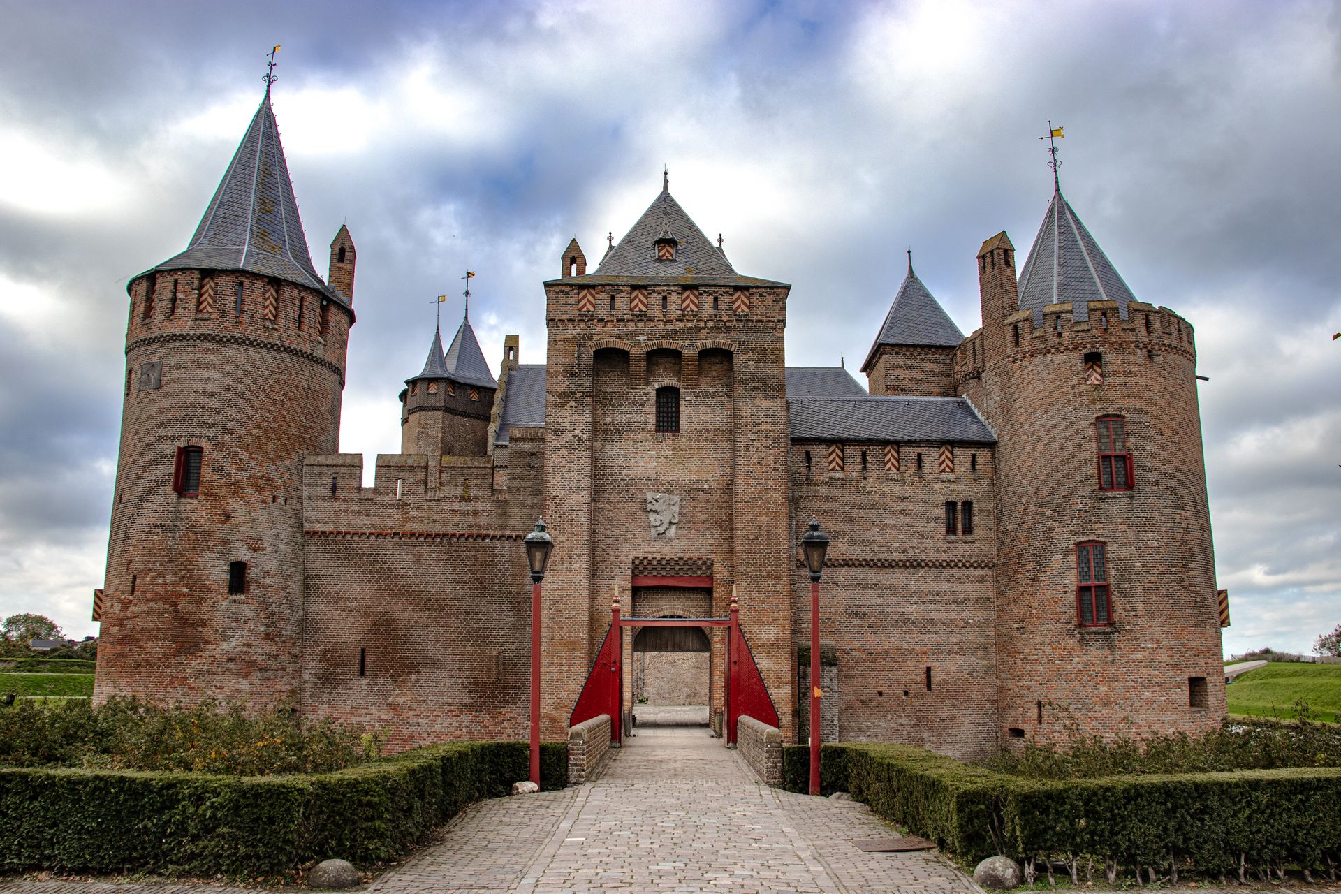
@Heritage Places, Castles & Architecture
07-Jul-2026 12 pm
07-Jul-2026 12 pm
This article uses text information from the Wikipedia article – Muiden_Castle – [Wikipedia-Article-Link: https://en.wikipedia.org/wiki/Muiden_Castle ] which is released under the -- Creative Commons Attribution-ShareAlike 4.0 License – [License-Link: https://creativecommons.org/licenses/by-sa/4.0/deed.en ( https://en.wikipedia.org/wiki/Wikipedia:Text_of_the_Creative_Commons_Attribution-ShareAlike_4.0_International_License )] and additional terms may apply. [List of Principal Authors (5 or less) of the Wikipedia-Article on the date of this Article being Created in this Website: - 213.84.67.163, Black Orchid, AnnekeBart, Wwikix, P199] [Use the following Authorship tool to find out the author contributions:- https://xtools.wmcloud.org/authorship ] [The Current Article on this Website has been paraphrased from the above linked corresponding Wikipedia-Article and You may redistribute this, verbatim or modified, provided that you comply with the terms of the Creative Commons Attribution-ShareAlike 4.0 License] [License-Link: https://creativecommons.org/licenses/by-sa/4.0/deed.en ( https://en.wikipedia.org/wiki/Wikipedia:Text_of_the_Creative_Commons_Attribution-ShareAlike_4.0_International_License )]
[Image: Explore the grandeur of the gothic architecture of the Muiden Castle in Muiden, Netherlands. A stunning medieval landmark (Image-description is paraphrased from original); Image-Author: Julien GAROT] [Image-Source-Link: https://www.pexels.com/photo/muiden-castle-in-netherlands-14622281/ ] [License-Link: https://www.pexels.com/license/ ] [Please Also Relate to Original Individual Text and Image URLs for More Usage Property and Sharing, Remixing or Attributing the Contents] [Contents on Wikipedia is covered by – Disclaimer – [Wikipedia-Disclaimer-Link: https://en.wikipedia.org/wiki/Wikipedia:General_disclaimer ] [Contents in this Website is also covered by Disclaimer linked at the bottom of the Page] [This website article means no intellectual appropriation by any way and only wishes to contribute in sharing of knowledge]
@Heritage Places, Castles & Architecture
04-Jul-2026 03 pm
04-Jul-2026 03 pm
This article uses text information from the Wikipedia article – Xativa_Castle – [Wikipedia-Article-Link: https://en.wikipedia.org/wiki/Xativa_Castle ] which is released under the -- Creative Commons Attribution-ShareAlike 4.0 License – [License-Link: https://creativecommons.org/licenses/by-sa/4.0/deed.en ( https://en.wikipedia.org/wiki/Wikipedia:Text_of_the_Creative_Commons_Attribution-ShareAlike_4.0_International_License )] and additional terms may apply. [List of Principal Authors (5 or less) of the Wikipedia-Article on the date of this Article being Created in this Website: - Emael Khan, Jaimeoa, Simon Burchell, 67.69.69.171, D6] [Use the following Authorship tool to find out the author contributions:- https://xtools.wmcloud.org/authorship ] [The Current Article on this Website has been paraphrased from the above linked corresponding Wikipedia-Article and You may redistribute this, verbatim or modified, provided that you comply with the terms of the Creative Commons Attribution-ShareAlike 4.0 License] [License-Link: https://creativecommons.org/licenses/by-sa/4.0/deed.en ( https://en.wikipedia.org/wiki/Wikipedia:Text_of_the_Creative_Commons_Attribution-ShareAlike_4.0_International_License )]
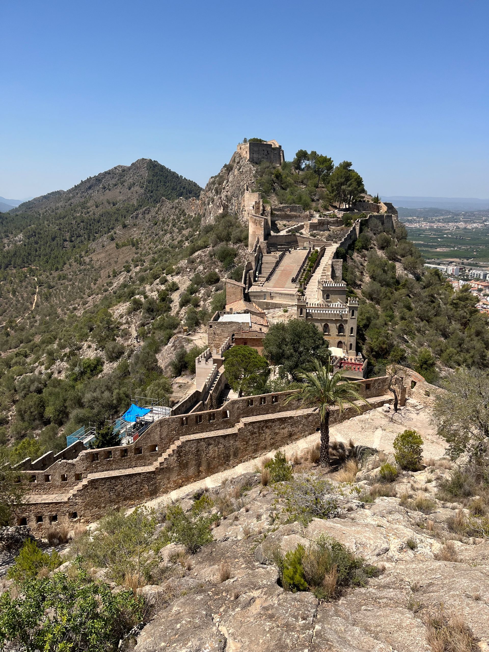
[Image: Explore the ancient Xàtiva Castle perched on a hill in Spain, showcasing historic fortifications and scenic landscapes; Image-Author: Isabelle K.] [Image-Source-Link: https://www.pexels.com/photo/the-castle-on-top-of-a-mountain-with-a-pool-27522922/ ] [License-Link: https://www.pexels.com/license/ ] [Please Also Relate to Original Individual Text and Image URLs for More Usage Property and Sharing, Remixing or Attributing the Contents] [Contents on Wikipedia is covered by – Disclaimer – [Wikipedia-Disclaimer-Link: https://en.wikipedia.org/wiki/Wikipedia:General_disclaimer ] [Contents in this Website is also covered by Disclaimer linked at the bottom of the Page] [This website article means no intellectual appropriation by any way and only wishes to contribute in sharing of knowledge]
@Heritage Places, Castles & Architecture
01-Jul-2026 09 am
01-Jul-2026 09 am
This article uses text information from the Wikipedia article – Château_de_Chaumont – [Wikipedia-Article-Link: https://en.wikipedia.org/wiki/Ch%C3%A2teau_de_Chaumont ] which is released under the -- Creative Commons Attribution-ShareAlike 4.0 License – [License-Link: https://creativecommons.org/licenses/by-sa/4.0/deed.en ( https://en.wikipedia.org/wiki/Wikipedia:Text_of_the_Creative_Commons_Attribution-ShareAlike_4.0_International_License )] and additional terms may apply. [List of Principal Authors (5 or less) of the Wikipedia-Article on the date of this Article being Created in this Website: - Wetman, Nev1, Garnet1106, Bohemian Baltimore, Bpierreb] [Use the following Authorship tool to find out the author contributions:- https://xtools.wmcloud.org/authorship ] [The Current Article on this Website has been paraphrased from the above linked corresponding Wikipedia-Article and You may redistribute this, verbatim or modified, provided that you comply with the terms of the Creative Commons Attribution-ShareAlike 4.0 License] [License-Link: https://creativecommons.org/licenses/by-sa/4.0/deed.en ( https://en.wikipedia.org/wiki/Wikipedia:Text_of_the_Creative_Commons_Attribution-ShareAlike_4.0_International_License )]
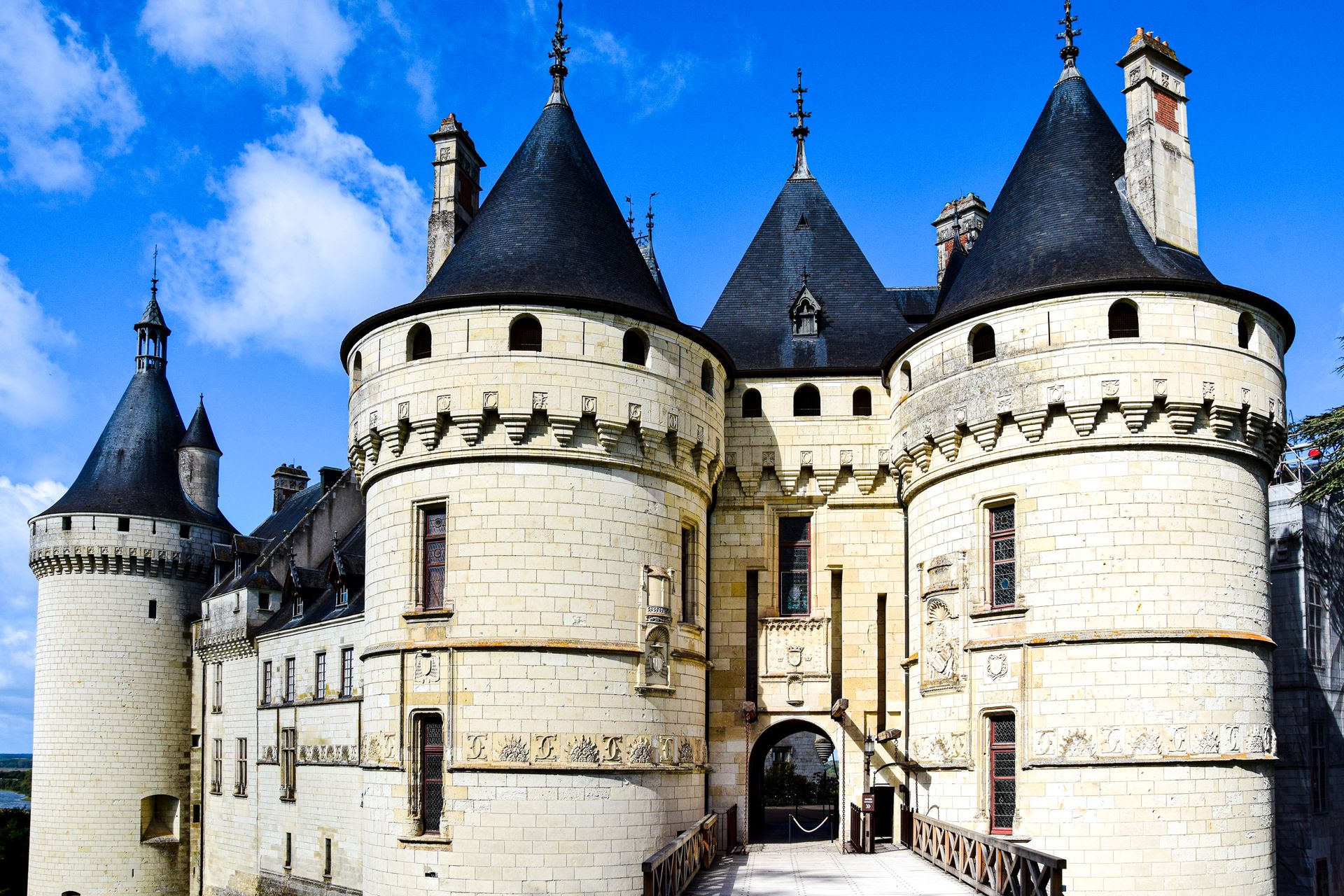
[Image: Explore the grandeur of Château de Chaumont, a renaissance castle in France, Loire Valley; Image-Author: AXP Photography] [Image-Source-Link: https://www.pexels.com/photo/gate-of-chateau-de-chenonceau-in-loire-valley-19136626/ ] [License-Link: https://www.pexels.com/license/ ] [Please Also Relate to Original Individual Text and Image URLs for More Usage Property and Sharing, Remixing or Attributing the Contents] [Contents on Wikipedia is covered by – Disclaimer – [Wikipedia-Disclaimer-Link: https://en.wikipedia.org/wiki/Wikipedia:General_disclaimer ] [Contents in this Website is also covered by Disclaimer linked at the bottom of the Page] [This website article means no intellectual appropriation by any way and only wishes to contribute in sharing of knowledge]
@Heritage Places, Castles & Architecture
30-Jun-2026 06 am
30-Jun-2026 06 am
This article uses text information from the Wikipedia article – Heidelberg_Castle – [Wikipedia-Article-Link: https://en.wikipedia.org/wiki/Heidelberg_Castle ] which is released under the -- Creative Commons Attribution-ShareAlike 4.0 License – [License-Link: https://creativecommons.org/licenses/by-sa/4.0/deed.en ( https://en.wikipedia.org/wiki/Wikipedia:Text_of_the_Creative_Commons_Attribution-ShareAlike_4.0_International_License )] and additional terms may apply. [List of Principal Authors (5 or less) of the Wikipedia-Article on the date of this Article being Created in this Website: - Rasolated, Gnasher72, Wikid77, Hedgehog33, 87.165.235.223] [Use the following Authorship tool to find out the author contributions:- https://xtools.wmcloud.org/authorship ] [The Current Article on this Website has been paraphrased from the above linked corresponding Wikipedia-Article and You may redistribute this, verbatim or modified, provided that you comply with the terms of the Creative Commons Attribution-ShareAlike 4.0 License] [License-Link: https://creativecommons.org/licenses/by-sa/4.0/deed.en ( https://en.wikipedia.org/wiki/Wikipedia:Text_of_the_Creative_Commons_Attribution-ShareAlike_4.0_International_License )]
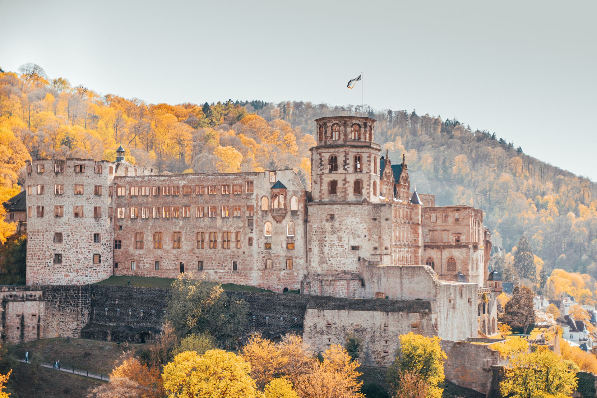
[Image: Scenic view of Heidelberg Castle surrounded by vibrant autumn foliage on a sunny day; Image-Author: Antonio Di Giacomo] [Image-Source-Link: https://www.pexels.com/photo/ruined-old-castle-on-a-hill-at-autumn-8164638/ ] [License-Link: https://www.pexels.com/license/ ] [Please Also Relate to Original Individual Text and Image URLs for More Usage Property and Sharing, Remixing or Attributing the Contents] [Contents on Wikipedia is covered by – Disclaimer – [Wikipedia-Disclaimer-Link: https://en.wikipedia.org/wiki/Wikipedia:General_disclaimer ] [Contents in this Website is also covered by Disclaimer linked at the bottom of the Page] [This website article means no intellectual appropriation by any way and only wishes to contribute in sharing of knowledge]
@Heritage Places, Castles & Architecture
28-Jun-2026 06 am
28-Jun-2026 06 am
This article uses text information from the Wikipedia article – Hluboká_Castle – [Wikipedia-Article-Link: https://en.wikipedia.org/wiki/Hlubok%C3%A1_Castle ] which is released under the -- Creative Commons Attribution-ShareAlike 4.0 License – [License-Link: https://creativecommons.org/licenses/by-sa/4.0/deed.en ( https://en.wikipedia.org/wiki/Wikipedia:Text_of_the_Creative_Commons_Attribution-ShareAlike_4.0_International_License )] and additional terms may apply. [List of Principal Authors (5 or less) of the Wikipedia-Article on the date of this Article being Created in this Website: - FromCzech, Etrielle, ~2026-16198-9, Anon lynx, Blairall] [Use the following Authorship tool to find out the author contributions:- https://xtools.wmcloud.org/authorship ] [The Current Article on this Website has been paraphrased from the above linked corresponding Wikipedia-Article and You may redistribute this, verbatim or modified, provided that you comply with the terms of the Creative Commons Attribution-ShareAlike 4.0 License] [License-Link: https://creativecommons.org/licenses/by-sa/4.0/deed.en ( https://en.wikipedia.org/wiki/Wikipedia:Text_of_the_Creative_Commons_Attribution-ShareAlike_4.0_International_License )]
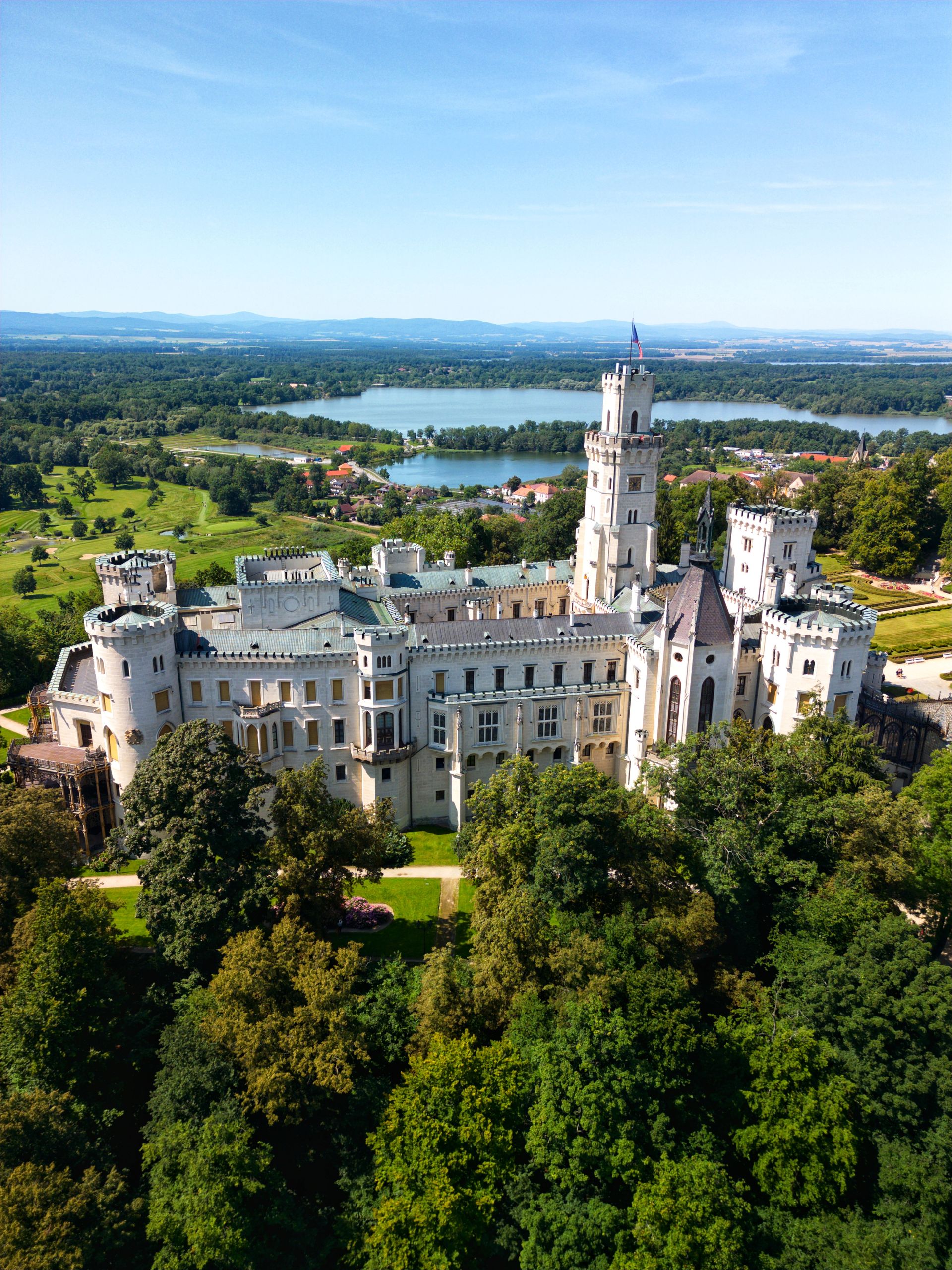
[Image: Stunning aerial shot of Hluboká Castle surrounded by lush greenery and a serene lake; Image-Author: Martin Škeřík] [Image-Source-Link: https://www.pexels.com/photo/aerial-view-of-majestic-hluboka-castle-in-summer-33370241/ ] [License-Link: https://www.pexels.com/license/ ] [Please Also Relate to Original Individual Text and Image URLs for More Usage Property and Sharing, Remixing or Attributing the Contents] [Contents on Wikipedia is covered by – Disclaimer – [Wikipedia-Disclaimer-Link: https://en.wikipedia.org/wiki/Wikipedia:General_disclaimer ] [Contents in this Website is also covered by Disclaimer linked at the bottom of the Page] [This website article means no intellectual appropriation by any way and only wishes to contribute in sharing of knowledge]
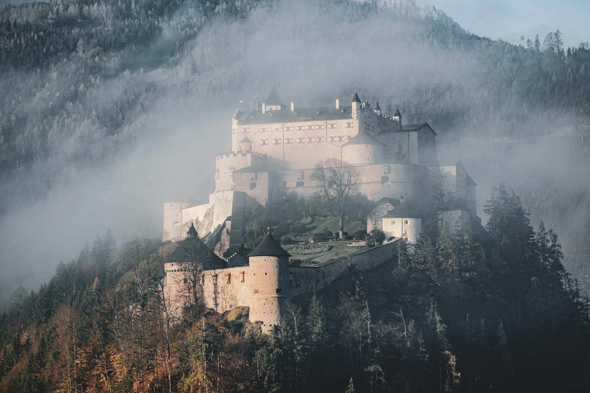
@Heritage Places, Castles & Architecture
25-Jun-2026 03 am
25-Jun-2026 03 am
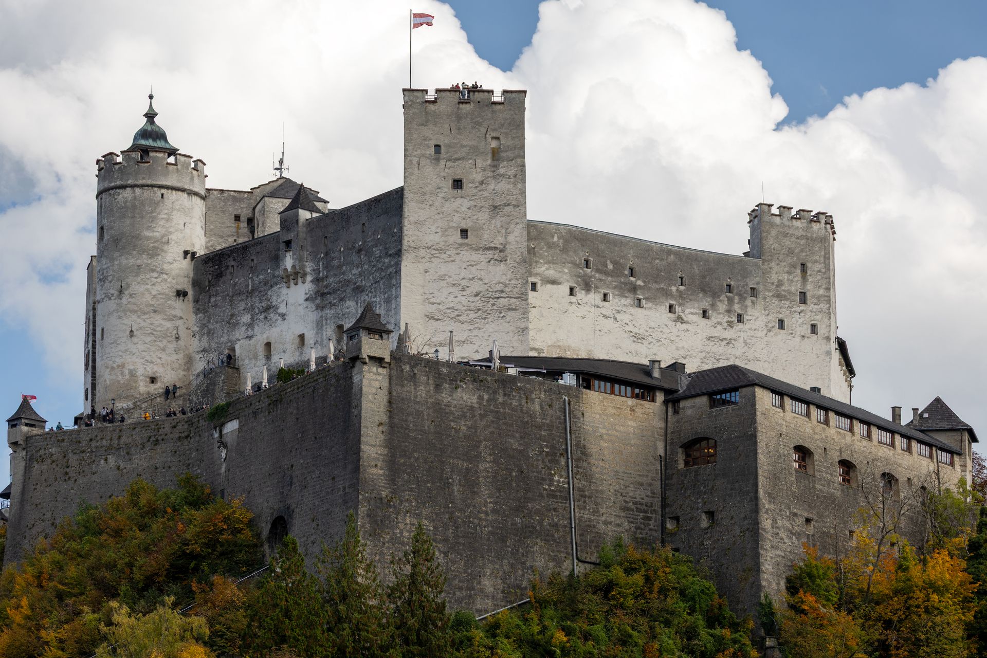
This article uses text information from the Wikipedia article – Hohensalzburg_Fortress – [Wikipedia-Article-Link: https://en.wikipedia.org/wiki/Hohensalzburg_Fortress ] which is released under the -- Creative Commons Attribution-ShareAlike 4.0 License – [License-Link: https://creativecommons.org/licenses/by-sa/4.0/deed.en ( https://en.wikipedia.org/wiki/Wikipedia:Text_of_the_Creative_Commons_Attribution-ShareAlike_4.0_International_License )] and additional terms may apply. [List of Principal Authors (5 or less) of the Wikipedia-Article on the date of this Article being Created in this Website: - ~Gryffindor, Akubra, 92.225.121.58, Starbois, MeliskaM] [Use the following Authorship tool to find out the author contributions:- https://xtools.wmcloud.org/authorship ] [The Current Article on this Website has been paraphrased from the above linked corresponding Wikipedia-Article and You may redistribute this, verbatim or modified, provided that you comply with the terms of the Creative Commons Attribution-ShareAlike 4.0 License] [License-Link: https://creativecommons.org/licenses/by-sa/4.0/deed.en ( https://en.wikipedia.org/wiki/Wikipedia:Text_of_the_Creative_Commons_Attribution-ShareAlike_4.0_International_License )]
[Image: Majestic Hohensalzburg Castle in Salzburg, surrounded by colorful autumn foliage; Image-Author: Alan Kabeš] [Image-Source-Link: https://www.pexels.com/photo/hohensalzburg-castle-in-autumn-salzburg-36499969/ ] [License-Link: https://www.pexels.com/license/ ] [Please Also Relate to Original Individual Text and Image URLs for More Usage Property and Sharing, Remixing or Attributing the Contents] [Contents on Wikipedia is covered by – Disclaimer – [Wikipedia-Disclaimer-Link: https://en.wikipedia.org/wiki/Wikipedia:General_disclaimer ] [Contents in this Website is also covered by Disclaimer linked at the bottom of the Page] [This website article means no intellectual appropriation by any way and only wishes to contribute in sharing of knowledge]
@Heritage Places, Castles & Architecture
24-Jun-2026 04 am
24-Jun-2026 04 am
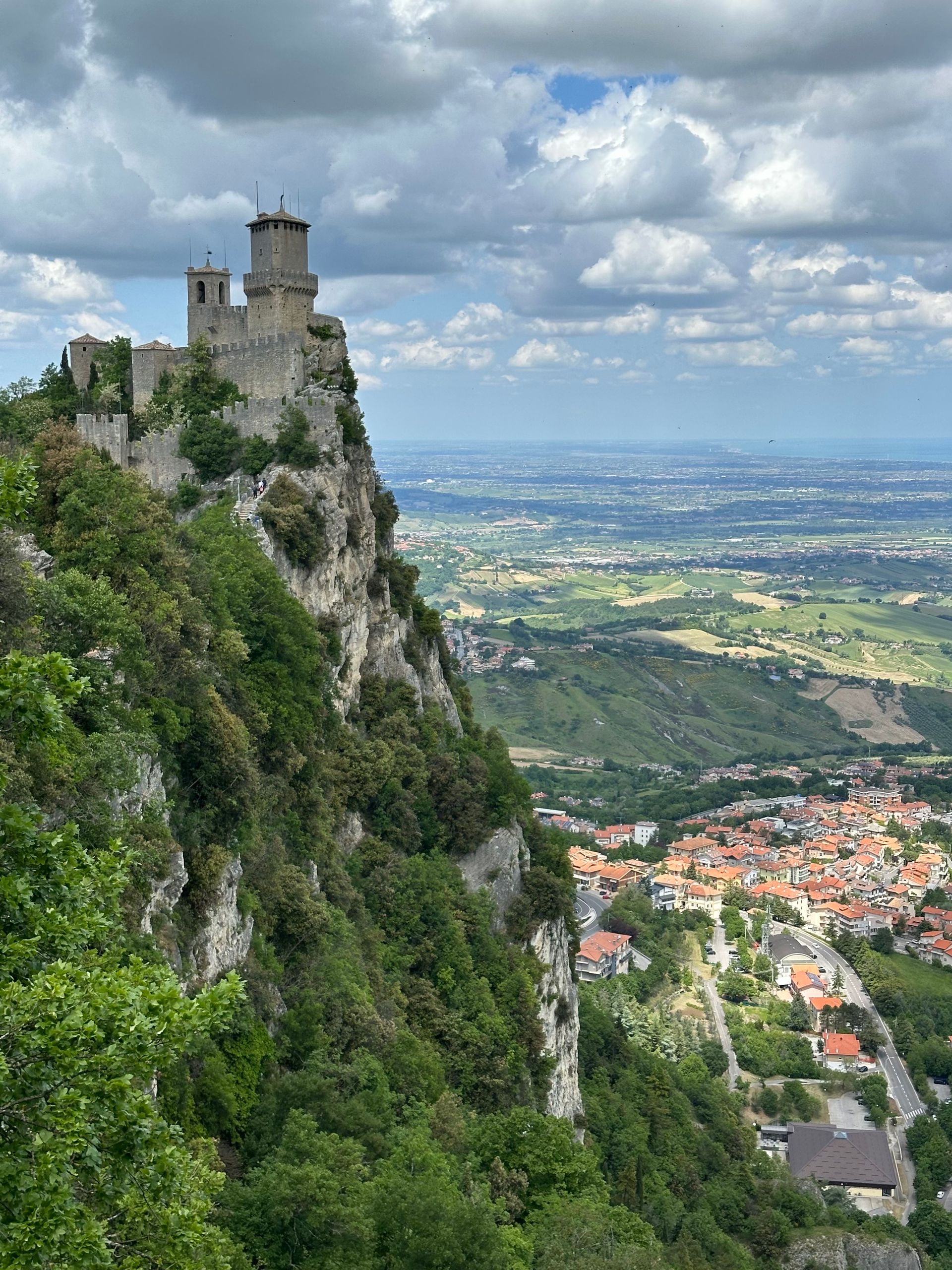
This article uses text information from the Wikipedia article – Guaita – [Wikipedia-Article-Link: https://en.wikipedia.org/wiki/Guaita ] which is released under the -- Creative Commons Attribution-ShareAlike 4.0 License – [License-Link: https://creativecommons.org/licenses/by-sa/4.0/deed.en ( https://en.wikipedia.org/wiki/Wikipedia:Text_of_the_Creative_Commons_Attribution-ShareAlike_4.0_International_License )] and additional terms may apply. [List of Principal Authors (5 or less) of the Wikipedia-Article on the date of this Article being Created in this Website: - ~2026-12976-31, Terragio67, FordJohnston45922, MishaPan, Grutness] [Use the following Authorship tool to find out the author contributions:- https://xtools.wmcloud.org/authorship ] [The Current Article on this Website has been paraphrased from the above linked corresponding Wikipedia-Article and You may redistribute this, verbatim or modified, provided that you comply with the terms of the Creative Commons Attribution-ShareAlike 4.0 License] [License-Link: https://creativecommons.org/licenses/by-sa/4.0/deed.en ( https://en.wikipedia.org/wiki/Wikipedia:Text_of_the_Creative_Commons_Attribution-ShareAlike_4.0_International_License )]
[Image: Breathtaking view of the Guaita Tower and surrounding landscape in San Marino; Image-Author: Sergei Gussev] [Image-Source-Link: https://www.pexels.com/photo/scenic-view-of-guaita-tower-in-san-marino-38017231/ ] [License-Link: https://www.pexels.com/license/ ] [Please Also Relate to Original Individual Text and Image URLs for More Usage Property and Sharing, Remixing or Attributing the Contents] [Contents on Wikipedia is covered by – Disclaimer – [Wikipedia-Disclaimer-Link: https://en.wikipedia.org/wiki/Wikipedia:General_disclaimer ] [Contents in this Website is also covered by Disclaimer linked at the bottom of the Page] [This website article means no intellectual appropriation by any way and only wishes to contribute in sharing of knowledge]
@Heritage Places, Castles & Architecture
23-Jun-2026 04 am
23-Jun-2026 04 am
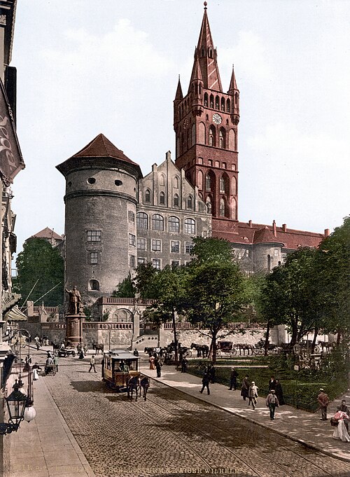
This article uses text information from the Wikipedia article – Königsberg_Castle – [Wikipedia-Article-Link: https://en.wikipedia.org/wiki/K%C3%B6nigsberg_Castle ] which is released under the -- Creative Commons Attribution-ShareAlike 4.0 License – [License-Link: https://creativecommons.org/licenses/by-sa/4.0/deed.en ( https://en.wikipedia.org/wiki/Wikipedia:Text_of_the_Creative_Commons_Attribution-ShareAlike_4.0_International_License )] and additional terms may apply. [List of Principal Authors (5 or less) of the Wikipedia-Article on the date of this Article being Created in this Website: - 2x2leax, GHStPaulMN, Bonthefox3, Olessi, WilliamH] [Use the following Authorship tool to find out the author contributions:- https://xtools.wmcloud.org/authorship ] [The Current Article on this Website has been paraphrased from the above linked corresponding Wikipedia-Article and You may redistribute this, verbatim or modified, provided that you comply with the terms of the Creative Commons Attribution-ShareAlike 4.0 License] [License-Link: https://creativecommons.org/licenses/by-sa/4.0/deed.en ( https://en.wikipedia.org/wiki/Wikipedia:Text_of_the_Creative_Commons_Attribution-ShareAlike_4.0_International_License )]
This article also uses an image from the Wikipedia article – Königsberg_Castle – [Wikipedia-Article-Link: https://en.wikipedia.org/wiki/K%C3%B6nigsberg_Castle ] [Image: Königsberger Schloss und Kaiser-Wilhelm-Denkmal in Königsberg (Preußen) (heute Kaliningrad, Russland) (Date: between 1894 and 1900); Wikipedia-Image-Author: Unknown author] [Wikipedia-Image-Link: https://en.wikipedia.org/wiki/File:K%C3%B6nigsberg_Castle.jpg ] [This work is from the Detroit Publishing Co. collection at the Library of Congress. According to the library, there are no known copyright restrictions on the use of this work. Most of the images in this collection were published before 1931 and are therefore in the public domain in the United States. A few images were published after this date and may be restricted by copyright. This work is in the public domain in the United States because it was published (or registered with the U.S. Copyright Office) before January 1, 1931. The author of this image from Switzerland is unknown, and the image was published at least 70 years ago. It is therefore in the public domain in Switzerland by virtue of Art. 31 of the Swiss Copyright Act.] [Please Also Relate to Original Individual Text and Image URLs for More Usage Property and Sharing, Remixing or Attributing the Contents] [Contents on Wikipedia is covered by – Disclaimer – Wikipedia-Disclaimer-Link: https://en.wikipedia.org/wiki/Wikipedia:General_disclaimer ] [Contents in this Website is also covered by Disclaimer linked at the bottom of the Page] [This website article means no intellectual appropriation by any way and only wishes to contribute in sharing of knowledge]
@Heritage Places, Castles & Architecture
22-Jun-2026 10 am
22-Jun-2026 10 am
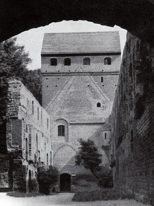
This article uses text information from the Wikipedia article – Balga – [Wikipedia-Article-Link: https://en.wikipedia.org/wiki/Balga ] which is released under the -- Creative Commons Attribution-ShareAlike 4.0 License – [License-Link: https://creativecommons.org/licenses/by-sa/4.0/deed.en ( https://en.wikipedia.org/wiki/Wikipedia:Text_of_the_Creative_Commons_Attribution-ShareAlike_4.0_International_License )] and additional terms may apply. [List of Principal Authors (5 or less) of the Wikipedia-Article on the date of this Article being Created in this Website: - Yungmemelord, 92.225.124.223, Olessi, Ilse birgen, Simon Brenner] [Use the following Authorship tool to find out the author contributions:- https://xtools.wmcloud.org/authorship ] [The Current Article on this Website has been paraphrased from the above linked corresponding Wikipedia-Article and You may redistribute this, verbatim or modified, provided that you comply with the terms of the Creative Commons Attribution-ShareAlike 4.0 License] [License-Link: https://creativecommons.org/licenses/by-sa/4.0/deed.en ( https://en.wikipedia.org/wiki/Wikipedia:Text_of_the_Creative_Commons_Attribution-ShareAlike_4.0_International_License )]
This article also uses an image from the Wikipedia article – Balga – [Wikipedia-Article-Link: https://en.wikipedia.org/wiki/Balga ] [Image: Die Burg Balga in den 30er Jahren (Balga ruins in their 1930s condition, before damage during World War II); Wikipedia-Image Author: Sendker] [Wikipedia-Image-Link: https://en.wikipedia.org/wiki/File:Balga3.jpg ] [This work is in the public domain in its country of origin and other countries and areas where the copyright term is the life of author plus 70 years or fewer. The work is also believed to be in the public domain in the United States as well.] [Please Also Relate to Original Individual Text and Image URLs for More Usage Property and Sharing, Remixing or Attributing the Contents]
[Contents on Wikipedia is covered by – Disclaimer – Wikipedia-Disclaimer-Link: https://en.wikipedia.org/wiki/Wikipedia:General_disclaimer ] [Contents in this Website is also covered by Disclaimer linked at the bottom of the Page] [This website article means no intellectual appropriation by any way and only wishes to contribute in sharing of knowledge]
@Heritage Places, Castles & Architecture
21-Jun-2026 03 am
21-Jun-2026 03 am
This article uses text information from the Wikipedia article – Kylemore_Abbey – [Wikipedia-Article-Link: https://en.wikipedia.org/wiki/Kylemore_Abbey ] which is released under the -- Creative Commons Attribution-ShareAlike 4.0 License – [License-Link: https://creativecommons.org/licenses/by-sa/4.0/deed.en ( https://en.wikipedia.org/wiki/Wikipedia:Text_of_the_Creative_Commons_Attribution-ShareAlike_4.0_International_License )] and additional terms may apply. [List of Principal Authors (5 or less) of the Wikipedia-Article on the date of this Article being Created in this Website: - Webwayz, Noel baran, Manannan67, Gahowe09, Shazice] [Use the following Authorship tool to find out the author contributions:- https://xtools.wmcloud.org/authorship ] [The Current Article on this Website has been paraphrased from the above linked corresponding Wikipedia-Article and You may redistribute this, verbatim or modified, provided that you comply with the terms of the Creative Commons Attribution-ShareAlike 4.0 License] [License-Link: https://creativecommons.org/licenses/by-sa/4.0/deed.en ( https://en.wikipedia.org/wiki/Wikipedia:Text_of_the_Creative_Commons_Attribution-ShareAlike_4.0_International_License )]
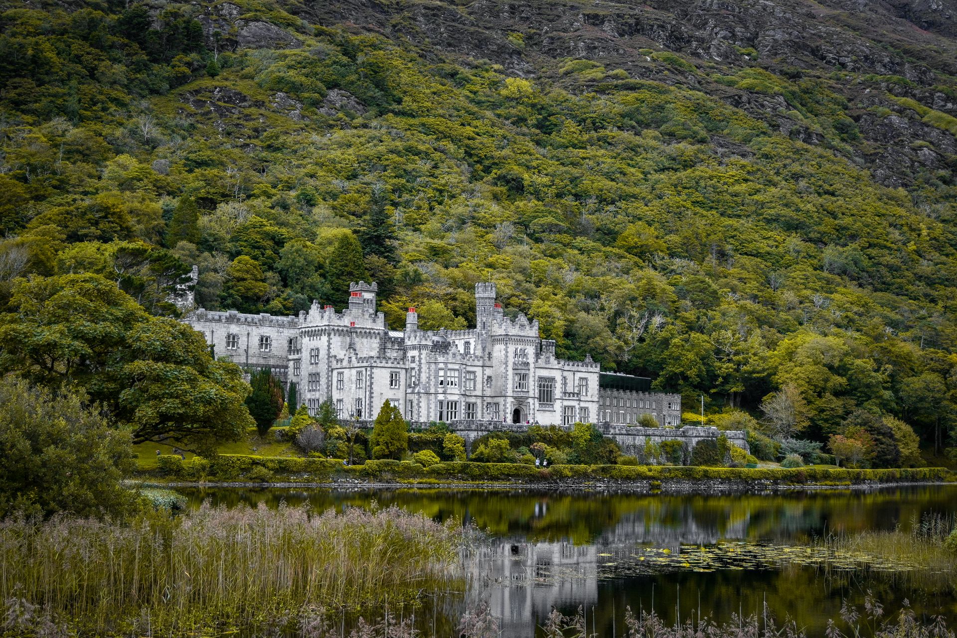
[Image: Scenic view of Kylemore Abbey and its reflection in a tranquil lake, Connemara, Ireland; Image-Author: Rick Johns] [Image-Source-Link: https://www.pexels.com/photo/kylemore-abbey-in-connemara-18549116/ ] [License-Link: https://www.pexels.com/license/ ] [Please Also Relate to Original Individual Text and Image URLs for More Usage Property and Sharing, Remixing or Attributing the Contents] [Contents on Wikipedia is covered by – Disclaimer – [Wikipedia-Disclaimer-Link: https://en.wikipedia.org/wiki/Wikipedia:General_disclaimer ] [Contents in this Website is also covered by Disclaimer linked at the bottom of the Page] [This website article means no intellectual appropriation by any way and only wishes to contribute in sharing of knowledge]
@Heritage Places, Castles & Architecture
18-Jun-2026 06 am
18-Jun-2026 06 am
This article uses text information from the Wikipedia article – Aarburg_Castle – [Wikipedia-Article-Link: https://en.wikipedia.org/wiki/Aarburg_Castle ] which is released under the -- Creative Commons Attribution-ShareAlike 4.0 License – [License-Link: https://creativecommons.org/licenses/by-sa/4.0/deed.en ( https://en.wikipedia.org/wiki/Wikipedia:Text_of_the_Creative_Commons_Attribution-ShareAlike_4.0_International_License )] and additional terms may apply. [List of Principal Authors (5 or less) of the Wikipedia-Article on the date of this Article being Created in this Website: - Tobyc75, InternetArchiveBot, AnomieBOT, GreenC bot, SimLibrarian] [Use the following Authorship tool to find out the author contributions:- https://xtools.wmcloud.org/authorship ] [The Current Article on this Website has been paraphrased from the above linked corresponding Wikipedia-Article and You may redistribute this, verbatim or modified, provided that you comply with the terms of the Creative Commons Attribution-ShareAlike 4.0 License] [License-Link: https://creativecommons.org/licenses/by-sa/4.0/deed.en ( https://en.wikipedia.org/wiki/Wikipedia:Text_of_the_Creative_Commons_Attribution-ShareAlike_4.0_International_License )]
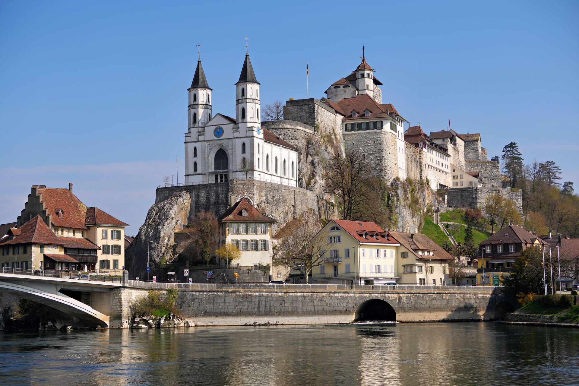
[Image: Aarburg Castle overlooking the Aare River, surrounded by historic buildings under a clear blue sky; Image-Author: Beat Bieri] [Image-Source-Link: https://www.pexels.com/photo/aarburg-castle-with-scenic-riverside-view-36674455/ ] [License-Link: https://www.pexels.com/license/ ] [Please Also Relate to Original Individual Text and Image URLs for More Usage Property and Sharing, Remixing or Attributing the Contents] [Contents on Wikipedia is covered by – Disclaimer – [Wikipedia-Disclaimer-Link : https://en.wikipedia.org/wiki/Wikipedia:General_disclaimer ] [Contents in this Website is also covered by Disclaimer linked at the bottom of the Page] [This website article means no intellectual appropriation by any way and only wishes to contribute in sharing of knowledge]
@Heritage Places, Castles & Architecture
07-Jun-2026 03 am
07-Jun-2026 03 am
This article uses text information from the Wikipedia article – Castle_of_Óbidos – [Wikipedia-Article-Link: https://en.wikipedia.org/wiki/Castle_of_%C3%93bidos ] which is released under the -- Creative Commons Attribution-ShareAlike 4.0 License – [License-Link: https://creativecommons.org/licenses/by-sa/4.0/deed.en ( https://en.wikipedia.org/wiki/Wikipedia:Text_of_the_Creative_Commons_Attribution-ShareAlike_4.0_International_License )] [List of Principal Authors (5 or less) of the Wikipedia-Article on the date of this Article being Created in this Website: - Zeorymer, Winterysteppe, Zackmann08, InternetArchiveBot, Plitchx] [Use the following Authorship tool to find out the author contributions:- https://xtools.wmcloud.org/authorship ] [The Current Article on this Website has been paraphrased from the above linked corresponding Wikipedia-Article and You may redistribute this, verbatim or modified, provided that you comply with the terms of the Creative Commons Attribution-ShareAlike 4.0 License] [License-Link: https://creativecommons.org/licenses/by-sa/4.0/deed.en ( https://en.wikipedia.org/wiki/Wikipedia:Text_of_the_Creative_Commons_Attribution-ShareAlike_4.0_International_License )]
[Image: A beautiful view of the medieval Obidos Castle with battlements under a clear blue sky in Portugal; Image-Author: Jose Cruz] [Image-Source-Link: https://www.pexels.com/photo/scenic-view-of-obidos-castle-battlements-in-portugal-34693564/ ] [License-Link: https://www.pexels.com/license/ ] [Please Also Relate to Original Individual Text and Image URLs for More Usage Property and Sharing, Remixing or Attributing the Contents] [Contents on Wikipedia is covered by – Disclaimer – [Wikipedia-Disclaimer-Link : https://en.wikipedia.org/wiki/Wikipedia:General_disclaimer ] [Contents in this Website is also covered by Disclaimer linked at the bottom of the Page] [This website article means no intellectual appropriation by any way and only wishes to contribute in sharing of knowledge]
@Heritage Places, Castles & Architecture
01-Jun-2026 04 am
01-Jun-2026 04 am
This article uses text information from the Wikipedia article – Gruyères_Castle – [Wikipedia-Article-Link: https://en.wikipedia.org/wiki/Gruy%C3%A8res_Castle ] which is released under the -- Creative Commons Attribution-ShareAlike 4.0 License – [License-Link: https://creativecommons.org/licenses/by-sa/4.0/deed.en ( https://en.wikipedia.org/wiki/Wikipedia:Text_of_the_Creative_Commons_Attribution-ShareAlike_4.0_International_License )] and additional terms may apply. [List of Principal Authors (5 or less) of the Wikipedia-Article on the date of this Article being Created in this Website: - SalomonCeb, Tobyc75, 96.231.12.44, Toadspike, InternetArchiveBot] [Use the following Authorship tool to find out the author contributions:- https://xtools.wmcloud.org/authorship ] [The Current Article on this Website has been paraphrased from the above linked corresponding Wikipedia-Article and You may redistribute this, verbatim or modified, provided that you comply with the terms of the Creative Commons Attribution-ShareAlike 4.0 License] [License-Link: https://creativecommons.org/licenses/by-sa/4.0/deed.en ( https://en.wikipedia.org/wiki/Wikipedia:Text_of_the_Creative_Commons_Attribution-ShareAlike_4.0_International_License )]
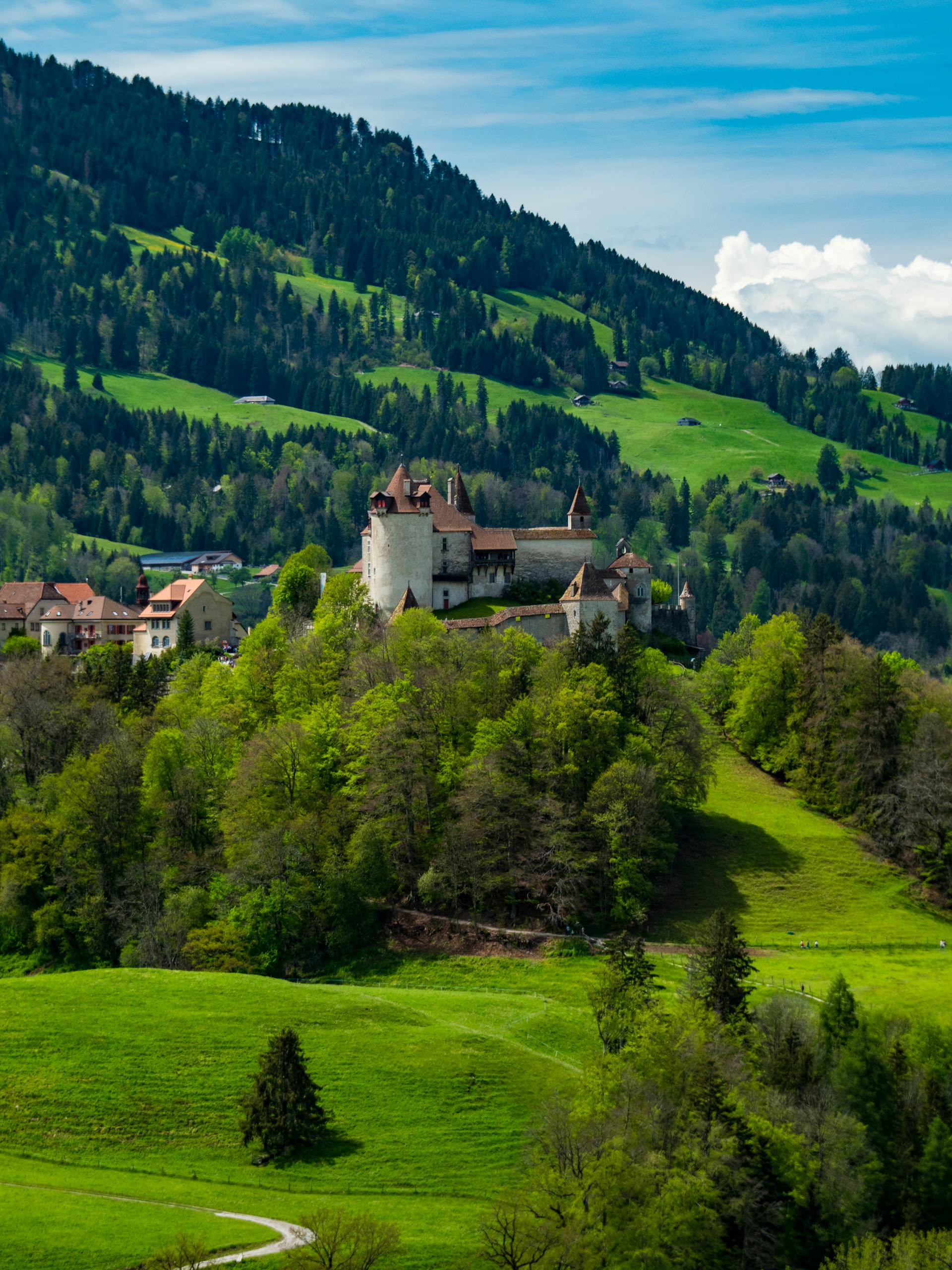
[Image: A picturesque view of the historic Gruyères Castle surrounded by lush greenery in Switzerland; Image-Author: Christopher Politano] [Image-Source-Link: https://www.pexels.com/photo/vertical-shot-of-the-gruyeres-castle-23503673/ ] [License-Link: https://www.pexels.com/license/ ] [Please Also Relate to Original Individual Text and Image URLs for More Usage Property and Sharing, Remixing or Attributing the Contents] [Contents on Wikipedia is covered by – Disclaimer – [Wikipedia-Disclaimer-Link : https://en.wikipedia.org/wiki/Wikipedia:General_disclaimer ] [Contents in this Website is also covered by Disclaimer linked at the bottom of the Page] [This website article means no intellectual appropriation by any way and only wishes to contribute in sharing of knowledge]
@Heritage Places, Castles & Architecture
28-May-2026 09 pm
28-May-2026 09 pm
This article uses text information from the Wikipedia article – Kidwelly_Castle – [Wikipedia-Article-Link: https://en.wikipedia.org/wiki/Kidwelly_Castle ] which is released under the -- Creative Commons Attribution-ShareAlike 4.0 License – [License-Link: https://creativecommons.org/licenses/by-sa/4.0/deed.en ( https://en.wikipedia.org/wiki/Wikipedia:Text_of_the_Creative_Commons_Attribution-ShareAlike_4.0_International_License )] and additional terms may apply. [List of Principal Authors (5 or less) of the Wikipedia-Article on the date of this Article being Created in this Website: - 82.12.202.32, MallardTV, 2607:FA49:1A44:4700:EC0A:EBDD:DC5A:AA13, Hchc2009, 114.75.189.114] [Use the following Authorship tool to find out the author contributions:- https://xtools.wmcloud.org/authorship ] [The Current Article on this Website has been paraphrased from the above linked corresponding Wikipedia-Article and You may redistribute this, verbatim or modified, provided that you comply with the terms of the Creative Commons Attribution-ShareAlike 4.0 License] [License-Link: https://creativecommons.org/licenses/by-sa/4.0/deed.en ( https://en.wikipedia.org/wiki/Wikipedia:Text_of_the_Creative_Commons_Attribution-ShareAlike_4.0_International_License )]
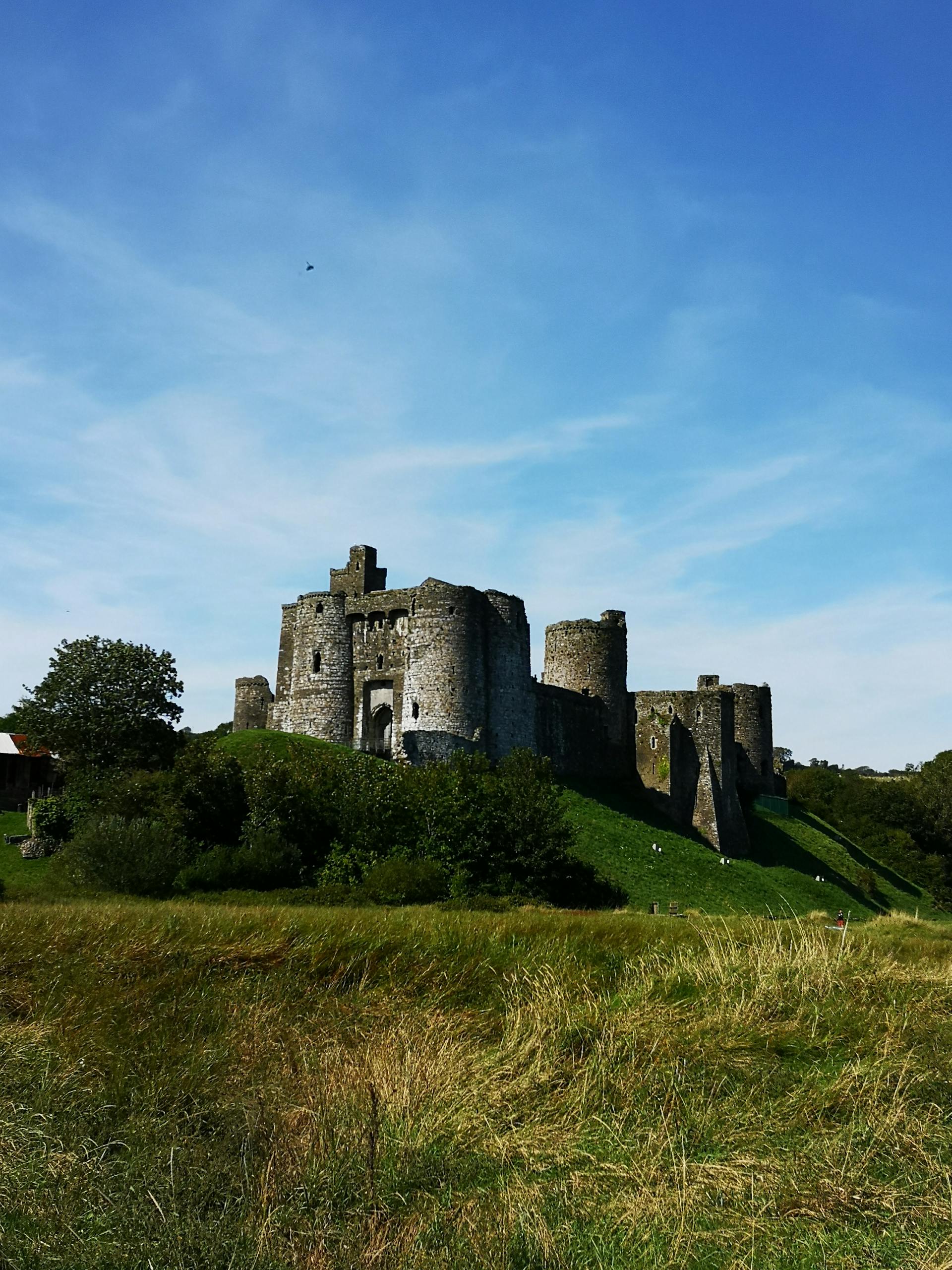
[Image: A stunning view of Kidwelly Castle set against a vibrant blue sky in Wales; Image-Author: Wayne Jackson] [Image-Source-Link: https://www.pexels.com/photo/kidwelly-castle-in-wales-9080851/ ] [License-Link: https://www.pexels.com/license/ ] [Please Also Relate to Original Individual Text and Image URLs for More Usage Property and Sharing, Remixing or Attributing the Contents] [Contents on Wikipedia is covered by – Disclaimer – [Wikipedia-Disclaimer-Link : https://en.wikipedia.org/wiki/Wikipedia:General_disclaimer ] [Contents in this Website is also covered by Disclaimer linked at the bottom of the Page] [This website article means no intellectual appropriation by any way and only wishes to contribute in sharing of knowledge]
@Heritage Places, Castles & Architecture
22-May-2026 10 pm
22-May-2026 10 pm
This article uses text information from the Wikipedia article – Rhuddlan_Castle – [Wikipedia-Article-Link: https://en.wikipedia.org/wiki/Rhuddlan_Castle ] which is released under the -- Creative Commons Attribution-ShareAlike 4.0 License – [License-Link: https://creativecommons.org/licenses/by-sa/4.0/deed.en ( https://en.wikipedia.org/wiki/Wikipedia:Text_of_the_Creative_Commons_Attribution-ShareAlike_4.0_International_License )] [List of Principal Authors (5 or less) of the Wikipedia-Article on the date of this Article being Created in this Website: - Deb, 86.149.220.92, DankJae, 86.130.125.248, 86.130.134.157] [Use the following Authorship tool to find out the author contributions:- https://xtools.wmcloud.org/authorship ] [The Current Article on this Website has been paraphrased from the above linked corresponding Wikipedia-Article and You may redistribute this, verbatim or modified, provided that you comply with the terms of the Creative Commons Attribution-ShareAlike 4.0 License] [License-Link: https://creativecommons.org/licenses/by-sa/4.0/deed.en ( https://en.wikipedia.org/wiki/Wikipedia:Text_of_the_Creative_Commons_Attribution-ShareAlike_4.0_International_License )]
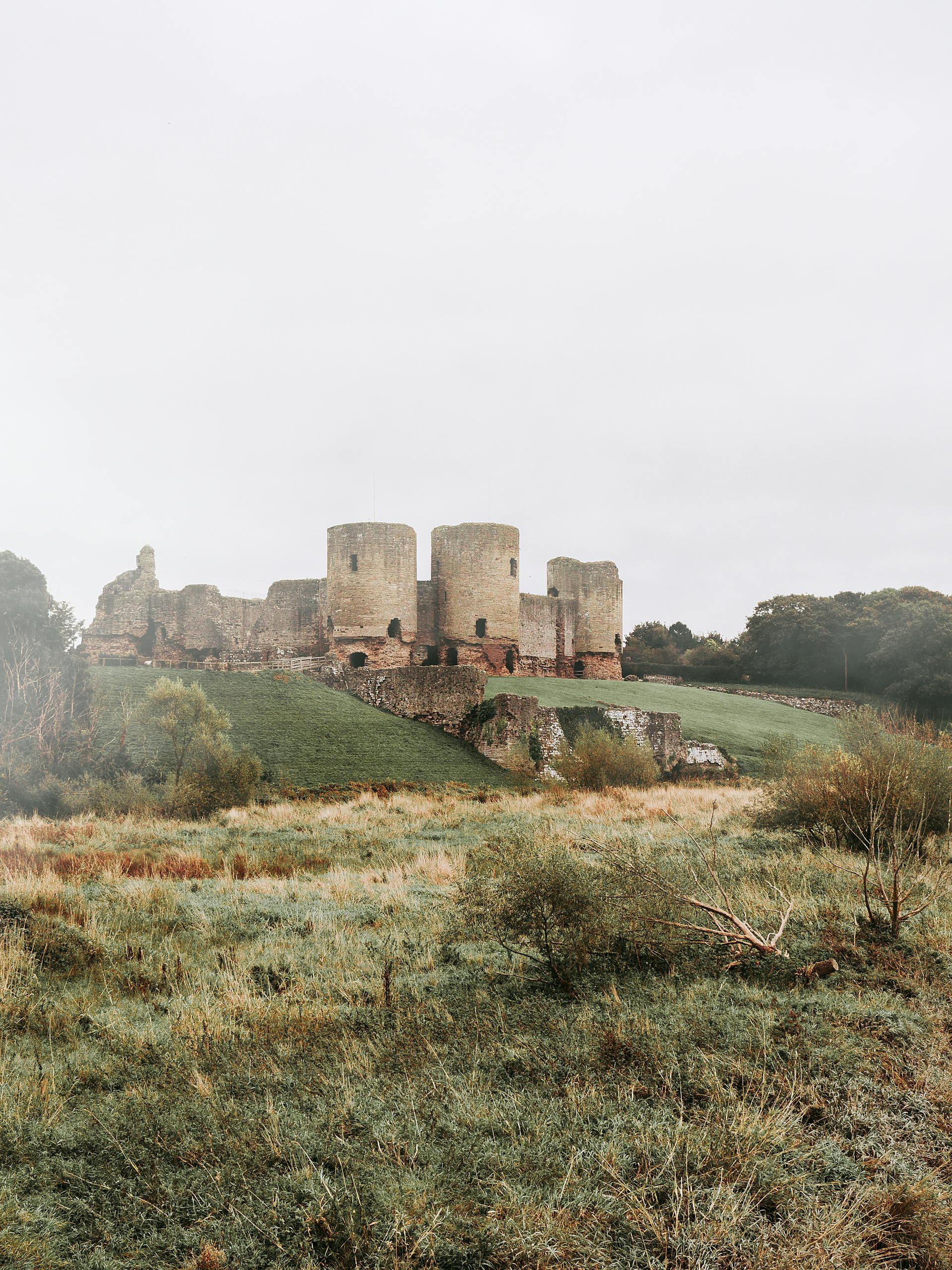
[Image: Capture of Rhuddlan Castle ruins amidst lush greenery in Wales, UK; Image-Author: Lisa from Pexels] [Image-Source-Link: https://www.pexels.com/photo/the-rhuddlan-castle-in-wales-9880895/ ] [License-Link: https://www.pexels.com/license/ ] [Please Also Relate to Original Individual Text and Image URLs for More Usage Property and Sharing, Remixing or Attributing the Contents] [Contents on Wikipedia is covered by – Disclaimer – [Wikipedia-Disclaimer-Link : https://en.wikipedia.org/wiki/Wikipedia:General_disclaimer ] [Contents in this Website is also covered by Disclaimer linked at the bottom of the Page] [This website article means no intellectual appropriation by any way and only wishes to contribute in sharing of knowledge]
@Heritage Places, Castles & Architecture
03-May-2026 02 am
03-May-2026 02 am
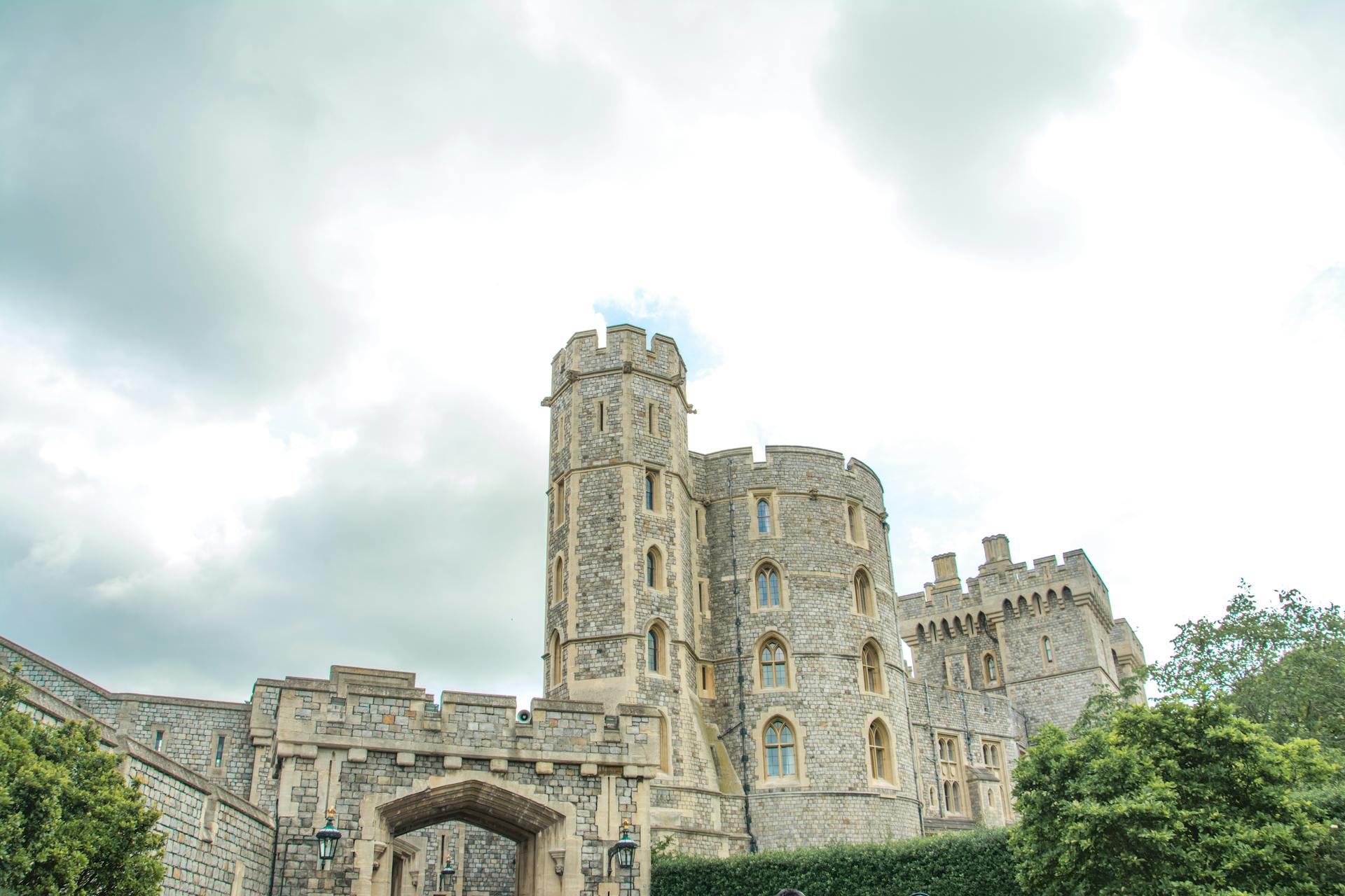
[Text-Information-Source: British Castles by Charles Henry Ashdown (1856-1922)] [The book is in the public domain in the United States of America, and possibly other nations.] [Image: View of Windsor Castles stone architecture with cloudy sky backdrop and lush greenery; Image-Author: Marvin Sacdalan] [N.B.: Windsor Castle is an example of original Motte and Bailey castle] [Image-Source-Link: https://www.pexels.com/photo/low-angle-shot-of-the-castle-under-cloudy-sky-13020627/ ] [License-Link: https://www.pexels.com/license/ ] [Please Also Relate to Original Image URL for More Usage Property and Sharing, Remixing or Attributing the Contents][Contents in this Website is also covered by Disclaimer linked at the bottom of the Page][This website article means no intellectual appropriation by any way and only wishes to contribute in sharing of knowledge]
@Heritage Places, Castles & Architecture
26-Apr-2026 10 pm
26-Apr-2026 10 pm
This article uses text information from the Wikipedia article – Bečov_nad_Teplou – [Wikipedia-Article-Link: https://en.wikipedia.org/wiki/Be%C4%8Dov_nad_Teplou ] which is released under the -- Creative Commons Attribution-ShareAlike 4.0 License – [License-Link: https://creativecommons.org/licenses/by-sa/4.0/deed.en ( https://en.wikipedia.org/wiki/Wikipedia:Text_of_the_Creative_Commons_Attribution-ShareAlike_4.0_International_License )] and additional terms may apply. [List of Principal Authors (5 or less) of the Wikipedia-Article on the date of this Article being Created in this Website: - FromCzech, Mikeshk, Zackmann08, Pavel Bednařík (WMCZ), JJMC89 bot] [Use the following Authorship tool to find out the author contributions:- https://xtools.wmcloud.org/authorship ] [The Current Article on this Website has been paraphrased from the above linked corresponding Wikipedia-Article and You may redistribute this, verbatim or modified, provided that you comply with the terms of the Creative Commons Attribution-ShareAlike 4.0 License] [License-Link: https://creativecommons.org/licenses/by-sa/4.0/deed.en ( https://en.wikipedia.org/wiki/Wikipedia:Text_of_the_Creative_Commons_Attribution-ShareAlike_4.0_International_License )]
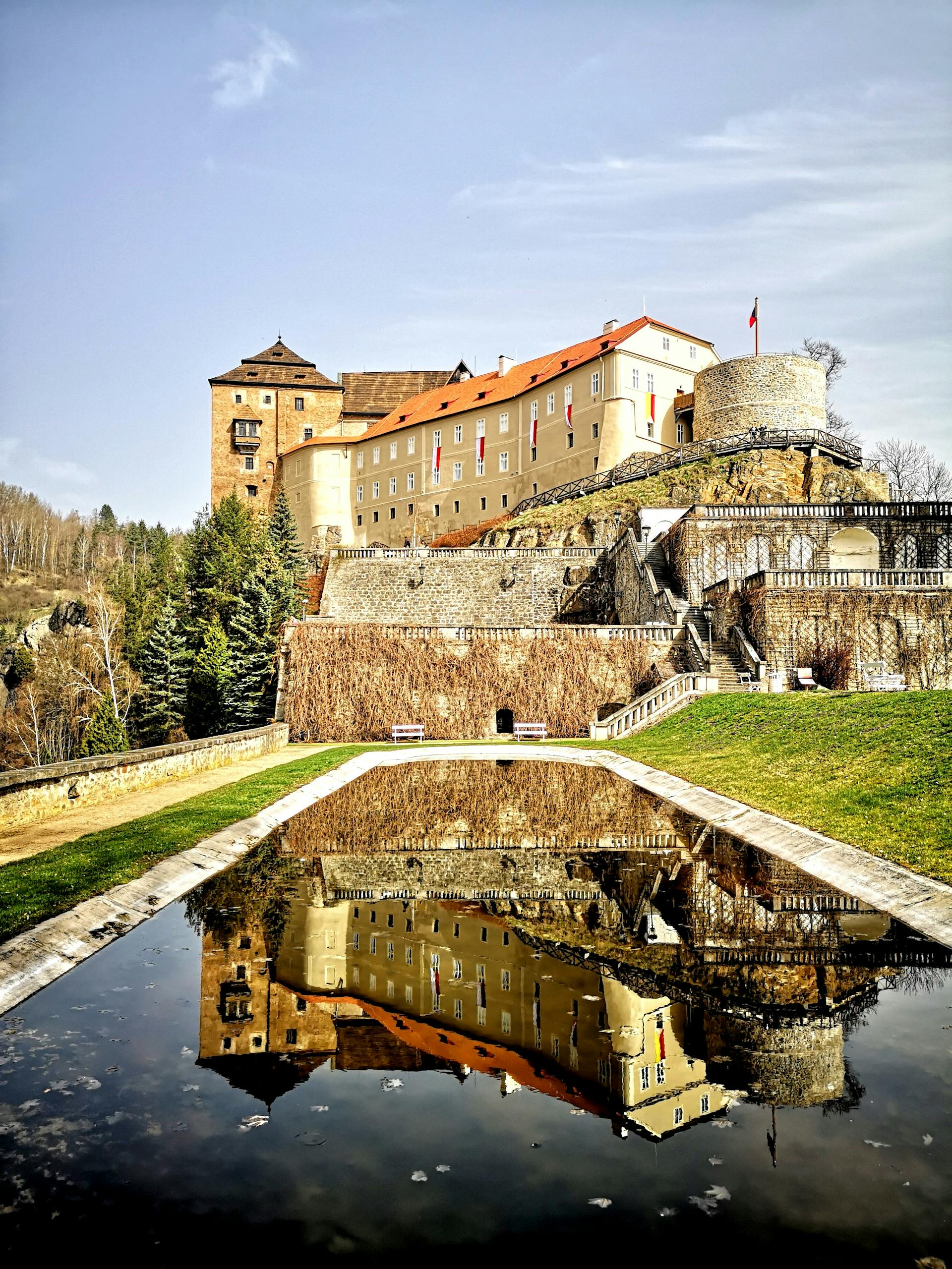
[Image: Pond Reflecting State Castle Becov in Czech Republic; Image-Author: Viliam Kudelka] [Image-Source-Link: https://www.pexels.com/photo/pond-reflecting-state-castle-becov-in-czech-republic-20893580/ ] [License-Link: https://www.pexels.com/license/ ] [Please Also Relate to Original Individual Text and Image URLs for More Usage Property and Sharing, Remixing or Attributing the Contents] [Contents on Wikipedia is covered by – Disclaimer – [Wikipedia-Disclaimer-Link : https://en.wikipedia.org/wiki/Wikipedia:General_disclaimer ] [Contents in this Website is also covered by Disclaimer linked at the bottom of the Page] [This website article means no intellectual appropriation by any way and only wishes to contribute in sharing of knowledge]
@Heritage Places, Castles & Architecture
25-Apr-2026 04 am
25-Apr-2026 04 am
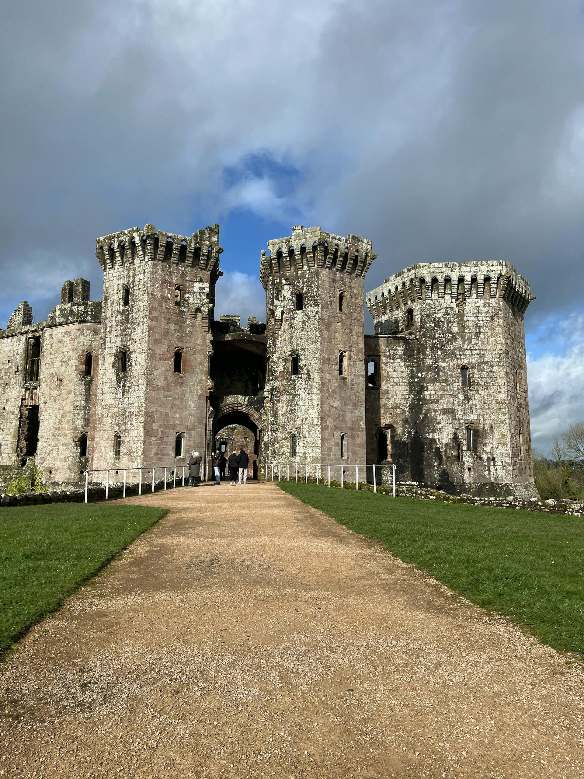
This article uses text information from the Wikipedia article – Raglan_Castle – [Wikipedia-Article-Link: https://en.wikipedia.org/wiki/Raglan_Castle ] which is released under the -- Creative Commons Attribution-ShareAlike 4.0 License – [License-Link: https://creativecommons.org/licenses/by-sa/4.0/deed.en ( https://en.wikipedia.org/wiki/Wikipedia:Text_of_the_Creative_Commons_Attribution-ShareAlike_4.0_International_License )] [List of Principal Authors (5 or less) of the Wikipedia-Article on the date of this Article being Created in this Website: - Hchc2009, KJP1, Richard Nevell, Robinvp11, InternetArchiveBot] [Use the following Authorship tool to find out the author contributions:- https://xtools.wmcloud.org/authorship ] [The Current Article on this Website has been paraphrased from the above linked corresponding Wikipedia-Article and You may redistribute this, verbatim or modified, provided that you comply with the terms of the Creative Commons Attribution-ShareAlike 4.0 License] [License-Link: https://creativecommons.org/licenses/by-sa/4.0/deed.en ( https://en.wikipedia.org/wiki/Wikipedia:Text_of_the_Creative_Commons_Attribution-ShareAlike_4.0_International_License )]
[Image: Majestic Raglan Castle in Wales; Image-Author: Archie] [Image-Source-Link: https://www.pexels.com/photo/majestic-raglan-castle-in-wales-36900197/ ] [License-Link: https://www.pexels.com/license/ ] [Please Also Relate to Original Individual Text and Image URLs for More Usage Property and Sharing, Remixing or Attributing the Contents] [Contents on Wikipedia is covered by – Disclaimer – [Wikipedia-Disclaimer-Link : https://en.wikipedia.org/wiki/Wikipedia:General_disclaimer ] [Contents in this Website is also covered by Disclaimer linked at the bottom of the Page] [This website article means no intellectual appropriation by any way and only wishes to contribute in sharing of knowledge]
@Heritage Places, Castles & Architecture
24-Apr-2026 07 am
24-Apr-2026 07 am
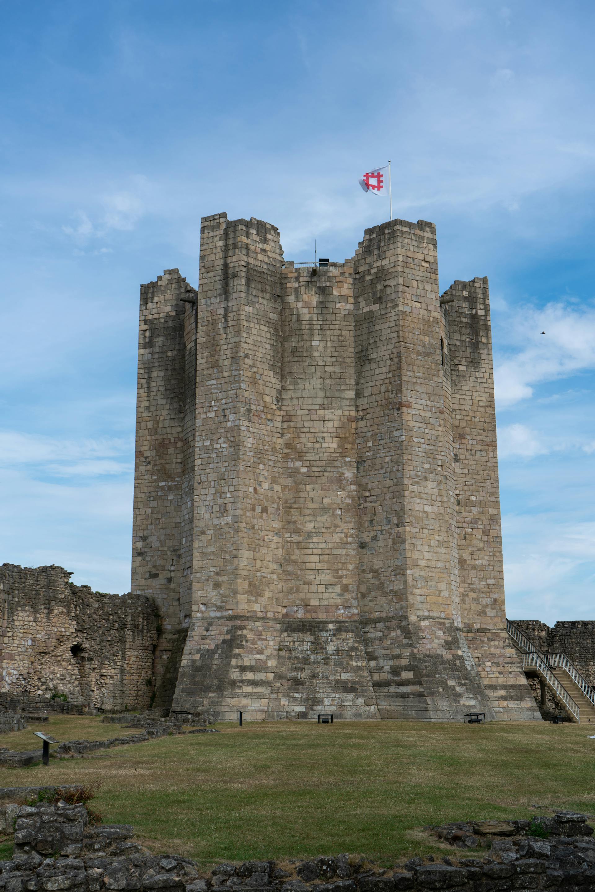
[Text-Information-Source: British Castles by Charles Henry Ashdown (1856-1922)] [The book is in the public domain in the United States of America, and possibly other nations.] [Image: Brick Castle with Flag on Top (Conisborough Castle); Image-Author: William Sutherland] [N.B.: Conisborough Castle is an example of castle with cylindrical keep] [Image-Source-Link: https://www.pexels.com/photo/brick-castle-with-flag-on-top-12878263/ ] [License-Link: https://www.pexels.com/license/ ][Please Also Relate to Original Image URL for More Usage Property and Sharing, Remixing or Attributing the Contents] [Contents in this Website is also covered by Disclaimer linked at the bottom of the Page][This website article means no intellectual appropriation by any way and only wishes to contribute in sharing of knowledge]
@Heritage Places, Castles & Architecture
10-Apr-2026 12 am
10-Apr-2026 12 am
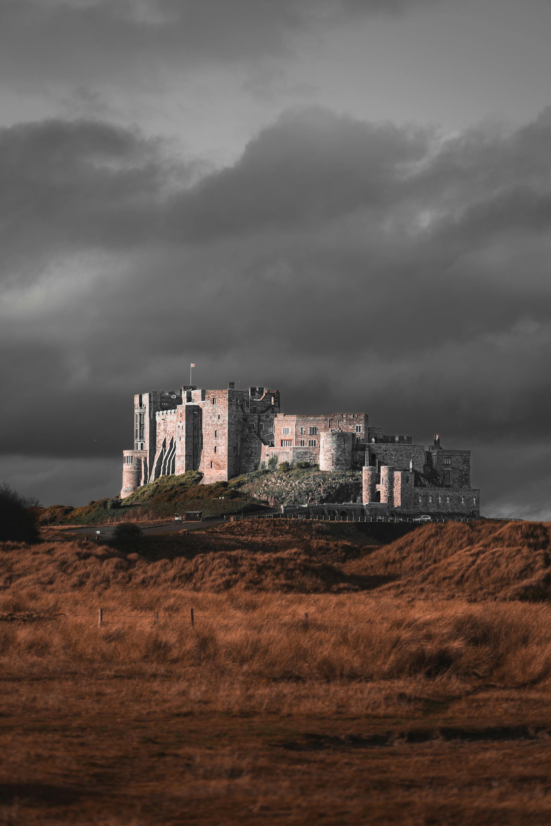
[Text-Information-Source: British Castles by Charles Henry Ashdown (1856-1922)] [The book is in the public domain in the United States of America, and possibly other nations.] [Image: Bamburgh Castle in England; Image-Author: urtimud. 89] [N.B.: Bamburgh Castle is an example of castle with rectangular keep] [Image-Source-Link: https://www.pexels.com/photo/bamburgh-castle-in-england-10200580/ ] [License-Link: https://www.pexels.com/license/ ] [Please Also Relate to Original Image URL for More Usage Property and Sharing, Remixing or Attributing the Contents] [This website article means no intellectual appropriation by any way and only wishes to contribute in sharing of knowledge]
@Heritage Places, Castles & Architecture
09-Apr-2026 05 am
09-Apr-2026 05 am
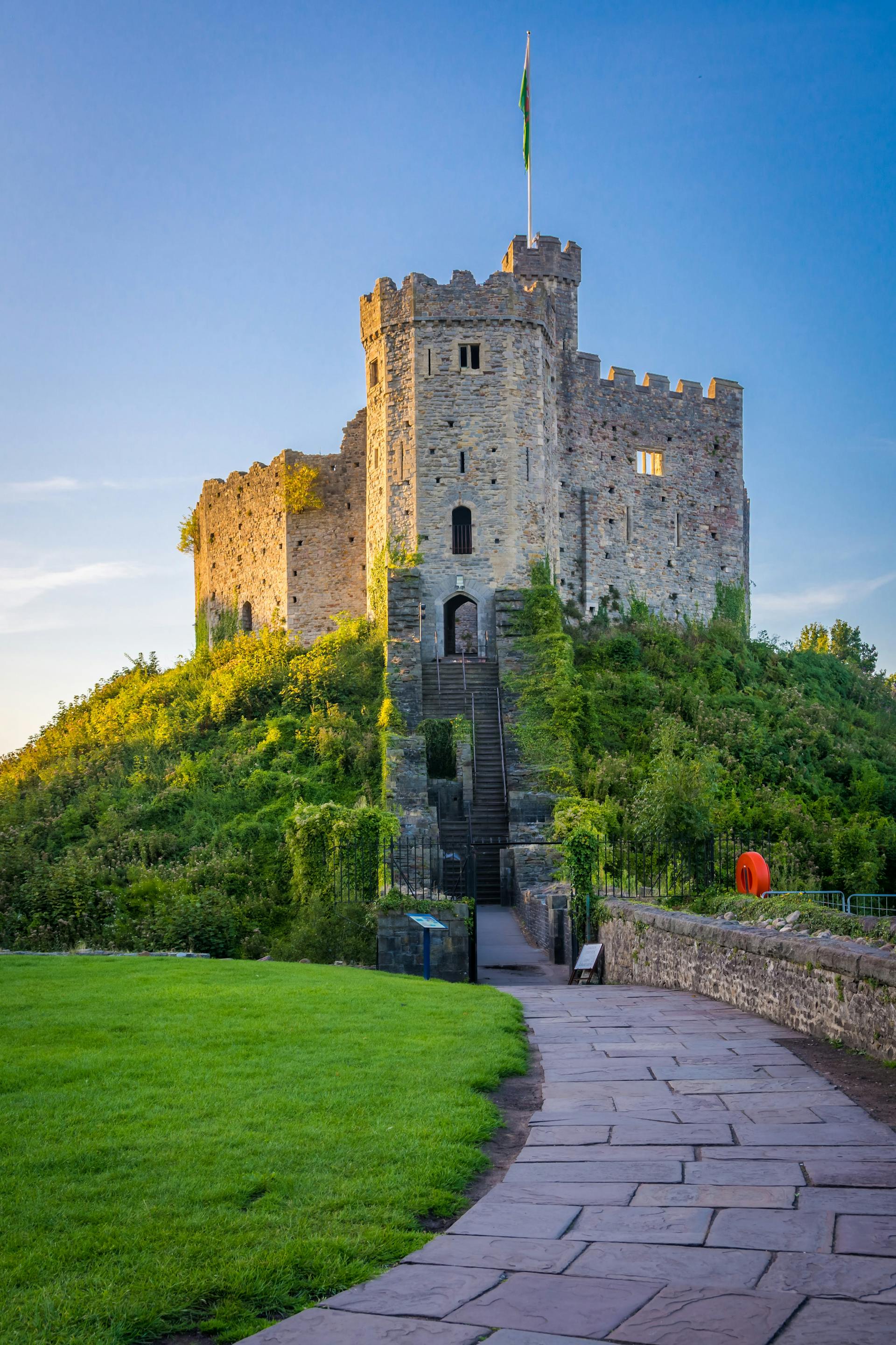
[Text-Information-Source: British Castles by Charles Henry Ashdown (1856-1922)] [The book is in the public domain in the United States of America, and possibly other nations.] [Image: Cardiff Castle in Wales; Image-Author: Balazs Bezeczky] [N.B.: Cardiff Castle is an example of Shell Keep] [Image-Source-Link: https://www.pexels.com/photo/cardiff-castle-in-wales-5743993/ ] [License-Link: https://www.pexels.com/license/ ] [Please Also Relate to Original Image URL for More Usage Property and Sharing, Remixing or Attributing the Contents] [This website article means no intellectual appropriation by any way and only wishes to contribute in sharing of knowledge]
@Heritage Places, Castles & Architecture
29-Mar-2026 02 am
29-Mar-2026 02 am
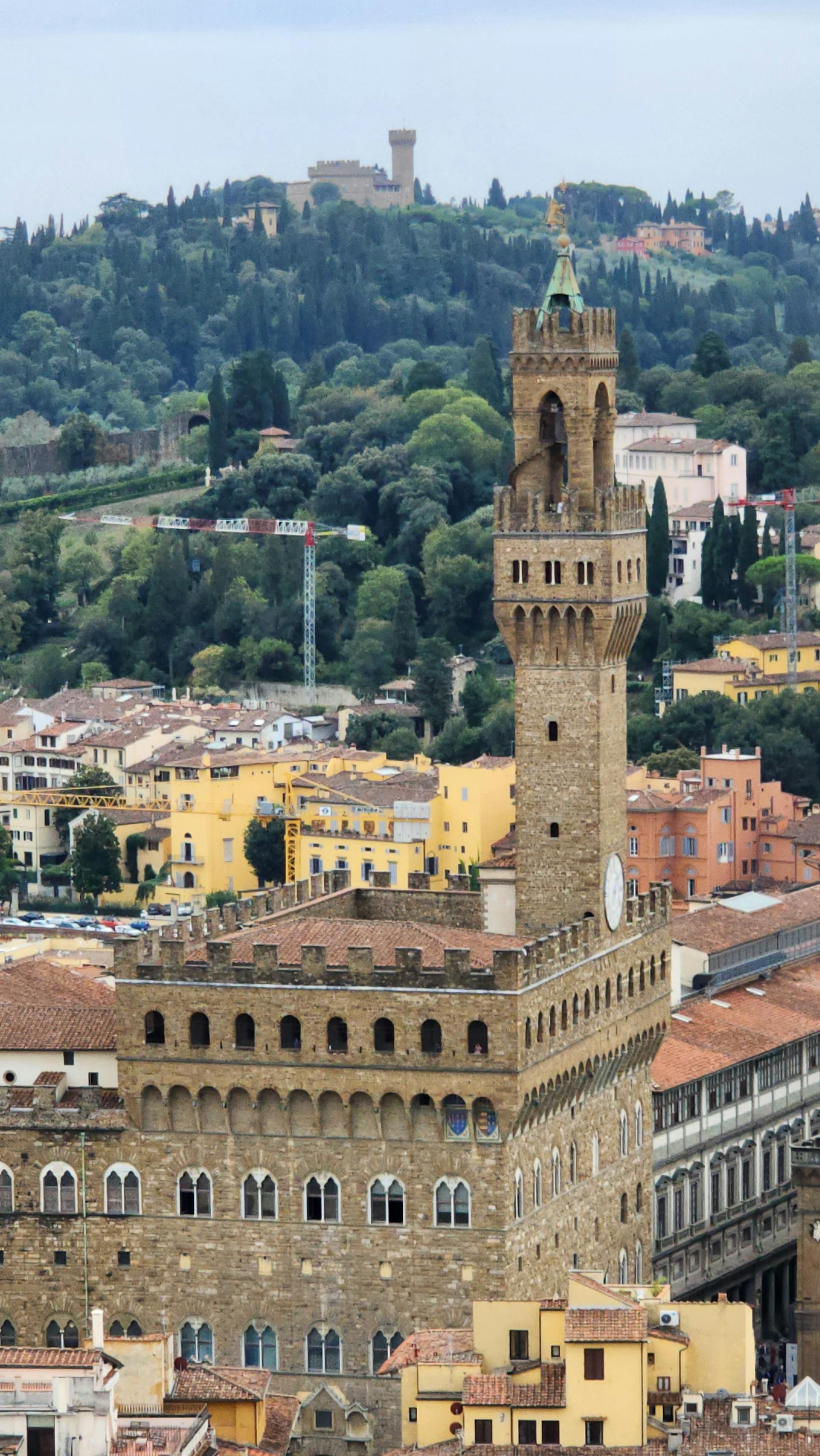
[Text-Information-Source: Romantic Castles and Palaces as seen and described by famous writers, Edited by Esther Singleton (1865-1930); (Essay: Palazzo Vecchio by Alexandre Dumas)][The book is in the public domain in the United States of America, and possibly other nations.] [Image: Aerial View of Palazzo Vecchio in Florence, Italy; Image-Author: Jorge Echegaray] [Image-Source-Link: https://www.pexels.com/photo/aerial-view-of-palazzo-vecchio-in-florence-italy-19976955/ ] [License-Link: https://www.pexels.com/license/ ] [Please Also Relate to Original Image URL for More Usage Property and Sharing, Remixing or Attributing the Contents] [This website article means no intellectual appropriation by any way and only wishes to contribute in sharing of knowledge]
@Heritage Places, Castles & Architecture
27-Mar-2026 12 am
27-Mar-2026 12 am
This article uses text information from the Wikipedia article – Château_of_Blois – [Wikipedia-Article-Link: https://en.wikipedia.org/wiki/Ch%C3%A2teau_of_Blois ] which is released under the -- Creative Commons Attribution-ShareAlike 4.0 License – [License-Link: https://creativecommons.org/licenses/by-sa/4.0/deed.en ( https://en.wikipedia.org/wiki/Wikipedia:Text_of_the_Creative_Commons_Attribution-ShareAlike_4.0_International_License )] and additional terms may apply. [List of Principal Authors (5 or less) of the Wikipedia-Article on the date of this Article being Created in this Website: - Manutdmomma, Thibaud4141, DW, Stevage, Wetman] [Use the following Authorship tool to find out the author contributions:- https://xtools.wmcloud.org/authorship ] [The Current Article on this Website has been paraphrased from the above linked corresponding Wikipedia-Article and You may redistribute this, verbatim or modified, provided that you comply with the terms of the Creative Commons Attribution-ShareAlike 4.0 License] [License-Link: https://creativecommons.org/licenses/by-sa/4.0/deed.en ( https://en.wikipedia.org/wiki/Wikipedia:Text_of_the_Creative_Commons_Attribution-ShareAlike_4.0_International_License )]
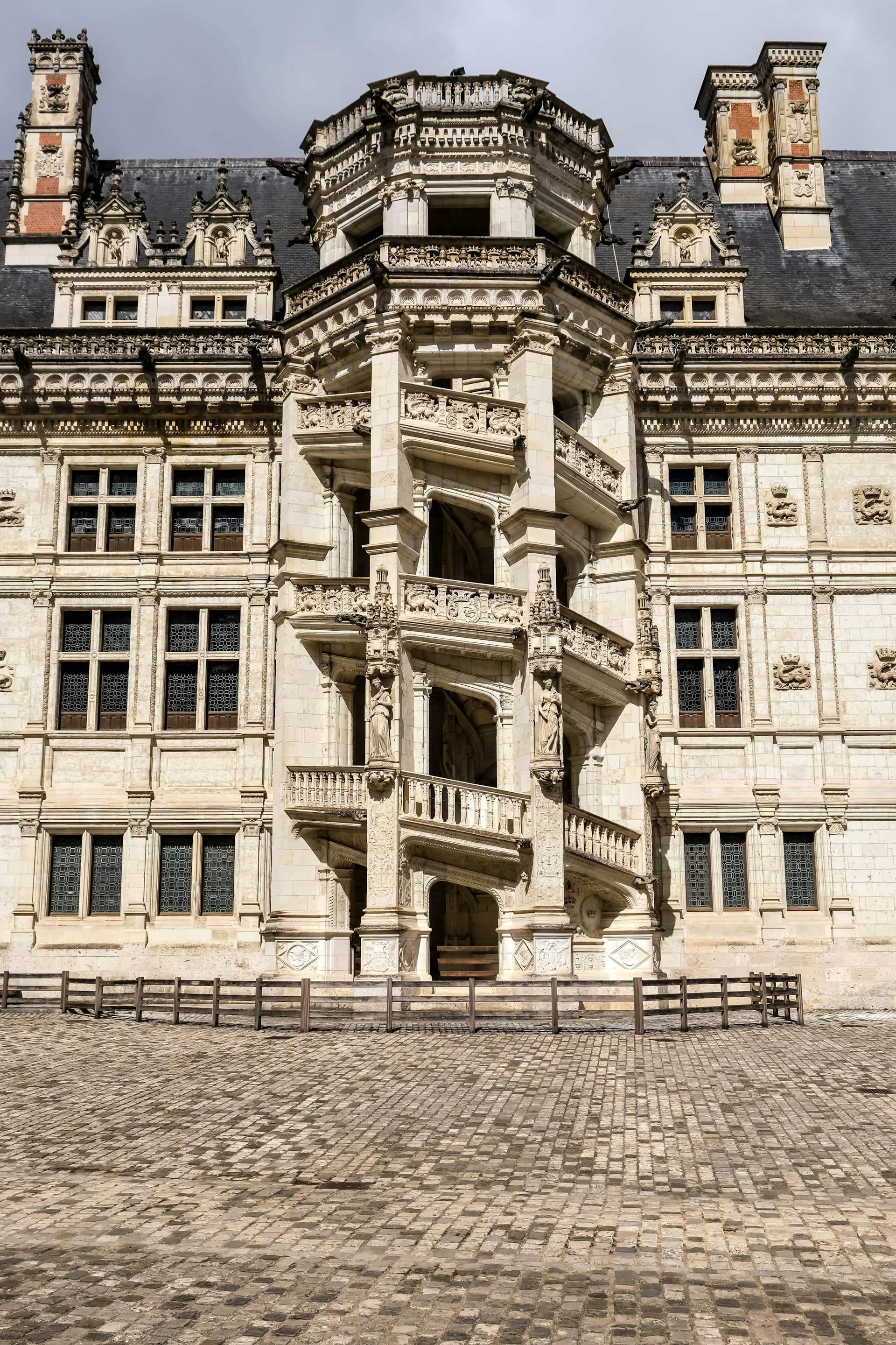
[Image: A Concrete Building with Glass Windows, Blois, France (The spiral staircase in the Francis I wing of the Royal Château of Blois); Image-Author: Kibo Silalack] [Image-Source-Link: https://www.pexels.com/photo/a-concrete-building-with-glass-windows-5232007/ ] [License-Link: https://www.pexels.com/license/ ] [Please Also Relate to Original Individual Text and Image URLs for More Usage Property and Sharing, Remixing or Attributing the Contents] [Contents on Wikipedia is covered by – Disclaimer – [Wikipedia-Disclaimer-Link : https://en.wikipedia.org/wiki/Wikipedia:General_disclaimer ] [Contents in this Website is also covered by Disclaimer linked at the bottom of the Page] [This website article means no intellectual appropriation by any way and only wishes to contribute in sharing of knowledge]
@Heritage Places, Castles & Architecture
20-Mar-2026 05 am
20-Mar-2026 05 am
This article uses text information from the Wikipedia article – Château_de_Najac – [Wikipedia-Article-Link: https://en.wikipedia.org/wiki/Ch%C3%A2teau_de_Najac ] which is released under the -- Creative Commons Attribution-ShareAlike 4.0 License – [License-Link: https://creativecommons.org/licenses/by-sa/4.0/deed.en ( https://en.wikipedia.org/wiki/Wikipedia:Text_of_the_Creative_Commons_Attribution-ShareAlike_4.0_International_License ) ] and additional terms may apply. [List of Principal Authors (5 or less) of the Wikipedia-Article on the date of this Article being Created in this Website: - 195.101.136.77, Emeraude, Perspicaris, Markussep, Olivier] [Use the following Authorship tool to find out the author contributions:- https://xtools.wmcloud.org/authorship ] [The Current Article on this Website has been paraphrased from the above linked corresponding Wikipedia-Article and You may redistribute this, verbatim or modified, provided that you comply with the terms of the Creative Commons Attribution-ShareAlike 4.0 License] [License-Link: https://creativecommons.org/licenses/by-sa/4.0/deed.en ( https://en.wikipedia.org/wiki/Wikipedia:Text_of_the_Creative_Commons_Attribution-ShareAlike_4.0_International_License ) ]
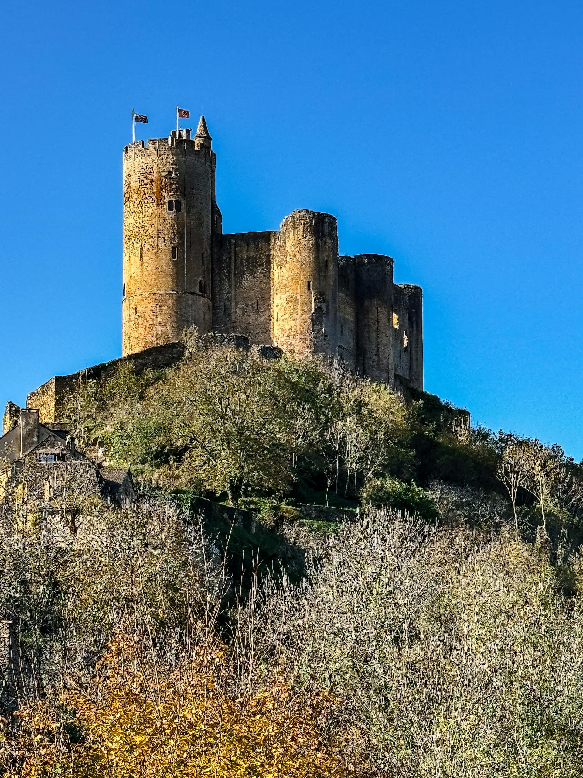
[Image: Majestic Château de Najac in Sunny France; Image-Author: ARNAUD VIGNE] [Image-Source-Link: https://www.pexels.com/photo/majestic-chateau-de-najac-in-sunny-france-29249221/ ] [License-Link: https://www.pexels.com/license/ ] [Please Also Relate to Original Individual Text and Image URLs for More Usage Property and Sharing, Remixing or Attributing the Contents]
[Contents on Wikipedia is covered by – Disclaimer – [Wikipedia-Disclaimer-Link : https://en.wikipedia.org/wiki/Wikipedia:General_disclaimer ] [Contents in this Website is also covered by Disclaimer linked at the bottom of the Page] [This website article means no intellectual appropriation by any way and only wishes to contribute in sharing of knowledge]
@Heritage Places, Castles & Architecture
15-Mar-2026 03 am
15-Mar-2026 03 am
This article uses text information from the Wikipedia article – Forte_di_San_Leo – [Wikipedia-Article-Link: https://en.wikipedia.org/wiki/Forte_di_San_Leo ] which is released under the -- Creative Commons Attribution-ShareAlike 4.0 License – [License-Link: https://creativecommons.org/licenses/by-sa/4.0/deed.en ( https://en.wikipedia.org/wiki/Wikipedia:Text_of_the_Creative_Commons_Attribution-ShareAlike_4.0_International_License )][Use the following Authorship tool to find out the author contributions:- https://xtools.wmcloud.org/authorship ] [The Current Article on this Website has been paraphrased from the above linked corresponding Wikipedia-Article and You may redistribute this, verbatim or modified, provided that you comply with the terms of the Creative Commons Attribution-ShareAlike 4.0 License] [License-Link: https://creativecommons.org/licenses/by-sa/4.0/deed.en ( https://en.wikipedia.org/wiki/Wikipedia:Text_of_the_Creative_Commons_Attribution-ShareAlike_4.0_International_License )]
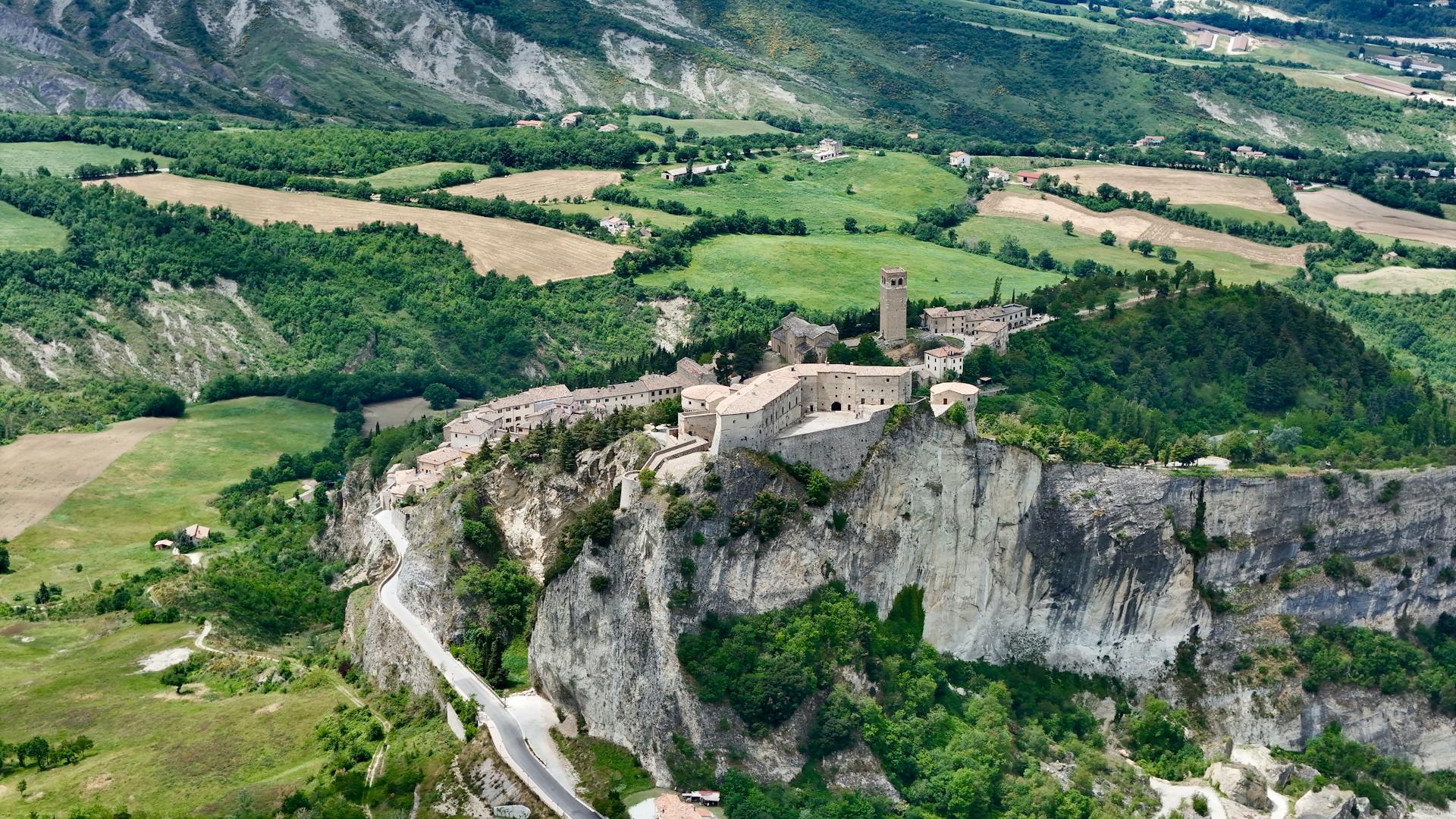
[Image: Drone Shot of the Fortress of San Leo in San Leo, Romagna, Italy; Image-Author: DeLuca G] [Image-Source-Link: https://www.pexels.com/photo/drone-shot-of-the-fortress-of-san-leo-in-san-leo-romagna-italy-24644685/ ] [License-Link: https://www.pexels.com/license/ ] [Please Also Relate to Original Individual Text and Image URLs for More Usage Property and Sharing, Remixing or Attributing the Contents]
[Contents on Wikipedia is covered by – Disclaimer – [Wikipedia-Disclaimer-Link : https://en.wikipedia.org/wiki/Wikipedia:General_disclaimer ] [Contents in this Website is also covered by Disclaimer linked at the bottom of the Page] [This website article means no intellectual appropriation by any way and only wishes to contribute in sharing of knowledge]
@Heritage Places, Castles & Architecture
13-Mar-2026 05 am
13-Mar-2026 05 am
This article uses text information from the Wikipedia article – Liebenzell_Castle – [Wikipedia-Article-Link: https://en.wikipedia.org/wiki/Liebenzell_Castle ] which is released under the -- Creative Commons Attribution-ShareAlike 4.0 License – [License-Link: https://creativecommons.org/licenses/by-sa/4.0/deed.en ( https://en.wikipedia.org/wiki/Wikipedia:Text_of_the_Creative_Commons_Attribution-ShareAlike_4.0_International_License )] [List of Principal Authors (5 or less) of the Wikipedia-Article on the date of this Article being Created in this Website: - Bermicourt, AnomieBOT, Vami IV, DB1729, Keith D] [Use the following Authorship tool to find out the author contributions:- https://xtools.wmcloud.org/authorship ] [The Current Article on this Website has been paraphrased from the above linked corresponding Wikipedia-Article and You may redistribute this, verbatim or modified, provided that you comply with the terms of the Creative Commons Attribution-ShareAlike 4.0 License] [License-Link: https://creativecommons.org/licenses/by-sa/4.0/deed.en ( https://en.wikipedia.org/wiki/Wikipedia:Text_of_the_Creative_Commons_Attribution-ShareAlike_4.0_International_License )]
[Image: Liebenzell Castle in Germany; Image-Author: Joerg Hartmann] [Image-Source-Link: https://www.pexels.com/photo/liebenzell-castle-in-germany-20454167/ ] [License-Link: https://www.pexels.com/license/ ] [Please Also Relate to Original Individual Text and Image URLs for More Usage Property and Sharing, Remixing or Attributing the Contents] [Contents on Wikipedia is covered by – Disclaimer – [Wikipedia-Disclaimer-Link : https://en.wikipedia.org/wiki/Wikipedia:General_disclaimer ] [Contents in this Website is also covered by Disclaimer linked at the bottom of the Page] [This website article means no intellectual appropriation by any way and only wishes to contribute in sharing of knowledge]
@Heritage Places, Castles & Architecture
11-Mar-2026 03 am
11-Mar-2026 03 am
This article uses text information from the Wikipedia article – Bled_Castle – [Wikipedia-Article-Link: https://en.wikipedia.org/wiki/Bled_Castle ] which is released under the -- Creative Commons Attribution-ShareAlike 4.0 License – [License-Link: https://creativecommons.org/licenses/by-sa/4.0/deed.en ( https://en.wikipedia.org/wiki/Wikipedia:Text_of_the_Creative_Commons_Attribution-ShareAlike_4.0_International_License )] [List of Principal Authors (5 or less) of the Wikipedia-Article on the date of this Article being Created in this Website: - TadejM, Dino Bizjak, Knewdates, Pinky sl, 92.225.111.135] [Use the following Authorship tool to find out the author contributions:- https://xtools.wmcloud.org/authorship ] [The Current Article on this Website has been paraphrased from the above linked corresponding Wikipedia-Article and You may redistribute this, verbatim or modified, provided that you comply with the terms of the Creative Commons Attribution-ShareAlike 4.0 License] [License-Link: https://creativecommons.org/licenses/by-sa/4.0/deed.en ( https://en.wikipedia.org/wiki/Wikipedia:Text_of_the_Creative_Commons_Attribution-ShareAlike_4.0_International_License )]
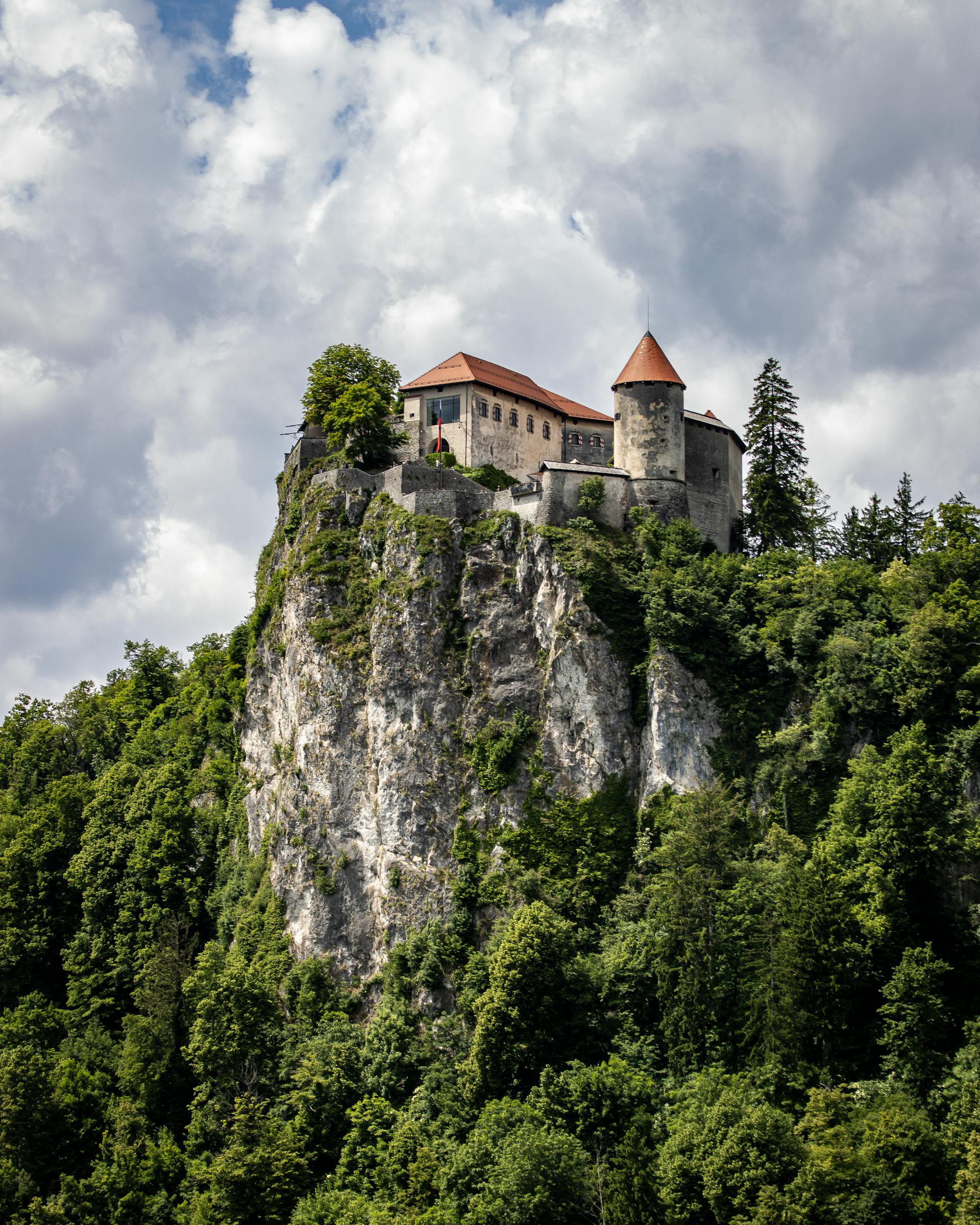
[Image: Majestic Bled Castle on Clifftop in Slovenia; Image-Author: Necmettin Rauf Ceviz] [Image-Source-Link: https://www.pexels.com/photo/majestic-bled-castle-on-clifftop-in-slovenia-32363624/ ] [License-Link: https://www.pexels.com/license/ ] [Please Also Relate to Original Individual Text and Image URLs for More Usage Property and Sharing, Remixing or Attributing the Contents] [Contents on Wikipedia is covered by – Disclaimer – [Wikipedia-Disclaimer-Link : https://en.wikipedia.org/wiki/Wikipedia:General_disclaimer ] [Contents in this Website is also covered by Disclaimer linked at the bottom of the Page] [This website article means no intellectual appropriation by any way and only wishes to contribute in sharing of knowledge]
@Heritage Places, Castles & Architecture
04-Mar-2026 11 pm
04-Mar-2026 11 pm
This article uses text information from the Wikipedia article – Peyrepertuse – [Wikipedia-Article-Link: https://en.wikipedia.org/wiki/Peyrepertuse ] which is released under the -- Creative Commons Attribution-ShareAlike 4.0 License – [License-Link: https://creativecommons.org/licenses/by-sa/4.0/deed.en ( https://en.wikipedia.org/wiki/Wikipedia:Text_of_the_Creative_Commons_Attribution-ShareAlike_4.0_International_License )] [List of Principal Authors (5 or less) of the Wikipedia-Article on the date of this Article being Created in this Website: - Adelaide1600, Filiep, Emeraude, Morningstar1814, ManyFireflies] [Use the following Authorship tool to find out the author contributions:- https://xtools.wmcloud.org/authorship ] [The Current Article on this Website has been paraphrased from the above linked corresponding Wikipedia-Article and You may redistribute this, verbatim or modified, provided that you comply with the terms of the Creative Commons Attribution-ShareAlike 4.0 License] [License-Link: https://creativecommons.org/licenses/by-sa/4.0/deed.en ( https://en.wikipedia.org/wiki/Wikipedia:Text_of_the_Creative_Commons_Attribution-ShareAlike_4.0_International_License )]
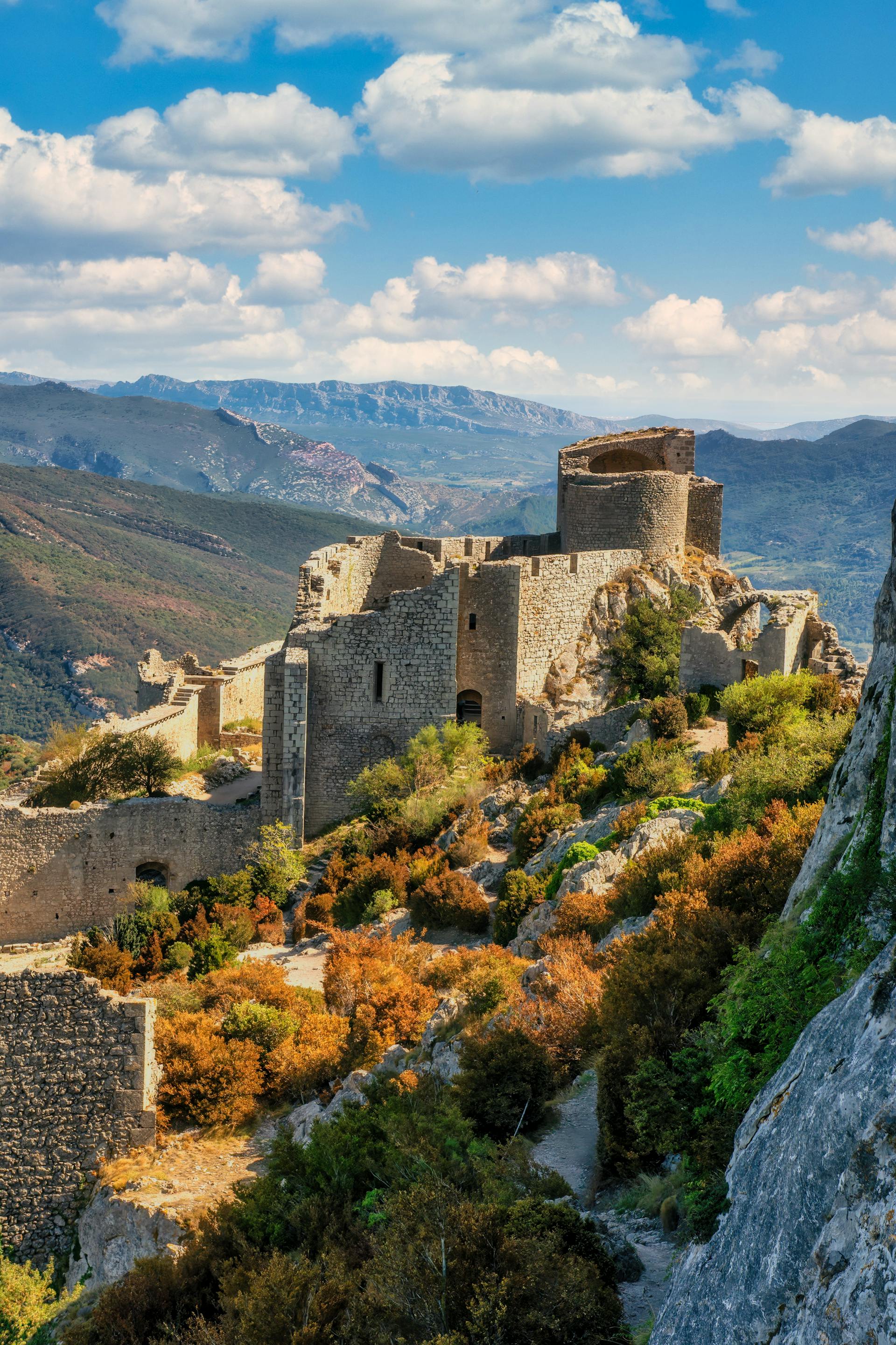
[Image: Historic Peyrepertuse Castle in the Pyrenees; Image-Author: juv] [Image-Source-Link: https://www.pexels.com/photo/historic-peyrepertuse-castle-in-the-pyrenees-32521582/ ] [License-Link: https://www.pexels.com/license/ ] [Please Also Relate to Original Individual Text and Image URLs for More Usage Property and Sharing, Remixing or Attributing the Contents]
[Contents on Wikipedia is covered by – Disclaimer – [Wikipedia-Disclaimer-Link : https://en.wikipedia.org/wiki/Wikipedia:General_disclaimer ] [Contents in this Website is also covered by Disclaimer linked at the bottom of the Page] [This website article means no intellectual appropriation by any way and only wishes to contribute in sharing of knowledge]
@Heritage Places, Castles & Architecture
03-Mar-2026 12 am
03-Mar-2026 12 am
This article uses text information from the Wikipedia article – Trenčín_Castle – [Wikipedia-Article-Link: https://en.wikipedia.org/wiki/Tren%C4%8D%C3%ADn_Castle ] which is released under the -- Creative Commons Attribution-ShareAlike 4.0 License – [License-Link: https://creativecommons.org/licenses/by-sa/4.0/deed.en ( https://en.wikipedia.org/wiki/Wikipedia:Text_of_the_Creative_Commons_Attribution-ShareAlike_4.0_International_License )] [List of Principal Authors (5 or less) of the Wikipedia-Article on the date of this Article being Created in this Website: - Marek. kvackaj, Lucullus19, Evrik, Vlendert, Tankred] [Use the following Authorship tool to find out the author contributions:- https://xtools.wmcloud.org/authorship ] [The Current Article on this Website has been paraphrased from the above linked corresponding Wikipedia-Article and You may redistribute this, verbatim or modified, provided that you comply with the terms of the Creative Commons Attribution-ShareAlike 4.0 License] [License-Link: https://creativecommons.org/licenses/by-sa/4.0/deed.en ( https://en.wikipedia.org/wiki/Wikipedia:Text_of_the_Creative_Commons_Attribution-ShareAlike_4.0_International_License )]
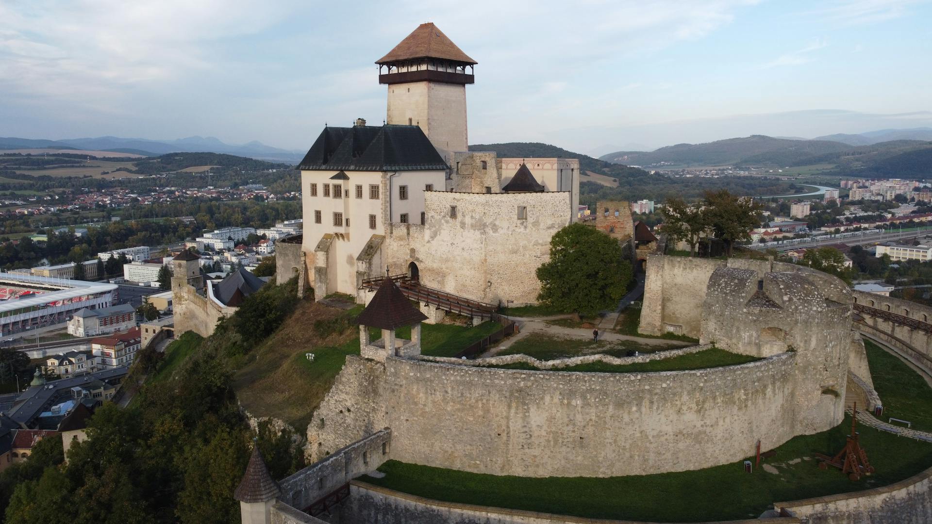
[Image: Aerial View of the Trencin Castle, Slovakia; Image-Author: Arnis Rascal] [Image-Source-Link: https://www.pexels.com/photo/aerial-view-of-the-trencin-castle-slovakia-10241225/ ] [License-Link: https://www.pexels.com/license/ ] [Please Also Relate to Original Individual Text and Image URLs for More Usage Property and Sharing, Remixing or Attributing the Contents] [Contents on Wikipedia is covered by – Disclaimer – [Wikipedia-Disclaimer-Link: https://en.wikipedia.org/wiki/Wikipedia:General_disclaimer ]] [Contents in this Website is also covered by Disclaimer linked at the bottom of the Page] [This website article means no intellectual appropriation by any way and only wishes to contribute in sharing of knowledge]
@Heritage Places, Castles & Architecture
27-Feb-2026 03 am
27-Feb-2026 03 am
This article uses text information from the Wikipedia article – Hohenwerfen_Castle – [Wikipedia-Article-Link: https://en.wikipedia.org/wiki/Hohenwerfen_Castle ] which is released under the -- Creative Commons Attribution-ShareAlike 4.0 License – [License-Link: https://creativecommons.org/licenses/by-sa/4.0/deed.en ( https://en.wikipedia.org/wiki/Wikipedia:Text_of_the_Creative_Commons_Attribution-ShareAlike_4.0_International_License )] [List of Principal Authors (5 or less) of the Wikipedia-Article on the date of this Article being Created in this Website: - Waxworker, Keallu, Velocitom, 92.225.108.54, 92.225.121.120] [Use the following Authorship tool to find out the author contributions:- https://xtools.wmcloud.org/authorship ] [The Current Article on this Website has been paraphrased from the above linked corresponding Wikipedia-Article and You may redistribute this, verbatim or modified, provided that you comply with the terms of the Creative Commons Attribution-ShareAlike 4.0 License] [License-Link: https://creativecommons.org/licenses/by-sa/4.0/deed.en ( https://en.wikipedia.org/wiki/Wikipedia:Text_of_the_Creative_Commons_Attribution-ShareAlike_4.0_International_License )]
[Image: Misty Hohenwerfen Castle in Austrian Alps; Image-Author: Karolina] [Image-Source-Link: https://www.pexels.com/photo/misty-hohenwerfen-castle-in-austrian-alps-29223328/ ] [License-Link: https://www.pexels.com/license/ ] [Please Also Relate to Original Individual Text and Image URLs for More Usage Property and Sharing, Remixing or Attributing the Contents] [Contents on Wikipedia is covered by – Disclaimer – [Wikipedia-Disclaimer-Link: https://en.wikipedia.org/wiki/Wikipedia:General_disclaimer ]] [Contents in this Website is also covered by Disclaimer linked at the bottom of the Page] [This website article means no intellectual appropriation by any way and only wishes to contribute in sharing of knowledge]
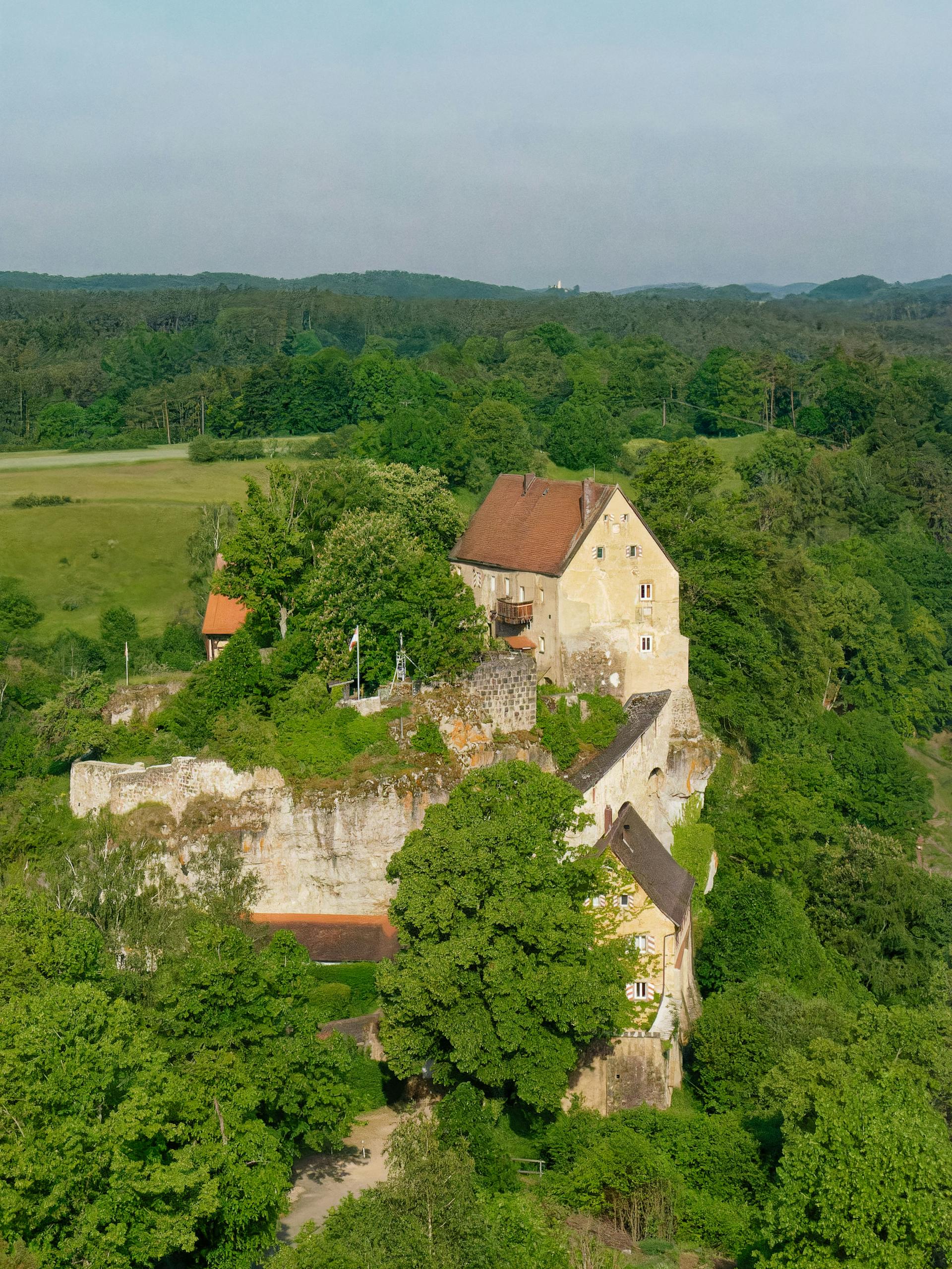
@Heritage Places, Castles & Architecture
23-Feb-2026 07 am
23-Feb-2026 07 am
This article uses text information from the Wikipedia article – Pottenstein_Castle – [Wikipedia-Article-Link: https://en.wikipedia.org/wiki/Pottenstein_Castle ] which is released under the -- Creative Commons Attribution-ShareAlike 4.0 License – [License-Link: https://creativecommons.org/licenses/by-sa/4.0/deed.en ( https://en.wikipedia.org/wiki/Wikipedia:Text_of_the_Creative_Commons_Attribution-ShareAlike_4.0_International_License )] [List of Principal Authors (5 or less) of the Wikipedia-Article on the date of this Article being Created in this Website: - Bermicourt, AnomieBOT, Yobot, Maxeto0910, PrimeBOT] [Use the following Authorship tool to find out the author contributions:- https://xtools.wmcloud.org/authorship ] [The Current Article on this Website has been paraphrased from the above linked corresponding Wikipedia-Article and You may redistribute this, verbatim or modified, provided that you comply with the terms of the Creative Commons Attribution-ShareAlike 4.0 License] [License-Link: https://creativecommons.org/licenses/by-sa/4.0/deed.en ( https://en.wikipedia.org/wiki/Wikipedia:Text_of_the_Creative_Commons_Attribution-ShareAlike_4.0_International_License )]
[Image: Birds View of Pottenstein Castle in Lush Greenery, Bavaria, Germany; Image-Author: Sabine Freiberger] [Image-Source-Link: https://www.pexels.com/photo/birds-view-of-pottenstein-castle-in-lush-greenery-bavaria-germany-17101108/ ] [License-Link: https://www.pexels.com/license/ ] [Please Also Relate to Original Individual Text and Image URLs for More Usage Property and Sharing, Remixing or Attributing the Contents] [Contents on Wikipedia is covered by – Disclaimer – [Wikipedia-Disclaimer-Link: https://en.wikipedia.org/wiki/Wikipedia:General_disclaimer ]] [Contents in this Website is also covered by Disclaimer linked at the bottom of the Page] [This website article means no intellectual appropriation by any way and only wishes to contribute in sharing of knowledge]
@Heritage Places, Castles & Architecture
18-Feb-2026 08 pm
18-Feb-2026 08 pm
This article uses text information from the Wikipedia article – Niederburg,_Kobern – [Wikipedia-Article-Link: https://en.wikipedia.org/wiki/Niederburg,_Kobern ] which is released under the -- Creative Commons Attribution-ShareAlike 4.0 License – [License-Link: https://creativecommons.org/licenses/by-sa/4.0/deed.en ( https://en.wikipedia.org/wiki/Wikipedia:Text_of_the_Creative_Commons_Attribution-ShareAlike_4.0_International_License )] [List of Principal Authors (5 or less) of the Wikipedia-Article on the date of this Article being Created in this Website: - Bermicourt, AnomieBOT, Grimes2, Onel5969, Vmavanti] [Use the following Authorship tool to find out the author contributions:- https://xtools.wmcloud.org/authorship ] [The Current Article on this Website has been paraphrased from the above linked corresponding Wikipedia-Article and You may redistribute this, verbatim or modified, provided that you comply with the terms of the Creative Commons Attribution-ShareAlike 4.0 License] [License-Link: https://creativecommons.org/licenses/by-sa/4.0/deed.en ( https://en.wikipedia.org/wiki/Wikipedia:Text_of_the_Creative_Commons_Attribution-ShareAlike_4.0_International_License )]
This article also uses an image from the Wikipedia article – Niederburg,_Kobern – [Wikipedia-Article-Link: https://en.wikipedia.org/wiki/Niederburg,_Kobern ] [Image: Kobern Niederburg; Photographer: Klaus Graf; Wikipedia-Image-Source: Source: German Wikipedia, uploaded there by user Historiograf on 23. Mar. 2005] [Wikipedia-Image-Link: https://en.wikipedia.org/wiki/File:Kobern_Niederburg.jpg ] [Image Availed Under Creative Commons Attribution 2.0 Generic license] [License-Link: https://creativecommons.org/licenses/by/2.0/deed.en ] [You may copy, distribute and transmit the work (image) or remix the work (image) and attribute the work (image) with proper license link, complying with the terms of the Creative Commons Attribution 2.0 Generic license in distribution] [License-Link: https://creativecommons.org/licenses/by/2.0/deed.en ] [Please Also Relate to Original Individual Text and Image URLs for More Usage Property and Sharing, Remixing or Attributing the Contents]
[Contents on Wikipedia is covered by – Disclaimer – Wikipedia-Disclaimer-Link: https://en.wikipedia.org/wiki/Wikipedia:General_disclaimer ] [Contents in this Website is also covered by Disclaimer linked at the bottom of the Page] [This website article means no intellectual appropriation by any way and only wishes to contribute in sharing of knowledge]

@Heritage Places, Castles & Architecture
16-Feb-2026 10 pm
16-Feb-2026 10 pm
This article uses text information from the Wikipedia article – Karlštejn – [Wikipedia-Article-Link: https://en.wikipedia.org/wiki/Karl%C5%A1tejn ] which is released under the -- Creative Commons Attribution-ShareAlike 4.0 License – [License-Link: https://creativecommons.org/licenses/by-sa/4.0/deed.en ( https://en.wikipedia.org/wiki/Wikipedia:Text_of_the_Creative_Commons_Attribution-ShareAlike_4.0_International_License )] [List of Principal Authors (5 or less) of the Wikipedia-Article on the date of this Article being Created in this Website: - Krenakarore, Matthead, FromCzech, 90.179.142.166, Scope creep] [Use the following Authorship tool to find out the author contributions:- https://xtools.wmcloud.org/authorship ] [The Current Article on this Website has been paraphrased from the above linked corresponding Wikipedia-Article and You may redistribute this, verbatim or modified, provided that you comply with the terms of the Creative Commons Attribution-ShareAlike 4.0 License] [License-Link: https://creativecommons.org/licenses/by-sa/4.0/deed.en ( https://en.wikipedia.org/wiki/Wikipedia:Text_of_the_Creative_Commons_Attribution-ShareAlike_4.0_International_License )]
[Image: Karlstejn Castle in Autumn; Image-Author: Galina Kudryashova] [Image_Source-Link: https://www.pexels.com/photo/karlstejn-castle-in-autumn-20291113/ ] [License-Link: https://www.pexels.com/license/ ] [Please Also Relate to Original Individual Text and Image URLs for More Usage Property and Sharing, Remixing or Attributing the Contents] [Contents on Wikipedia is covered by -- Disclaimer – Wikipedia-Disclaimer-Link: https://en.wikipedia.org/wiki/Wikipedia:General_disclaimer ] [Contents in this Website is also covered by Disclaimer linked at the bottom of the Page] [This website article means no intellectual appropriation by any way and only wishes to contribute in sharing of knowledge]
@Heritage Places, Castles & Architecture
16-Feb-2026 06 am
16-Feb-2026 06 am
This article uses text information from the Wikipedia article – Schloss_Berlepsch – [Wikipedia-Article-Link: https://de.wikipedia.org/wiki/Schloss_Berlepsch ] which is released under the -- Creative-Commons Namensnennung – Weitergabe unter gleichen Bedingungen – [License-Link: https://creativecommons.org/licenses/by-sa/4.0/deed.de ] [List of Principal Authors (5 or less) of the Wikipedia-Article on the date of this Article being Created in this Website: - 195.93.60.9, 46.114.90.22, Kreisleriana, Presse03, Commander-pirx] [Use the following Authorship tool to find out the author contributions:- https://xtools.wmcloud.org/authorship ] [The Current Article on this Website has been translated and paraphrased from the above linked corresponding Wikipedia-Article and You may redistribute this, verbatim or modified, provided that you comply with the terms of the Creative-Commons Namensnennung – Weitergabe unter gleichen Bedingungen] [License-Link: https://creativecommons.org/licenses/by-sa/4.0/deed.de ]
[Image: Schloss Berlepsch; Image-Author: Christina & Peter] [Image_Source-Link: https://www.pexels.com/photo/schloss-berlepsch-28431213/ ] [License-Link: https://www.pexels.com/license/ ] [Please Also Relate to Original Individual Text and Image URLs for More Usage Property and Sharing, Remixing or Attributing the Contents]
[Contents on Wikipedia is covered by -- Disclaimer – Wikipedia-Disclaimer-Link: https://en.wikipedia.org/wiki/Wikipedia:General_disclaimer ] [Contents in this Website is also covered by Disclaimer linked at the bottom of the Page] [This website article means no intellectual appropriation by any way and only wishes to contribute in sharing of knowledge]
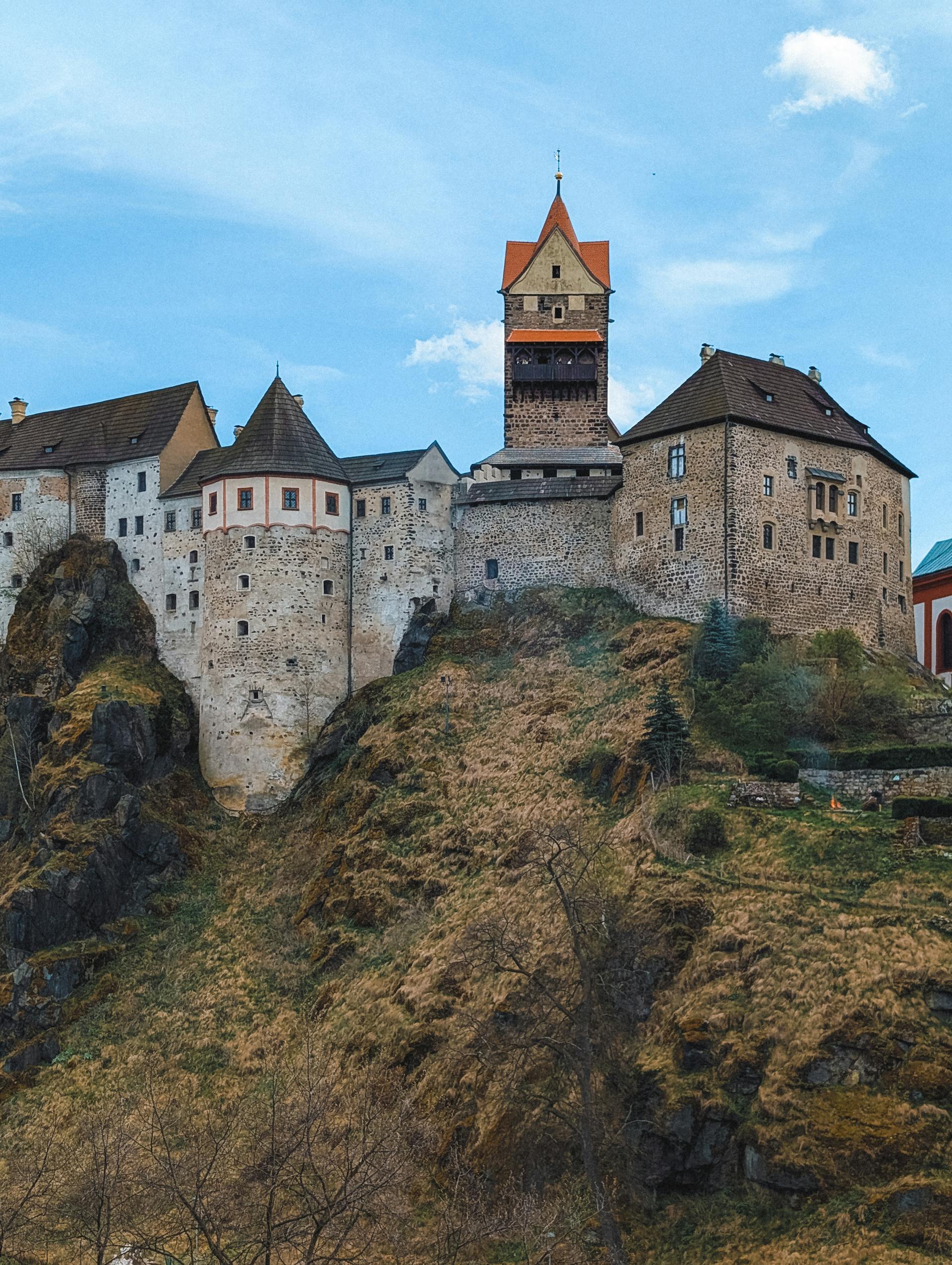
@Heritage Places, Castles & Architecture
13-Feb-2026 12 am
13-Feb-2026 12 am
This article uses text information from the Wikipedia article – Loket_Castle – [Wikipedia-Article-Link: https://en.wikipedia.org/wiki/Loket_Castle ] which is released under the -- Creative Commons Attribution-ShareAlike 4.0 License – [License-Link: https://creativecommons.org/licenses/by-sa/4.0/deed.en ( https://en.wikipedia.org/wiki/Wikipedia:Text_of_the_Creative_Commons_Attribution-ShareAlike_4.0_International_License )] [List of Principal Authors (5 or less) of the Wikipedia-Article on the date of this Article being Created in this Website: - Krenakarore, Arminden, Addshore, Zackmann08, FromCzech] [Use the following Authorship tool to find out the author contributions:- https://xtools.wmcloud.org/authorship ] [The Current Article on this Website has been paraphrased from the above linked corresponding Wikipedia-Article and You may redistribute this, verbatim or modified, provided that you comply with the terms of the Creative Commons Attribution-ShareAlike 4.0 License] [License-Link: https://creativecommons.org/licenses/by-sa/4.0/deed.en ( https://en.wikipedia.org/wiki/Wikipedia:Text_of_the_Creative_Commons_Attribution-ShareAlike_4.0_International_License )]
[Image: Scenic View of Loket Castle in Czechia; Image-Author: Alexey K. ] [Image_Source-Link: https://www.pexels.com/photo/scenic-view-of-loket-castle-in-czechia-31718815/ ] [License-Link: https://www.pexels.com/license/ ] [Please Also Relate to Original Individual Text and Image URLs for More Usage Property and Sharing, Remixing or Attributing the Contents] [Contents on Wikipedia is covered by -- Disclaimer – Wikipedia-Disclaimer-Link: https://en.wikipedia.org/wiki/Wikipedia:General_disclaimer ] [Contents in this Website is also covered by Disclaimer linked at the bottom of the Page] [This website article means no intellectual appropriation by any way and only wishes to contribute in sharing of knowledge]
@Heritage Places, Castles & Architecture
09-Feb-2026 09 pm
09-Feb-2026 09 pm
This article uses text information from the Wikipedia article -- Castillo_de_La_Calahorra -- [Wikipedia-Article-Link: https://en.wikipedia.org/wiki/Castillo_de_La_Calahorra ] which is released under the -- Creative Commons Attribution-ShareAlike 4.0 License – [License-Link: https://en.wikipedia.org/wiki/Wikipedia:Text_of_the_Creative_Commons_Attribution-ShareAlike_4.0_International_License ] [List of Principal Authors (5 or less) of the Wikipedia-Article on the date of this Article being Created in this Website: - Rosiestep, 2001:56A:7840:4F00:695D:DC7B:BB16:E54C, Wolfgang Pehlemann, Anil1956, InternetArchiveBot] [Use the following Authorship tool to find out the author contributions:- https://xtools.wmcloud.org/authorship ] [The Current Article on this Website has been paraphrased from the above linked corresponding Wikipedia-Article and You may redistribute this, verbatim or modified, provided that you comply with the terms of the Creative Commons Attribution-ShareAlike 4.0 License] [License-Link: https://en.wikipedia.org/wiki/Wikipedia:Text_of_the_Creative_Commons_Attribution-ShareAlike_4.0_International_License ]
[Image: View of the Castillo de La Calahorra, La Calahorra, in the Province of Granada, Spain; Image-Author: Pedro Luis Domínguez Ruiz] [Image_Source-Link: https://www.pexels.com/photo/view-of-the-castillo-de-la-calahorra-la-calahorra-in-the-province-of-granada-spain-15488108/ ] [License-Link: https://www.pexels.com/license/ ] [Please Also Relate to Original Individual Text and Image URLs for More Usage Property and Sharing, Remixing or Attributing the Contents]
[Contents on Wikipedia is covered by -- Disclaimer – Wikipedia-Disclaimer-Link: https://en.wikipedia.org/wiki/Wikipedia:General_disclaimer ] [Contents in this Website is also covered by Disclaimer linked at the bottom of the Page] [This website article means no intellectual appropriation by any way and only wishes to contribute in sharing of knowledge]
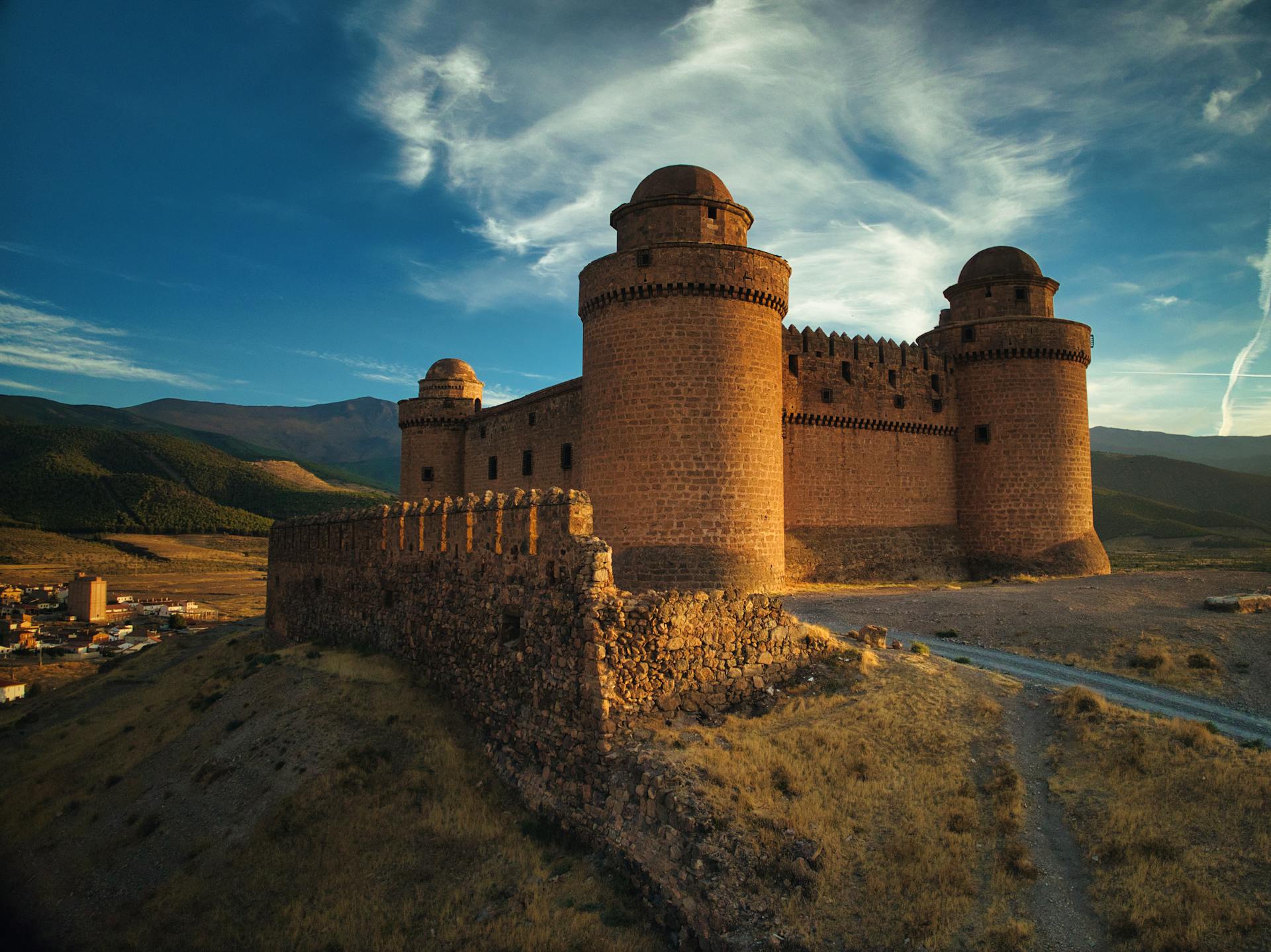
@Heritage Places, Castles & Architecture
04-Feb-2026 05 pm
04-Feb-2026 05 pm
This article uses text information from the Wikipedia article -- Schloss_Philippsfreude -- [Wikipedia-Article-Link: https://en.wikipedia.org/wiki/Schloss_Philippsfreude ] which is released under the -- Creative Commons Attribution-ShareAlike 4.0 License – [License-Link: https://en.wikipedia.org/wiki/Wikipedia:Text_of_the_Creative_Commons_Attribution-ShareAlike_4.0_International_License ] [List of Principal Authors (5 or less) of the Wikipedia-Article on the date of this Article being Created in this Website: - Ipflo, Onel5969, JJMC89 bot III, Aronlee90, Grimes2] [Use the following Authorship tool to find out the author contributions:- https://xtools.wmcloud.org/authorship ] [The Current Article on this Website has been paraphrased from the above linked corresponding Wikipedia-Article and You may redistribute this, verbatim or modified, provided that you comply with the terms of the Creative Commons Attribution-ShareAlike 4.0 License] [License-Link: https://en.wikipedia.org/wiki/Wikipedia:Text_of_the_Creative_Commons_Attribution-ShareAlike_4.0_International_License ]
This article also uses an image from the Wikipedia article – Schloss_Philippsfreude – [Wikipedia-Article-Link: https://en.wikipedia.org/wiki/Schloss_Philippsfreude ] [Image: Schloss Philippsfreude in Wittlich (1760) by Bernhard Gottfried Manskirch] [Wikipedia-Image-Link: https://en.wikipedia.org/wiki/File:Wittlich_Schloss_Philippsfreude_Bernard_Gottfried_Manskirch_1760.jpg ] [The Work is in the public domain in its country of origin and other countries and areas where the copyright term is the life of author plus 70 years or fewer. The work is in the public domain in the United States because it was published (or registered with the U.S. Copyright Office) before January 1, 1931. ][Please Also Relate to Original Individual Text and Image URLs for More Usage Property and Sharing, Remixing or Attributing the Contents]
[Contents on Wikipedia is covered by – Disclaimer – Wikipedia-Disclaimer-Link: https://en.wikipedia.org/wiki/Wikipedia:General_disclaimer ] [Contents in this Website is also covered by Disclaimer linked at the bottom of the Page] [This website article means no intellectual appropriation by any way and only wishes to contribute in sharing of knowledge]
@Heritage Places, Castles & Architecture
03-Feb-2026 05 am
03-Feb-2026 05 am
This article uses text information from the Wikipedia article -- Veste_Coburg -- [Wikipedia-Article-Link: https://en.wikipedia.org/wiki/Veste_Coburg ] which is released under the -- Creative Commons Attribution-ShareAlike 4.0 License – [License-Link: https://en.wikipedia.org/wiki/Wikipedia:Text_of_the_Creative_Commons_Attribution-ShareAlike_4.0_International_License ] [List of Principal Authors (5 or less) of the Wikipedia-Article on the date of this Article being Created in this Website: - Drow69, Bartimaeus blue, Nikantmark, Moonraker, Neptuul] [Use the following Authorship tool to find out the author contributions:- https://xtools.wmcloud.org/authorship ] [The Current Article on this Website has been paraphrased from the above linked corresponding Wikipedia-Article and You may redistribute this, verbatim or modified, provided that you comply with the terms of the Creative Commons Attribution-ShareAlike 4.0 License] [License-Link: https://en.wikipedia.org/wiki/Wikipedia:Text_of_the_Creative_Commons_Attribution-ShareAlike_4.0_International_License ]
This article also uses an image from the Wikipedia article -- Veste_Coburg -- [Wikipedia-Article-Link: https://en.wikipedia.org/wiki/Veste_Coburg ] [Image: Veste Coburg, Ansicht vom Bismarkturm aus (Westansicht); Wikipedia-Image-Author: Presse03 https://commons.wikimedia.org/wiki/User:Presse03 ] [Wikipedia-Image-Link: https://en.wikipedia.org/wiki/File:Veste_Coburg_West.jpg ] [Image Availed Under Creative Commons Attribution-Share Alike 3.0 Unported license] [License-Link: https://creativecommons.org/licenses/by-sa/3.0/deed.en ] [You may copy, distribute and transmit the work (image) or share (alike) the work (image), provided that you comply with the terms of the Creative Commons Attribution-Share Alike 3.0 Unported license or other compatible license in distribution] [License-Link: https://creativecommons.org/licenses/by-sa/3.0/deed.en ] [Please Also Relate to Original Individual Text and Image URLs for More Usage Property and Sharing, Remixing or Attributing the Contents]
[Contents on Wikipedia is covered by -- Disclaimer – Wikipedia-Disclaimer-Link: https://en.wikipedia.org/wiki/Wikipedia:General_disclaimer ] [Contents in this Website is also covered by Disclaimer linked at the bottom of the Page] [This website article means no intellectual appropriation by any way and only wishes to contribute in sharing of knowledge]
@Heritage Places, Castles & Architecture
31-Jan-2026 04 am
31-Jan-2026 04 am
This article uses text information from the Wikipedia article -- Pfalzgrafenstein_Castle -- [Wikipedia-Article-Link: https://en.wikipedia.org/wiki/Pfalzgrafenstein_Castle ] which is released under the -- Creative Commons Attribution-ShareAlike 4.0 License – [License-Link: https://en.wikipedia.org/wiki/Wikipedia:Text_of_the_Creative_Commons_Attribution-ShareAlike_4.0_International_License ] [List of Principal Authors (5 or less) of the Wikipedia-Article on the date of this Article being Created in this Website: - Golem08, Ekem, Dimadick, Citation bot, 79.200.112.228] [Use the following Authorship tool to find out the author contributions:- https://xtools.wmcloud.org/authorship ] [The Current Article on this Website has been paraphrased from the above linked corresponding Wikipedia-Article and You may redistribute this, verbatim or modified, provided that you comply with the terms of the Creative Commons Attribution-ShareAlike 4.0 License] [License-Link: https://en.wikipedia.org/wiki/Wikipedia:Text_of_the_Creative_Commons_Attribution-ShareAlike_4.0_International_License ]
[Image: Pfalzgrafenstein Castle on Lake Shore, Germany; Image-Author: op23] [Image_Source-Link: https://www.pexels.com/photo/pfalzgrafenstein-castle-on-lake-shore-germany-12323346/ ] [License-Link: https://www.pexels.com/license/ ] [Please Also Relate to Original Individual Text and Image URLs for More Usage Property and Sharing, Remixing or Attributing the Contents]
[Contents on Wikipedia is covered by -- Disclaimer – Wikipedia-Disclaimer-Link: https://en.wikipedia.org/wiki/Wikipedia:General_disclaimer ] [Contents in this Website is also covered by Disclaimer linked at the bottom of the Page] [This website article means no intellectual appropriation by any way and only wishes to contribute in sharing of knowledge]
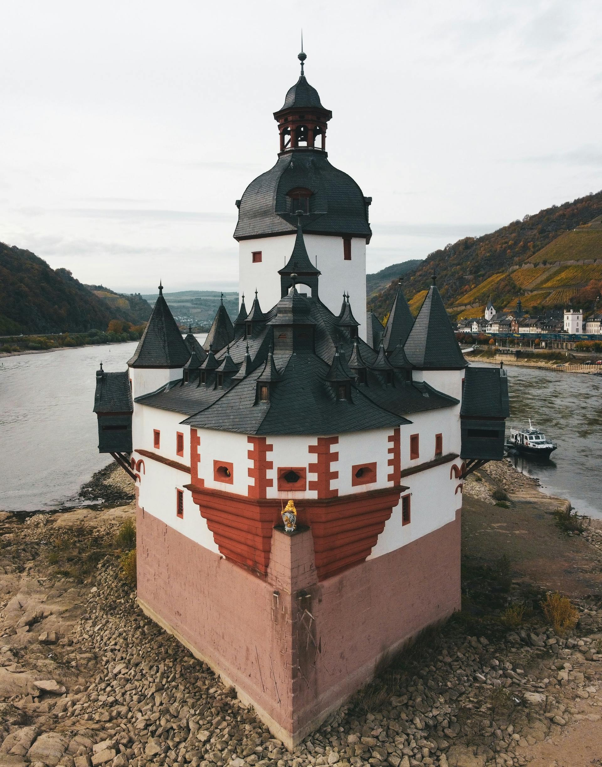
@Heritage Places, Castles & Architecture
26-Jan-2026 01 am
26-Jan-2026 01 am
This article uses text information from the Wikipedia article -- Bentheim_Castle -- [Wikipedia-Article-Link: https://en.wikipedia.org/wiki/Bentheim_Castle ] which is released under the -- Creative Commons Attribution-ShareAlike 4.0 License – [License-Link: https://en.wikipedia.org/wiki/Wikipedia:Text_of_the_Creative_Commons_Attribution-ShareAlike_4.0_International_License ] [List of Principal Authors (5 or less) of the Wikipedia-Article on the date of this Article being Created in this Website: - Kleuske, InternetArchiveBot, Equord, 87.165.112.139, Dimadick] [Use the following Authorship tool to find out the author contributions:- https://xtools.wmcloud.org/authorship ] [The Current Article on this Website has been paraphrased from the above linked corresponding Wikipedia-Article and You may redistribute this, verbatim or modified, provided that you comply with the terms of the Creative Commons Attribution-ShareAlike 4.0 License] [License-Link: https://en.wikipedia.org/wiki/Wikipedia:Text_of_the_Creative_Commons_Attribution-ShareAlike_4.0_International_License ]
This article also uses an image from the Wikipedia article -- Bad_Bentheim -- [Wikipedia-Article-Link: https://en.wikipedia.org/wiki/Bad_Bentheim ] [Image: Burg Bentheim Pulverturm; Wikipedia-Image-Source: Stahlkocher] [Wikipedia-Image-Link: https://en.wikipedia.org/wiki/File:Burg_Bentheim_Pulverturm.jpg ] [Image Availed Under Creative Commons Attribution-Share Alike 3.0 Unported license] [License-Link: https://creativecommons.org/licenses/by-sa/3.0/deed.en ] [You may copy, distribute and transmit the work (image) or share (alike) the work (image), provided that you comply with the terms of the Creative Commons Attribution-Share Alike 3.0 Unported license or other compatible license in distribution] [License-Link: https://creativecommons.org/licenses/by-sa/3.0/deed.en ] [Please Also Relate to Original Individual Text and Image URLs for More Usage Property and Sharing, Remixing or Attributing the Contents]
[Contents on Wikipedia is covered by -- Disclaimer – Wikipedia-Disclaimer-Link: https://en.wikipedia.org/wiki/Wikipedia:General_disclaimer ] [Contents in this Website is also covered by Disclaimer linked at the bottom of the Page] [This website article means no intellectual appropriation by any way and only wishes to contribute in sharing of knowledge]
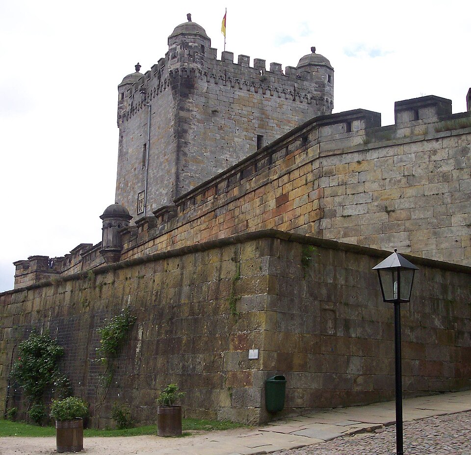
@Heritage Places, Castles & Architecture
22-Jan-2026 11 pm
22-Jan-2026 11 pm
This article uses text information from the Wikipedia article – Bouchout_Castle – [Wikipedia-Article-Link : https://en.wikipedia.org/wiki/Bouchout_Castle ] which is released under the -- Creative Commons Attribution-ShareAlike 4.0 License – [License-Link: https://creativecommons.org/licenses/by-sa/4.0/deed.en ( https://en.wikipedia.org/wiki/Wikipedia:Text_of_the_Creative_Commons_Attribution-ShareAlike_4.0_International_License )] [List of Principal Authors (5 or less) of the Wikipedia-Article on the date of this Article being Created in this Website: - Kees Recourt, Afernand74, Michel Chauvet, InternetArchiveBot, Epolk] [Use the following Authorship tool to find out the author contributions:- https://xtools.wmcloud.org/authorship ] [The Current Article on this Website has been paraphrased from the above linked corresponding Wikipedia-Article and You may redistribute this, verbatim or modified, provided that you comply with the terms of the Creative Commons Attribution-ShareAlike 4.0 License] [License-Link: https://creativecommons.org/licenses/by-sa/4.0/deed.en ( https://en.wikipedia.org/wiki/Wikipedia:Text_of_the_Creative_Commons_Attribution-ShareAlike_4.0_International_License )]
[Image: Bouchout Castle, Meise, Flemish Brabant, Belgium; Image-Author: Laura Paredis] [Image_Source-Link: https://www.pexels.com/photo/bouchout-castle-meise-flemish-brabant-belgium-13095218/ ] [License-Link: https://www.pexels.com/license/ ] [Please Also Relate to Original Individual Text and Image URLs for More Usage Property and Sharing, Remixing or Attributing the Contents] [Contents on Wikipedia is covered by -- Disclaimer – Wikipedia-Disclaimer-Link: https://en.wikipedia.org/wiki/Wikipedia:General_disclaimer ] [Contents in this Website is also covered by Disclaimer linked at the bottom of the Page] [This website article means no intellectual appropriation by any way and only wishes to contribute in sharing of knowledge]
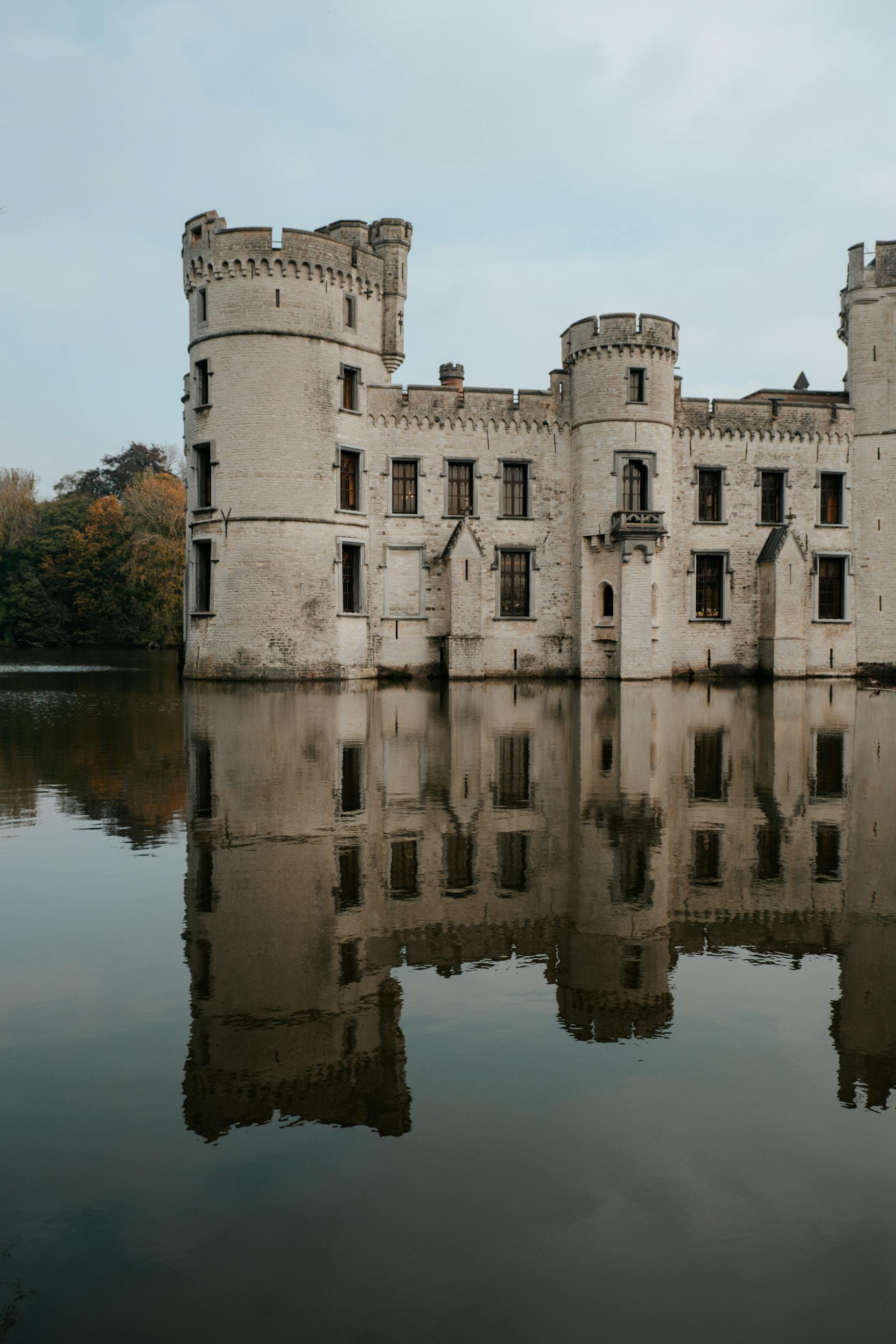
@Heritage Places, Castles & Architecture
19-Jan-2026 04 am
19-Jan-2026 04 am
This article uses text information from the Wikipedia article – Blackrock_Castle – [Wikipedia-Article-Link : https://en.wikipedia.org/wiki/Blackrock_Castle ] which is released under the -- Creative Commons Attribution-ShareAlike 4.0 License – [License-Link: https://en.wikipedia.org/wiki/Wikipedia:Text_of_the_Creative_Commons_Attribution-ShareAlike_4.0_International_License ] [List of Principal Authors (5 or less) of the Wikipedia-Article on the date of this Article being Created in this Website: - Guliolopez, Agiltinan, InternetArchiveBot, Snow Lion Fenian, Anna Frodesiak] [Use the following Authorship tool to find out the author contributions:- https://xtools.wmcloud.org/authorship ] [The Current Article on this Website has been paraphrased from the above linked corresponding Wikipedia-Article and You may redistribute this, verbatim or modified, provided that you comply with the terms of the Creative Commons Attribution-ShareAlike 4.0 License] [License-Link: https://en.wikipedia.org/wiki/Wikipedia:Text_of_the_Creative_Commons_Attribution-ShareAlike_4.0_International_License ]
[Image: 16th Century Blackrock Castle with Observatory; Image-Author: Liudmyla Shalimova] [Image_Source-Link: https://www.pexels.com/photo/16th-century-blackrock-castle-with-observatory-18996928/ ] [License-Link: https://www.pexels.com/license/ ] [Please Also Relate to Original Individual Text and Image URLs for More Usage Property and Sharing, Remixing or Attributing the Contents]
[Contents on Wikipedia is covered by -- Disclaimer – Wikipedia-Disclaimer-Link: https://en.wikipedia.org/wiki/Wikipedia:General_disclaimer ] [Contents in this Website is also covered by Disclaimer linked at the bottom of the Page] [This website article means no intellectual appropriation by any way and only wishes to contribute in sharing of knowledge]
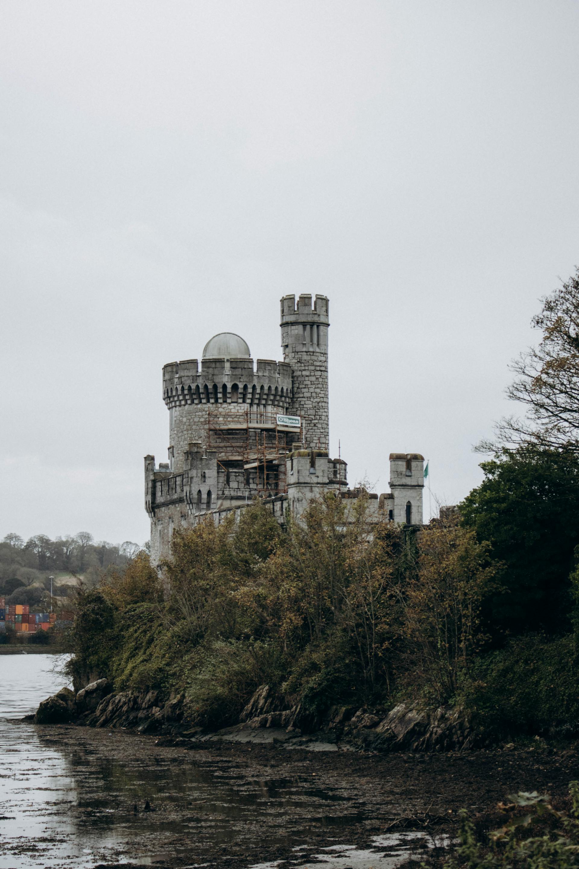
@Heritage Places, Castles & Architecture
14-Dec-2025 03 am
14-Dec-2025 03 am
This article uses text information from the Wikipedia article – Caerlaverock_Castle – [Wikipedia-Article-Link: https://en.wikipedia.org/wiki/Caerlaverock_Castle ] which is released under the -- Creative Commons Attribution-ShareAlike 4.0 License – [License-Link: https://en.wikipedia.org/wiki/Wikipedia:Text_of_the_Creative_Commons_Attribution-ShareAlike_4.0_International_License ] [List of Principal Authors (5 or less) of the Wikipedia-Article on the date of this Article being Created in this Website: - Jonathan Oldenbuck, ArchaicW, GrindtXX, JoeyofScotia, Mariannep] [Use the following Authorship tool to find out the author contributions:- https://xtools.wmcloud.org/authorship ] [The Current Article on this Website has been paraphrased from the above linked corresponding Wikipedia-Article and You may redistribute this, verbatim or modified, provided that you comply with the terms of the Creative Commons Attribution-ShareAlike 4.0 License] [License-Link: https://en.wikipedia.org/wiki/Wikipedia:Text_of_the_Creative_Commons_Attribution-ShareAlike_4.0_International_License ]
[Image: View of the Caerlaverock Castle, Scotland; Image-Author: urtimud. 89] [Image-Source-Link: https://www.pexels.com/photo/view-of-the-caerlaverock-castle-scotland-20989931/ ] [License-Link: https://www.pexels.com/license/ ] [Please Also Relate to Original Individual Text and Image URLs for More Usage Property and Sharing, Remixing or Attributing the Contents]
[Contents on Wikipedia is covered by – Disclaimer – [Wikipedia-Disclaimer-Link: https://en.wikipedia.org/wiki/Wikipedia:General_disclaimer ]] [Contents in this Website is also covered by Disclaimer linked at the bottom of the Page] [This website article means no intellectual appropriation by any way and only wishes to contribute in sharing of knowledge]
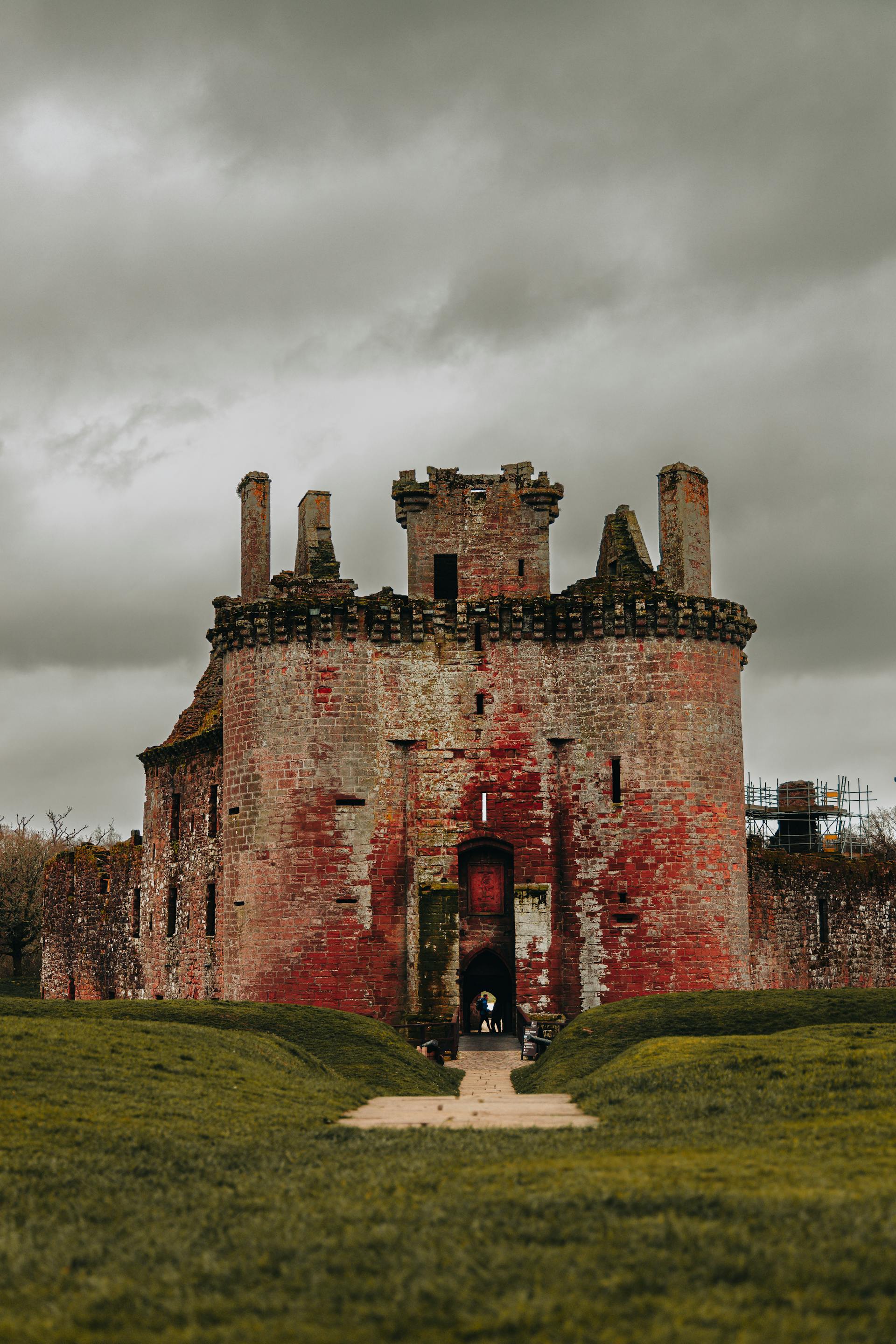
@Heritage Places, Castles & Architecture
07-Dec-2025 10 pm
07-Dec-2025 10 pm
This article uses text information from the Wikipedia article – Schloss_Muskau – [Wikipedia-Article-Link: https://en.wikipedia.org/wiki/Schloss_Muskau ] which is released under the -- Creative Commons Attribution-ShareAlike 4.0 License – [License-Link: https://en.wikipedia.org/wiki/Wikipedia:Text_of_the_Creative_Commons_Attribution-ShareAlike_4.0_International_License ] [List of Principal Authors (5 or less) of the Wikipedia-Article on the date of this Article being Created in this Website: - Gerda Arendt, Drow69, Equord, Carsten Steger, Walahfrid Schwarzenberg] [Use the following Authorship tool to find out the author contributions:- https://xtools.wmcloud.org/authorship ] [The Current Article on this Website has been paraphrased from the above linked corresponding Wikipedia-Article and You may redistribute this, verbatim or modified, provided that you comply with the terms of the Creative Commons Attribution-ShareAlike 4.0 License] [License-Link: https://en.wikipedia.org/wiki/Wikipedia:Text_of_the_Creative_Commons_Attribution-ShareAlike_4.0_International_License ]
[Image: Majestic Muskau Castle Reflected in Autumn Lake; Image-Author: Laura Meinhardt] [Image-Source-Link: https://www.pexels.com/photo/majestic-muskau-castle-reflected-in-autumn-lake-34149553/ ] [License-Link: https://www.pexels.com/license/ ] [Please Also Relate to Original Individual Text and Image URLs for More Usage Property and Sharing, Remixing or Attributing the Contents] [Contents on Wikipedia is covered by – Disclaimer – [Wikipedia-Disclaimer-Link: https://en.wikipedia.org/wiki/Wikipedia:General_disclaimer ]]
[Contents in this Website is also covered by Disclaimer linked at the bottom of the Page] [This website article means no intellectual appropriation by any way and only wishes to contribute in sharing of knowledge]
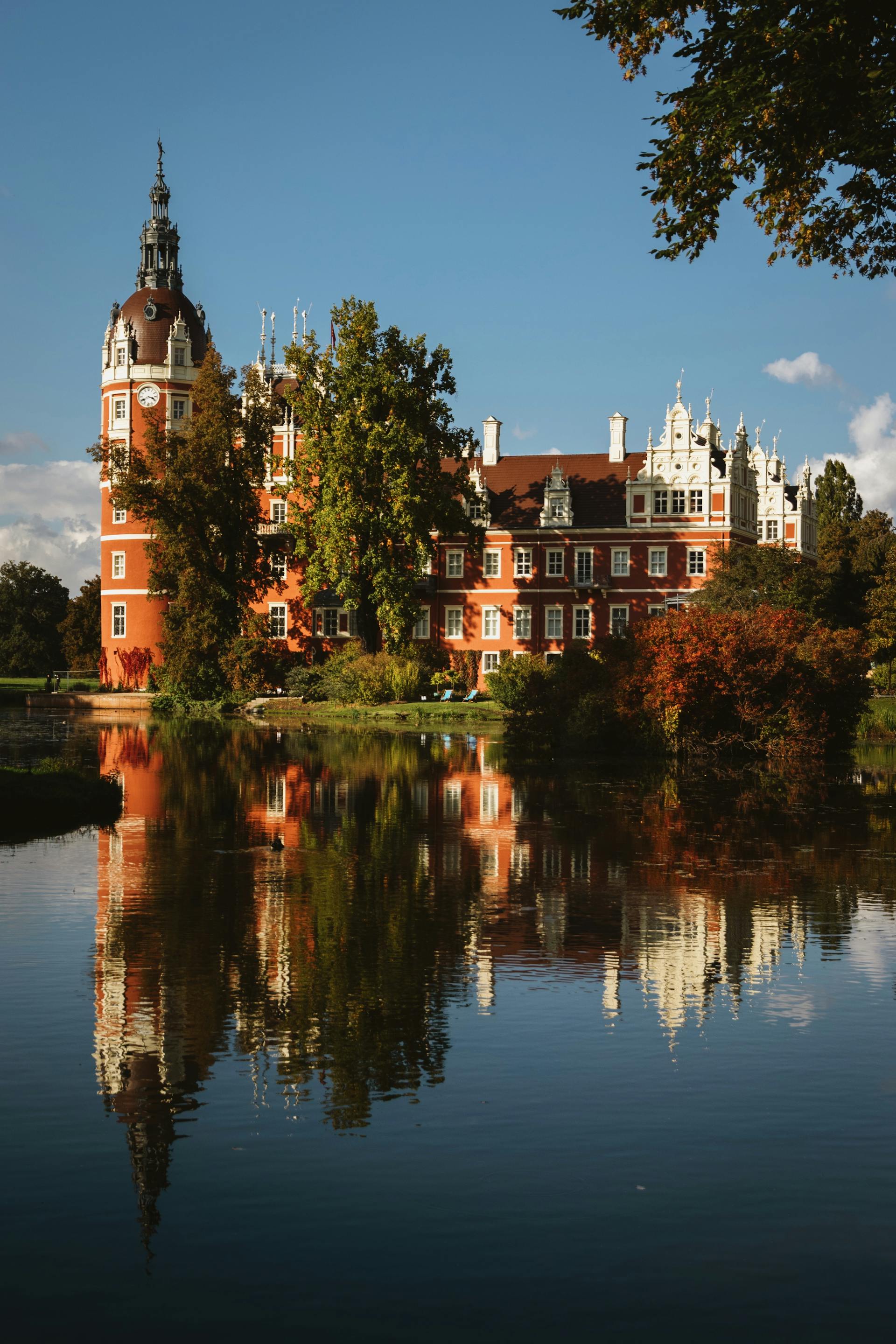
@Heritage Places, Castles & Architecture
05-Dec-2025 11 pm
05-Dec-2025 11 pm
This article uses text information from the Wikipedia article – Mir_Castle_Complex – [Wikipedia-Article-Link: https://en.wikipedia.org/wiki/Mir_Castle_Complex ] which is released under the -- Creative Commons Attribution-ShareAlike 4.0 License – [License-Link: https://creativecommons.org/licenses/by-sa/4.0/deed.en ( https://en.wikipedia.org/wiki/Wikipedia:Text_of_the_Creative_Commons_Attribution-ShareAlike_4.0_International_License )] [List of Principal Authors (5 or less) of the Wikipedia-Article on the date of this Article being Created in this Website: - DwightKingsbury, Alexey Ostrometski, Alex756, Milicz, Crislia] [Use the following Authorship tool to find out the author contributions:- https://xtools.wmcloud.org/authorship ] [The Current Article on this Website has been paraphrased from the above linked corresponding Wikipedia-Article and You may redistribute this, verbatim or modified, provided that you comply with the terms of the Creative Commons Attribution-ShareAlike 4.0 License] [License-Link: https://creativecommons.org/licenses/by-sa/4.0/deed.en ( https://en.wikipedia.org/wiki/Wikipedia:Text_of_the_Creative_Commons_Attribution-ShareAlike_4.0_International_License )]
[Image: The Mir Castle Complex on Green Grass Field; Image-Author: Sarazh Izmailov] [Image-Source-Link: https://www.pexels.com/photo/the-mir-castle-complex-on-green-grass-field-13087008/ ] [License-Link: https://www.pexels.com/license/ ] [Please Also Relate to Original Individual Text and Image URLs for More Usage Property and Sharing, Remixing or Attributing the Contents] [Contents on Wikipedia is covered by – Disclaimer – [Wikipedia-Disclaimer-Link: https://en.wikipedia.org/wiki/Wikipedia:General_disclaimer ]] [Contents in this Website is also covered by Disclaimer linked at the bottom of the Page] [This website article means no intellectual appropriation by any way and only wishes to contribute in sharing of knowledge]
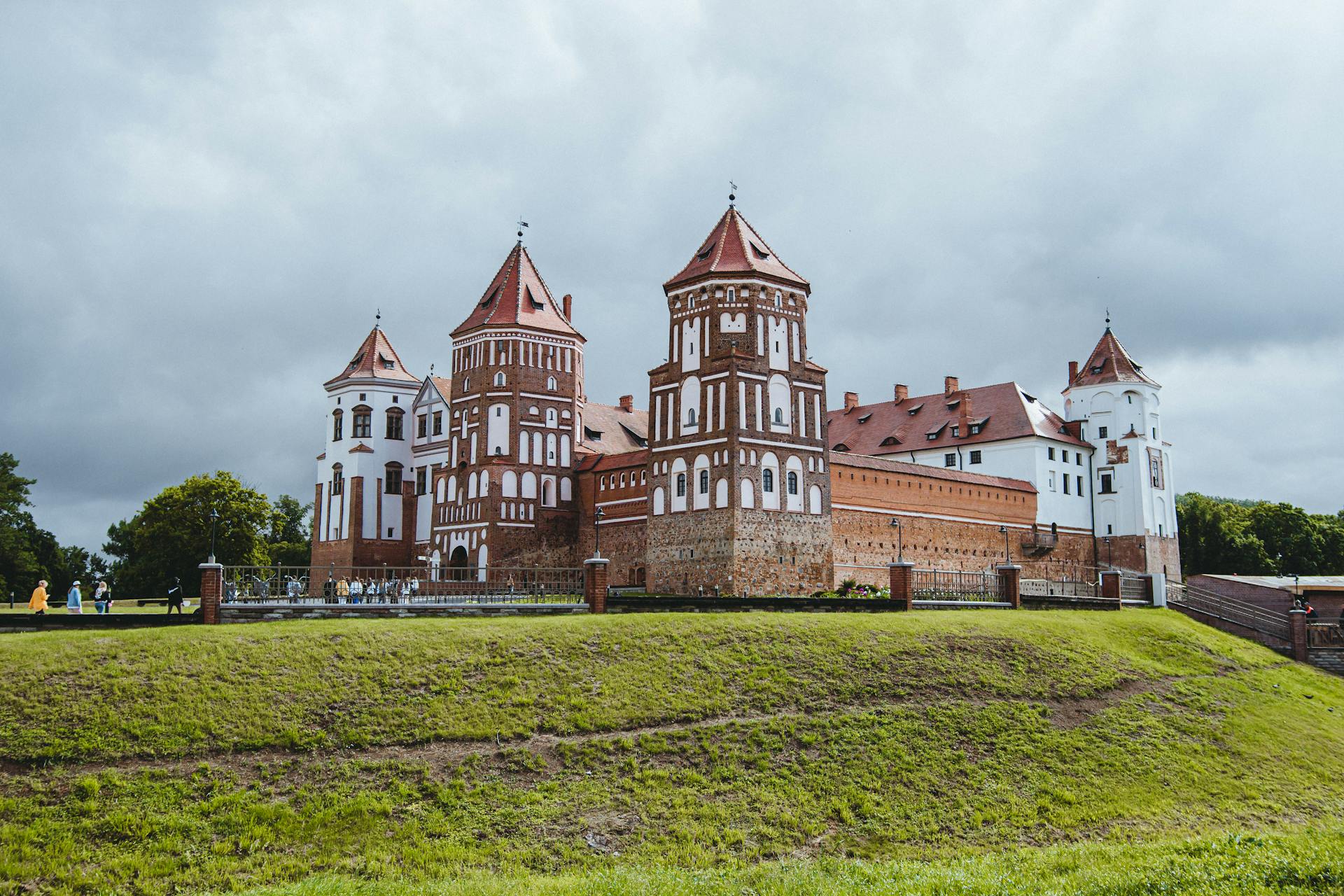
@Heritage Places, Castles & Architecture
04-Dec-2025 12 am
04-Dec-2025 12 am
This article uses text information from the Wikipedia article – Babelsberg_Palace – [Wikipedia-Article-Link: https://en.wikipedia.org/wiki/Babelsberg_Palace ] which is released under the -- Creative Commons Attribution-ShareAlike 4.0 License – [License-Link: https://en.wikipedia.org/wiki/Wikipedia:Text_of_the_Creative_Commons_Attribution-ShareAlike_4.0_International_License ] [List of Principal Authors (5 or less) of the Wikipedia-Article on the date of this Article being Created in this Website: - Bermicourt, Drow69, Brshipley, Helpfulwikieditoryay, Francis Schonken] [Use the following Authorship tool to find out the author contributions:- https://xtools.wmcloud.org/authorship ] [The Current Article on this Website has been paraphrased from the above linked corresponding Wikipedia-Article and You may redistribute this, verbatim or modified, provided that you comply with the terms of the Creative Commons Attribution-ShareAlike 4.0 License] [License-Link: https://en.wikipedia.org/wiki/Wikipedia:Text_of_the_Creative_Commons_Attribution-ShareAlike_4.0_International_License ]
[Image: Babelsberg Palace in Potsdam, Germany; Image-Author: János Csatlós] [Image-Source-Link: https://www.pexels.com/photo/babelsberg-palace-in-potsdam-germany-18174957/ ] [License-Link: https://www.pexels.com/license/ ] [Please Also Relate to Original Individual Text and Image URLs for More Usage Property and Sharing, Remixing or Attributing the Contents]
[Contents on Wikipedia is covered by – Disclaimer – [Wikipedia-Disclaimer-Link: https://en.wikipedia.org/wiki/Wikipedia:General_disclaimer ]] [Contents in this Website is also covered by Disclaimer linked at the bottom of the Page] [This website article means no intellectual appropriation by any way and only wishes to contribute in sharing of knowledge]
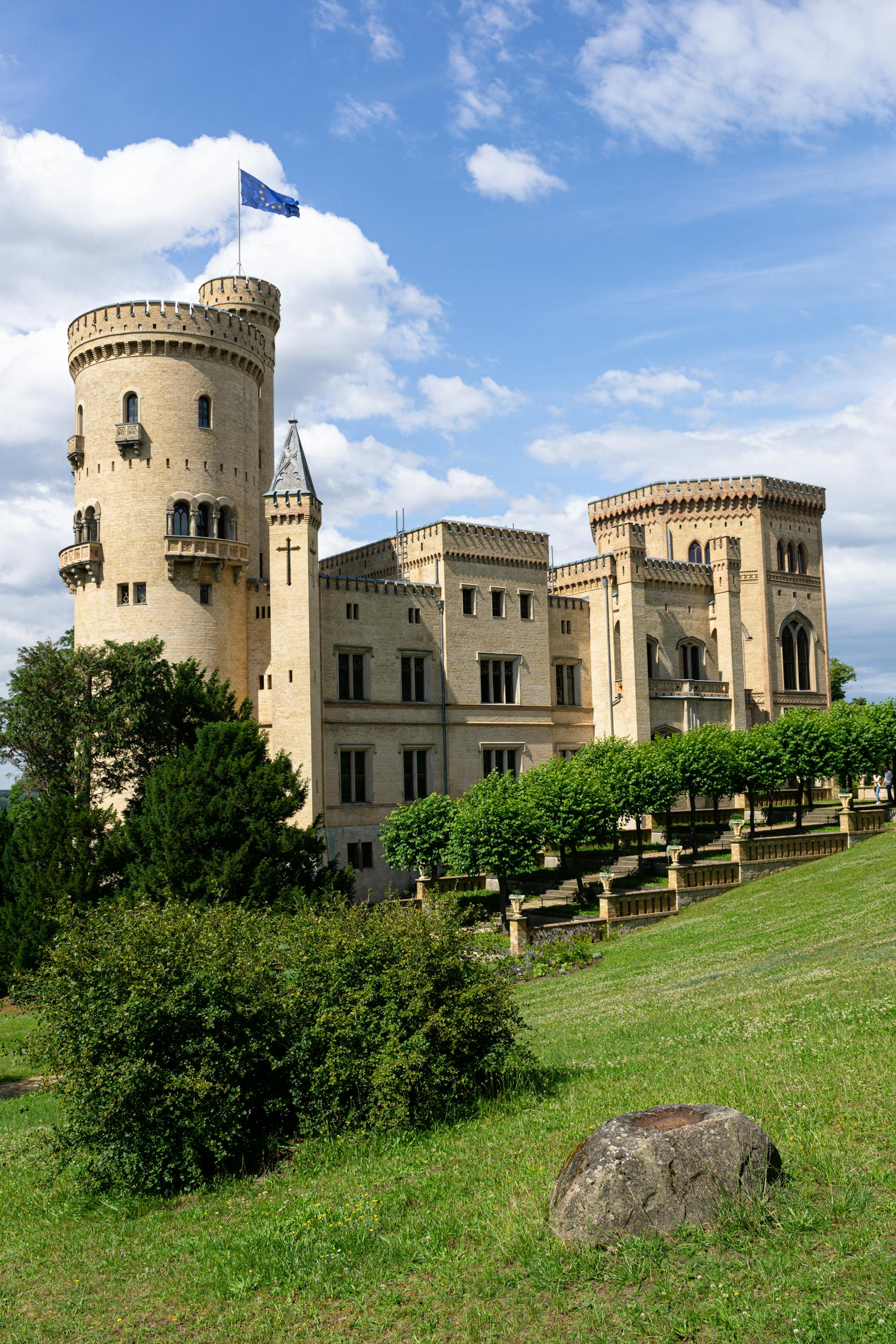
@Heritage Places, Castles & Architecture
03-Dec-2025 05 am
03-Dec-2025 05 am
This article uses text information from the Wikipedia article – Moszna_Castle – [Wikipedia-Article-Link: https://en.wikipedia.org/wiki/Moszna_Castle ] which is released under the -- Creative Commons Attribution-ShareAlike 4.0 License – [License-Link: https://creativecommons.org/licenses/by-sa/4.0/deed.en ( https://en.wikipedia.org/wiki/Wikipedia:Text_of_the_Creative_Commons_Attribution-ShareAlike_4.0_International_License )] [List of Principal Authors (5 or less) of the Wikipedia-Article on the date of this Article being Created in this Website: - Piotrus, Merangs, InternetArchiveBot, Brookmount, Pdunnigan] [Use the following Authorship tool to find out the author contributions:- https://xtools.wmcloud.org/authorship ] [The Current Article on this Website has been paraphrased from the above linked corresponding Wikipedia-Article and You may redistribute this, verbatim or modified, provided that you comply with the terms of the Creative Commons Attribution-ShareAlike 4.0 License] [License-Link: https://creativecommons.org/licenses/by-sa/4.0/deed.en ( https://en.wikipedia.org/wiki/Wikipedia:Text_of_the_Creative_Commons_Attribution-ShareAlike_4.0_International_License )]
[Image: Hotel Moszna Castle; Image-Author: Grzegorz Sobus][Image-Source-Link: https://www.pexels.com/photo/hotel-moszna-castle-18990341/ ] [License-Link: https://www.pexels.com/license/ ] [Please Also Relate to Original Individual Text and Image URLs for More Usage Property and Sharing, Remixing or Attributing the Contents] [Contents on Wikipedia is covered by – Disclaimer – [Wikipedia-Disclaimer-Link: https://en.wikipedia.org/wiki/Wikipedia:General_disclaimer ]] [Contents in this Website is also covered by Disclaimer linked at the bottom of the Page] [This website article means no intellectual appropriation by any way and only wishes to contribute in sharing of knowledge]
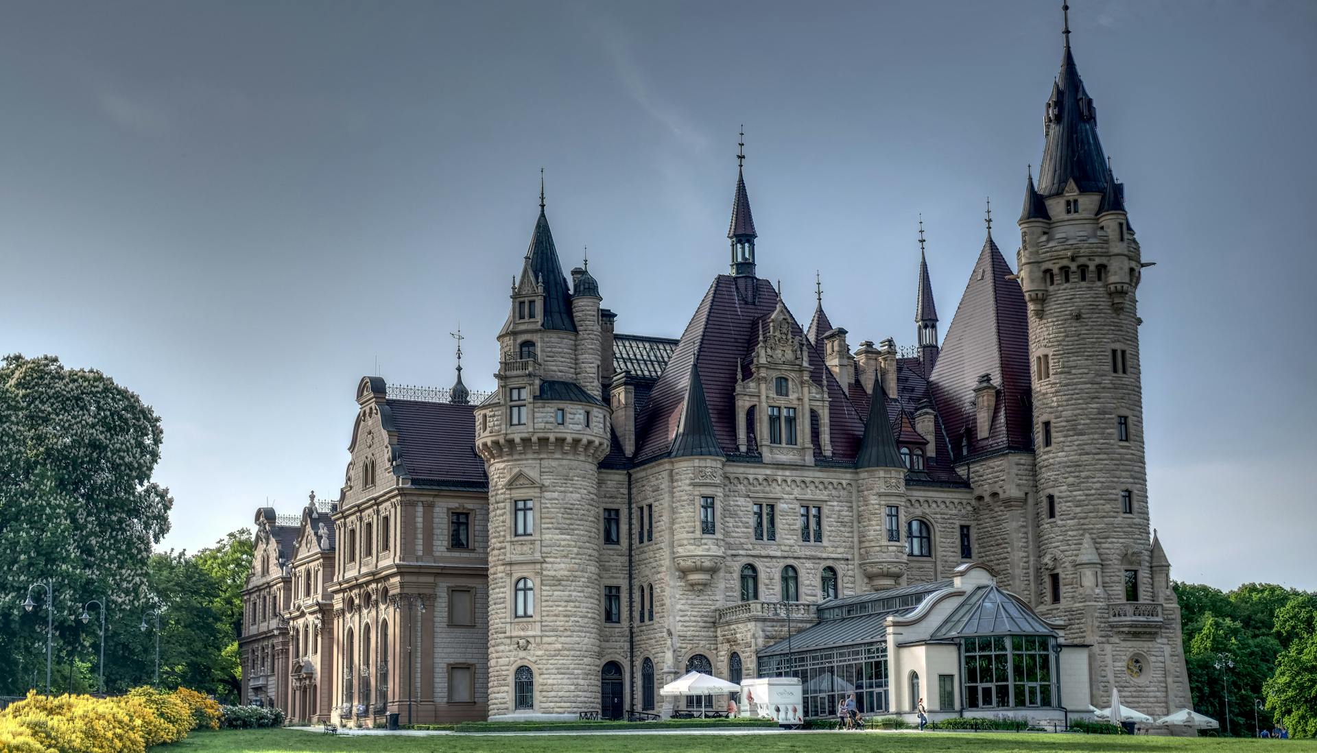
@Heritage Places, Castles & Architecture
01-Dec-2025 03 am
01-Dec-2025 03 am
This article uses text information from the Wikipedia article – Marienberg_Fortress – [Wikipedia-Article-Link: https://en.wikipedia.org/wiki/Marienberg_Fortress ] which is released under the -- Creative Commons Attribution-ShareAlike 4.0 License – [License-Link: https://en.wikipedia.org/wiki/Wikipedia:Text_of_the_Creative_Commons_Attribution-ShareAlike_4.0_International_License ] [List of Principal Authors (5 or less) of the Wikipedia-Article on the date of this Article being Created in this Website: - Drow69, Theodore Christopher, EnglishGarden, Martpol, 211.31.175.148] [Use the following Authorship tool to find out the author contributions:- https://xtools.wmcloud.org/authorship ] [The Current Article on this Website has been paraphrased from the above linked corresponding Wikipedia-Article and You may redistribute this, verbatim or modified, provided that you comply with the terms of the Creative Commons Attribution-ShareAlike 4.0 License] [License-Link: https://en.wikipedia.org/wiki/Wikipedia:Text_of_the_Creative_Commons_Attribution-ShareAlike_4.0_International_License ]
[Image: A View of the Marienberg Fortress in Germany; Image-Author: Patrycja Grobelny][Image-Source-Link: https://www.pexels.com/photo/a-view-of-the-marienberg-fortress-in-germany-12300946/ ] [License-Link: https://www.pexels.com/license/ ] [Please Also Relate to Original Individual Text and Image URLs for More Usage Property and Sharing, Remixing or Attributing the Contents]
[Contents on Wikipedia is covered by – Disclaimer – [Wikipedia-Disclaimer-Link: https://en.wikipedia.org/wiki/Wikipedia:General_disclaimer ]] [Contents in this Website is also covered by Disclaimer linked at the bottom of the Page] [This website article means no intellectual appropriation by any way and only wishes to contribute in sharing of knowledge]
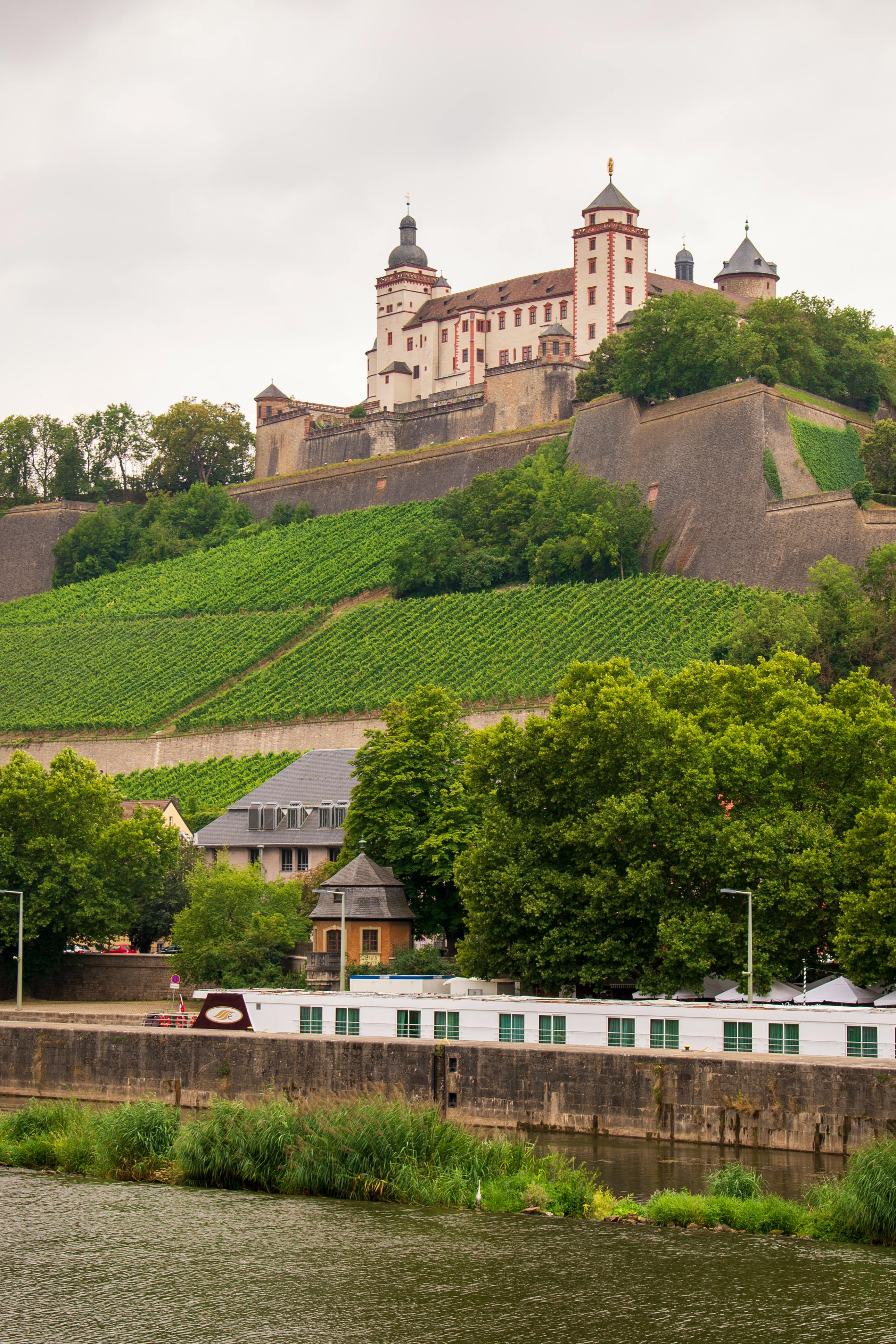
@Heritage Places, Castles & Architecture
19-Nov-2025 11 pm
19-Nov-2025 11 pm
This article uses text information from the Wikipedia article -- Glücksburg_Castle -- [Wikipedia-Article-Link: https://en.wikipedia.org/wiki/Gl%C3%BCcksburg_Castle ] which is released under the -- Creative Commons Attribution-ShareAlike 4.0 License – [License-Link: https://en.wikipedia.org/wiki/Wikipedia:Text_of_the_Creative_Commons_Attribution-ShareAlike_4.0_International_License ] [List of Principal Authors (5 or less) of the Wikipedia-Article on the date of this Article being Created in this Website: - YogiTaylor, InternetArchiveBot, Anna reg, 84.67.18.9, Inwind] [Use the following Authorship tool to find out the author contributions:- https://xtools.wmcloud.org/authorship ] [The Current Article on this Website has been paraphrased from the above linked corresponding Wikipedia-Article and You may redistribute this, verbatim or modified, provided that you comply with the terms of the Creative Commons Attribution-ShareAlike 4.0 License] [License-Link: https://en.wikipedia.org/wiki/Wikipedia:Text_of_the_Creative_Commons_Attribution-ShareAlike_4.0_International_License ]
This article also uses an image from the Wikipedia article -- Christoph_of_Schleswig-Holstein -- [Wikipedia-Article-Link: https://en.wikipedia.org/wiki/Christoph_of_Schleswig-Holstein ] [Image: Luftbild vom Kulturdenkmal-Komplex Schloss Glücksburg, das Wasserschloss mit Wirtschaftsgebäuden und Schosspark in der Stadt Glücksburg in Schleswig-Holstein - Foto Wolfgang Pehlemann Steinberg/Ostsee IMG 6753; Wikipedia-Image-Author: Wolfgang Pehlemann https://commons.wikimedia.org/wiki/User:Wolfgang_Pehlemann ] [Wikipedia-Image-Link: https://en.wikipedia.org/wiki/File:Luftbild_Kulturdenkmal_Schloss_Gl%C3%BCcksburg_Wasserschloss_Schleswig-Holstein_-_Foto_Wolfgang_Pehlemann_Steinberg_IMG_6753.jpg ] [Image Availed Under Creative Commons Attribution-Share Alike 3.0 Unported license;] [License-Link: https://creativecommons.org/licenses/by-sa/3.0/deed.en ] [You may copy, distribute and transmit the work (image) or share (alike) the work (image), provided that you comply with the terms of the Creative Commons Attribution-Share Alike 3.0 Unported license or other compatible license in distribution.] [License-Link: https://creativecommons.org/licenses/by-sa/3.0/deed.en ] [Please Also Relate to Original Individual Text and Image URLs for More Usage Property and Sharing, Remixing or Attributing the Contents]
[Contents on Wikipedia is covered by -- Disclaimer – Wikipedia-Disclaimer-Link: https://en.wikipedia.org/wiki/Wikipedia:General_disclaimer ] [Contents in this Website is also covered by Disclaimer linked at the bottom of the Page] [This website article means no intellectual appropriation by any way and only wishes to contribute in sharing of knowledge]
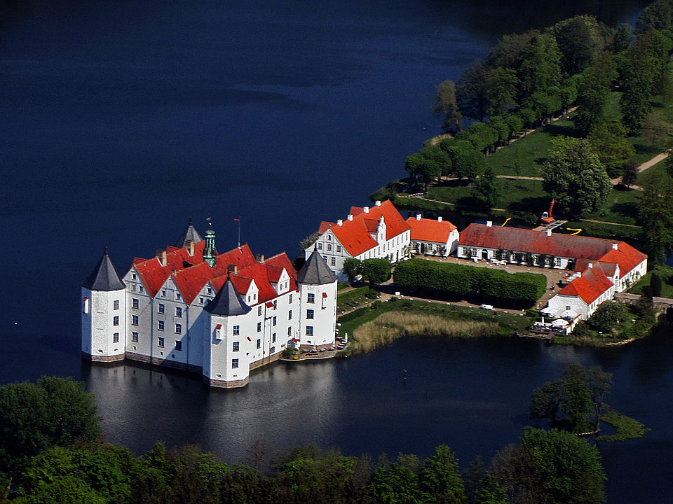
@Heritage Places, Castles & Architecture
11-Nov-2025 03 am
11-Nov-2025 03 am
This article uses text information from the Wikipedia article – Beckov_Castle – [Wikipedia-Article-Link: https://en.wikipedia.org/wiki/Beckov_Castle ] which is released under the -- Creative Commons Attribution-ShareAlike 4.0 License – [License-Link: https://creativecommons.org/licenses/by-sa/4.0/deed.en ( https://en.wikipedia.org/wiki/Wikipedia:Text_of_the_Creative_Commons_Attribution-ShareAlike_4.0_International_License )] [List of Principal Authors (5 or less) of the Wikipedia-Article on the date of this Article being Created in this Website: - FeatherPluma, Vlendert, Svetovid, Elskopo, Wiki-wuki] [Use the following Authorship tool to find out the author contributions:- https://xtools.wmcloud.org/authorship ] [The Current Article on this Website has been paraphrased from the above linked corresponding Wikipedia-Article and You may redistribute this, verbatim or modified, provided that you comply with the terms of the Creative Commons Attribution-ShareAlike 4.0 License] [License-Link: https://creativecommons.org/licenses/by-sa/4.0/deed.en ( https://en.wikipedia.org/wiki/Wikipedia:Text_of_the_Creative_Commons_Attribution-ShareAlike_4.0_International_License )]
[Image: Photo of Castle (Beckov, Trenčiansky kraj, Slovakia); Image-Author: Daniel][Image-Source-Link: https://www.pexels.com/photo/photo-of-castle-1130256/ ] [License-Link: https://www.pexels.com/license/ ] [Please Also Relate to Original Individual Text and Image URLs for More Usage Property and Sharing, Remixing or Attributing the Contents] [Contents on Wikipedia is covered by – Disclaimer – [Wikipedia-Disclaimer-Link : https://en.wikipedia.org/wiki/Wikipedia:General_disclaimer ] [Contents in this Website is also covered by Disclaimer linked at the bottom of the Page] [This website article means no intellectual appropriation by any way and only wishes to contribute in sharing of knowledge]
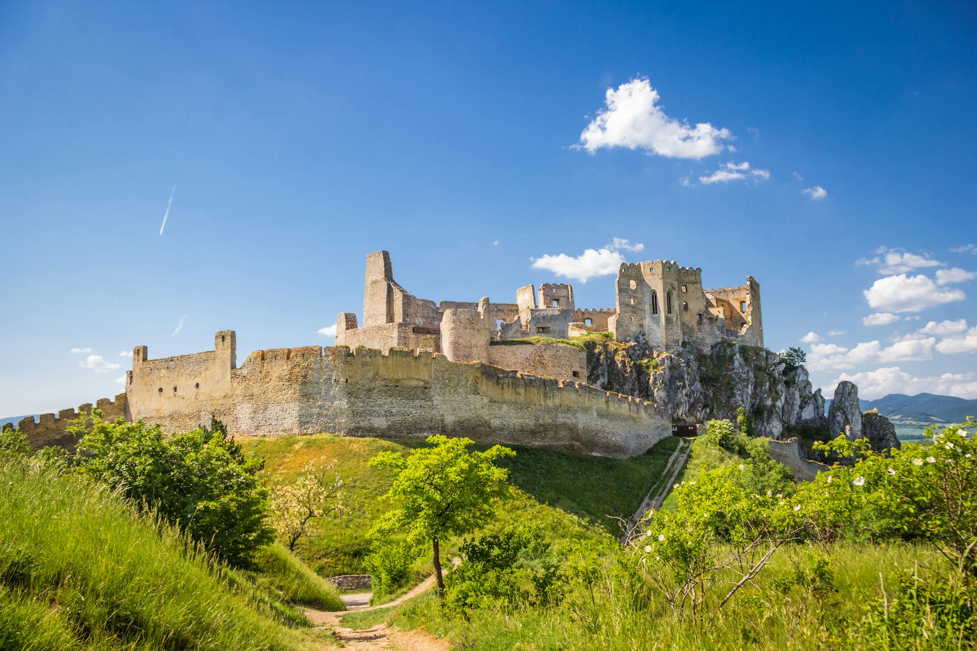
@Heritage Places, Castles & Architecture
10-Nov-2025 11 pm
10-Nov-2025 11 pm
This article uses text information from the Wikipedia article – Lichtenstein_Castle_(Württemberg) – [Wikipedia-Article-Link: https://en.wikipedia.org/wiki/Lichtenstein_Castle_(W%C3%BCrttemberg) ] which is released under the -- Creative Commons Attribution-ShareAlike 4.0 License – [License-Link: https://creativecommons.org/licenses/by-sa/4.0/deed.en ( https://en.wikipedia.org/wiki/Wikipedia:Text_of_the_Creative_Commons_Attribution-ShareAlike_4.0_International_License )] [List of Principal Authors (5 or less) of the Wikipedia-Article on the date of this Article being Created in this Website: - Vami IV, InternetArchiveBot, Drow69, 10W40, Albrecht Conz] [Use the following Authorship tool to find out the author contributions:- https://xtools.wmcloud.org/authorship ] [The Current Article on this Website has been paraphrased from the above linked corresponding Wikipedia-Article and You may redistribute this, verbatim or modified, provided that you comply with the terms of the Creative Commons Attribution-ShareAlike 4.0 License] [License-Link: https://creativecommons.org/licenses/by-sa/4.0/deed.en ( https://en.wikipedia.org/wiki/Wikipedia:Text_of_the_Creative_Commons_Attribution-ShareAlike_4.0_International_License )]
[Image: Photo of Lichtenstein Castle; Image-Author: MARTHA SALES][Image-Source-Link: https://www.pexels.com/photo/photo-of-lichtenstein-castle-1590882/ ] [License-Link: https://www.pexels.com/license/ ] [Please Also Relate to Original Individual Text and Image URLs for More Usage Property and Sharing, Remixing or Attributing the Contents] [Contents on Wikipedia is covered by – Disclaimer – [Wikipedia-Disclaimer-Link : https://en.wikipedia.org/wiki/Wikipedia:General_disclaimer ] [Contents in this Website is also covered by Disclaimer linked at the bottom of the Page] [This website article means no intellectual appropriation by any way and only wishes to contribute in sharing of knowledge]
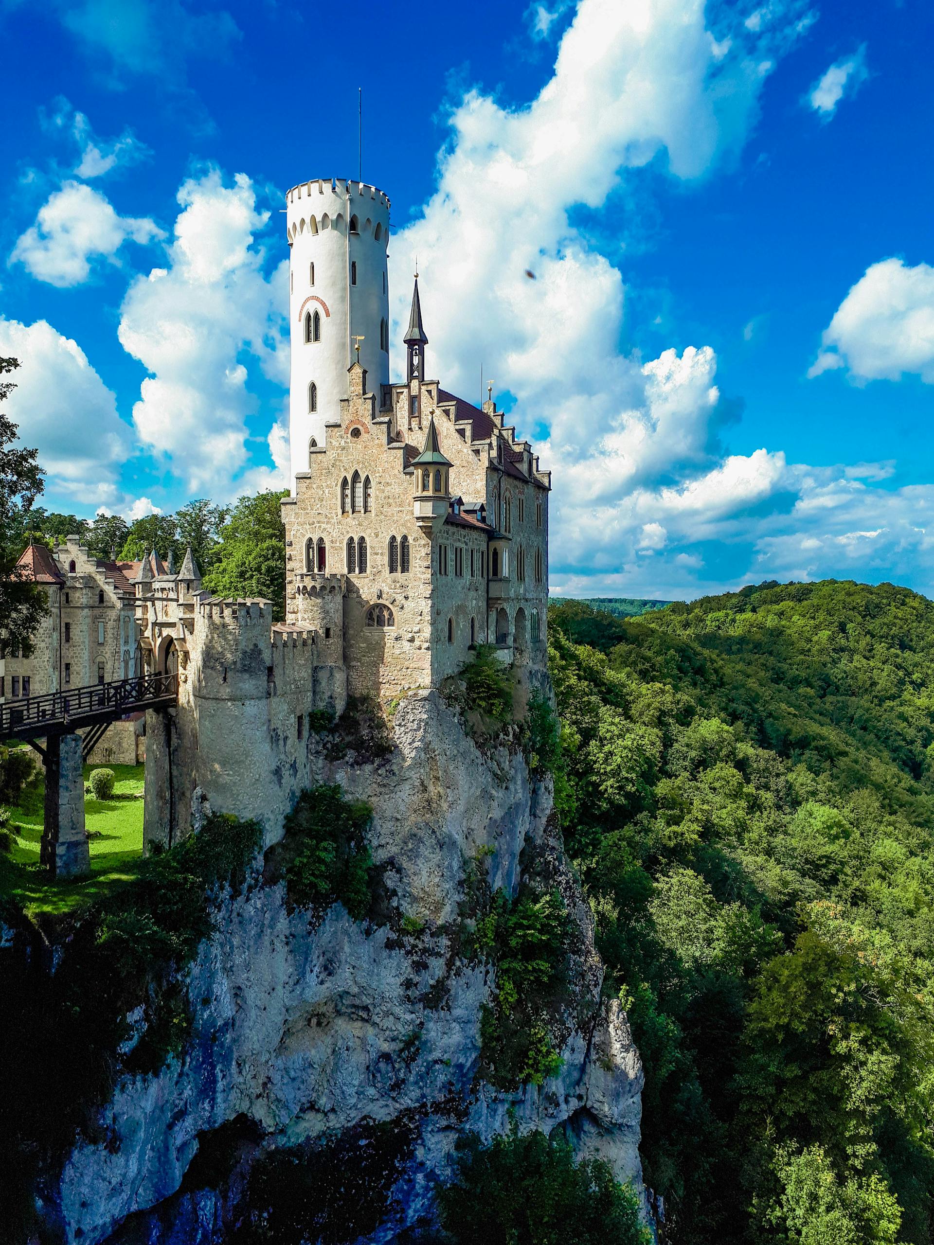
@Heritage Places, Castles & Architecture
08-Nov-2025 04 am
08-Nov-2025 04 am
#History #Architecture #Castles This article uses text information from the Wikipedia article – Egeskov_Castle – [Wikipedia-Article-Link: https://en.wikipedia.org/wiki/Egeskov_Castle ] which is released under the -- Creative Commons Attribution-ShareAlike 4.0 License – [License-Link: https://en.wikipedia.org/wiki/Wikipedia:Text_of_the_Creative_Commons_Attribution-ShareAlike_4.0_International_License ] [List of Principal Authors (5 or less) of the Wikipedia-Article on the date of this Article being Created in this Website: - Angelbo, Valentinian, Covalent, Ipigott, 193.88.144.166] [Use the following Authorship tool to find out the author contributions:- https://xtools.wmcloud.org/authorship ] [The Current Article on this Website has been paraphrased from the above linked corresponding Wikipedia-Article and You may redistribute this, verbatim or modified, provided that you comply with the terms of the Creative Commons Attribution-ShareAlike 4.0 License] [License-Link: https://en.wikipedia.org/wiki/Wikipedia:Text_of_the_Creative_Commons_Attribution-ShareAlike_4.0_International_License ]
[Image: Egeskov Castle, Kvrndrup, Denmark; Image-Author: Bruna Noronha][Image-Source-Link: https://www.pexels.com/photo/egeskov-castle-kvrndrup-denmark-6270891/ ] [License-Link: https://www.pexels.com/license/ ] [Please Also Relate to Original Individual Text and Image URLs for More Usage Property and Sharing, Remixing or Attributing the Contents]
[Contents on Wikipedia is covered by – Disclaimer – [Wikipedia-Disclaimer-Link : https://en.wikipedia.org/wiki/Wikipedia:General_disclaimer ] [Contents in this Website is also covered by Disclaimer linked at the bottom of the Page] [This website article means no intellectual appropriation by any way and only wishes to contribute in sharing of knowledge]
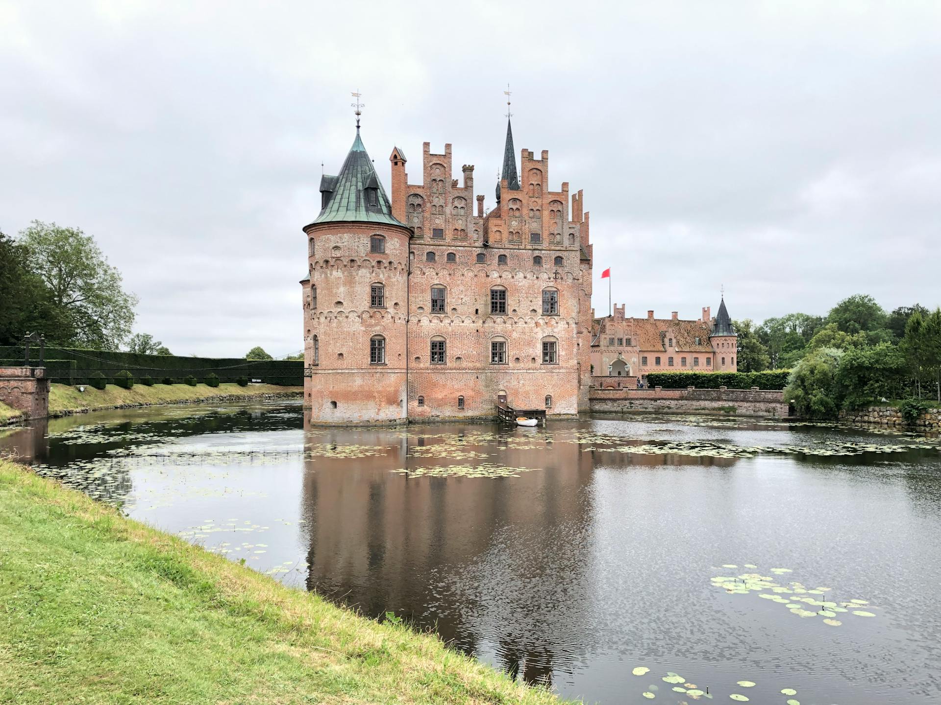
@Heritage Places, Castles & Architecture
07-Nov-2025 11 pm
07-Nov-2025 11 pm
This article uses text information from the Wikipedia article -- Castle_of_Peñaranda_de_Duero -- [Wikipedia-Article-Link: https://en.wikipedia.org/wiki/Castle_of_Pe%C3%B1aranda_de_Duero ] which is released under the -- Creative Commons Attribution-ShareAlike 4.0 License – [License-Link: https://en.wikipedia.org/wiki/Wikipedia:Text_of_the_Creative_Commons_Attribution-ShareAlike_4.0_International_License ] [List of Principal Authors (5 or less) of the Wikipedia-Article on the date of this Article being Created in this Website: - HCPUNXKID, 3Félix, Brandybcross, InternetArchiveBot, SimLibrarian] [Use the following Authorship tool to find out the author contributions:- https://xtools.wmcloud.org/authorship ] [The Current Article on this Website has been paraphrased from the above linked corresponding Wikipedia-Article and You may redistribute this, verbatim or modified, provided that you comply with the terms of the Creative Commons Attribution-ShareAlike 4.0 License] [License-Link: https://en.wikipedia.org/wiki/Wikipedia:Text_of_the_Creative_Commons_Attribution-ShareAlike_4.0_International_License ]
This article also uses an image from the Wikipedia article -- Castle_of_Peñaranda_de_Duero -- [Wikipedia-Article-Link: https://en.wikipedia.org/wiki/Castle_of_Pe%C3%B1aranda_de_Duero ] [Image: Castillo de Peñaranda de Duero, Burgos; Wikipedia-Image-Author: Rowanwindwhistler https://commons.wikimedia.org/wiki/User:Rowanwindwhistler ] [Wikipedia-Image-Link: https://en.wikipedia.org/wiki/File:CastilloDePe%C3%B1arandaDeDuero20110625111805P1120520.jpg ] [Image Availed Under Creative Commons Attribution-Share Alike 3.0 Unported license] [License-Link: https://creativecommons.org/licenses/by-sa/3.0/deed.en ] [You may copy, distribute and transmit the work (image) or share (alike) the work (image), provided that you comply with the terms of the Creative Commons Attribution-Share Alike 3.0 Unported license or other compatible license in distribution] [License-Link: https://creativecommons.org/licenses/by-sa/3.0/deed.en ] [Please Also Relate to Original Individual Text and Image URLs for More Usage Property and Sharing, Remixing or Attributing the Contents]
[Contents on Wikipedia is covered by – Disclaimer – Wikipedia-Disclaimer-Link: https://en.wikipedia.org/wiki/Wikipedia:General_disclaimer ] [Contents in this Website is also covered by Disclaimer linked at the bottom of the Page] [This website article means no intellectual appropriation by any way and only wishes to contribute in sharing of knowledge]
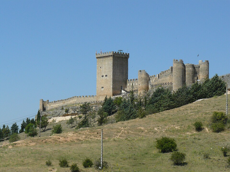
@Heritage Places, Castles & Architecture
05-Nov-2025 11 pm
05-Nov-2025 11 pm
This article uses text information from the Wikipedia article -- Falak-ol-Aflak -- [Wikipedia-Article-Link: https://en.wikipedia.org/wiki/Falak-ol-Aflak ] which is released under the -- Creative Commons Attribution-ShareAlike 4.0 License – [License-Link: https://creativecommons.org/licenses/by-sa/4.0/deed.en ( https://en.wikipedia.org/wiki/Wikipedia:Text_of_the_Creative_Commons_Attribution-ShareAlike_4.0_International_License )] [List of Principal Authors (5 or less) of the Wikipedia-Article on the date of this Article being Created in this Website: - Tototom, M. k. m2003, Arad, Amhmr, Apiculate] [Use the following Authorship tool to find out the author contributions:- https://xtools.wmcloud.org/authorship ] [The Current Article on this Website has been paraphrased from the above linked corresponding Wikipedia-Article and You may redistribute this, verbatim or modified, provided that you comply with the terms of the Creative Commons Attribution-ShareAlike 4.0 License] [License-Link: https://creativecommons.org/licenses/by-sa/4.0/deed.en ( https://en.wikipedia.org/wiki/Wikipedia:Text_of_the_Creative_Commons_Attribution-ShareAlike_4.0_International_License )]
This article also uses an image from the Wikipedia article -- Falak-ol-Aflak -- [Wikipedia-Article-Link: https://en.wikipedia.org/wiki/Falak-ol-Aflak ] [Image: Falak ol-aflak castle, central Khorramabad; Wikipedia-Image-Author: Omid. Koli https://commons.wikimedia.org/wiki/User:KOLI ] [Wikipedia-Image-Link: https://en.wikipedia.org/wiki/File:Falak-ol-aflak-Khorramaabaadcxxxx.jpg ] [Image Availed Under Creative Commons Attribution-Share Alike 3.0 Unported license] [License-Link: https://creativecommons.org/licenses/by-sa/3.0/deed.en ] [You may copy, distribute and transmit the work (image) or share (alike) the work (image), provided that you comply with the terms of the Creative Commons Attribution-Share Alike 3.0 Unported license or other compatible license in distribution] [License-Link: https://creativecommons.org/licenses/by-sa/3.0/deed.en ] [Please Also Relate to Original Individual Text and Image URLs for More Usage Property and Sharing, Remixing or Attributing the Contents]
[Contents on Wikipedia is covered by -- Disclaimer – Wikipedia-Disclaimer-Link: https://en.wikipedia.org/wiki/Wikipedia:General_disclaimer ] [Contents in this Website is also covered by Disclaimer linked at the bottom of the Page] [This website article means no intellectual appropriation by any way and only wishes to contribute in sharing of knowledge]
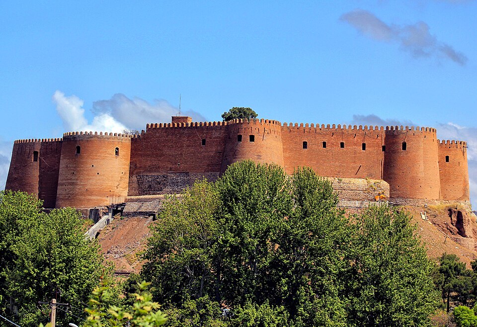
@Heritage Places, Castles & Architecture
03-Nov-2025 11 pm
03-Nov-2025 11 pm
This article uses text information from the Wikipedia article -- Doe_Castle -- [Wikipedia-Article-Link: https://en.wikipedia.org/wiki/Doe_Castle ] which is released under the -- Creative Commons Attribution-ShareAlike 4.0 License – [License-Link: https://creativecommons.org/licenses/by-sa/4.0/deed.en ( https://en.wikipedia.org/wiki/Wikipedia:Text_of_the_Creative_Commons_Attribution-ShareAlike_4.0_International_License )] [List of Principal Authors (5 or less) of the Wikipedia-Article on the date of this Article being Created in this Website: - Donegal1922, Austrasia1, Brendandh, Xx78900, Itzcuauhtli11] [Use the following Authorship tool to find out the author contributions:- https://xtools.wmcloud.org/authorship ] [The Current Article on this Website has been paraphrased from the above linked corresponding Wikipedia-Article and You may redistribute this, verbatim or modified, provided that you comply with the terms of the Creative Commons Attribution-ShareAlike 4.0 License] [License-Link: https://creativecommons.org/licenses/by-sa/4.0/deed.en ( https://en.wikipedia.org/wiki/Wikipedia:Text_of_the_Creative_Commons_Attribution-ShareAlike_4.0_International_License )]
This article also uses an image from the Wikipedia article -- Doe_Castle -- [Wikipedia-Article-Link: https://en.wikipedia.org/wiki/Doe_Castle ] [Image: Doe Castle from the front, featuring Towerhouse and Bawn Walls; Wikipedia-Image-Author: Seamus mcmonagle] [Wikipedia-Image-Link: https://en.wikipedia.org/wiki/File:Doe_Castle,_Donegal.jpg ] [Image Availed Under Creative Commons Attribution-Share Alike 4.0 International license] [License-Link: https://creativecommons.org/licenses/by-sa/4.0/deed.en ] [You may copy, distribute and transmit the work (image) or share (alike) the work (image), provided that you comply with the terms of the Creative Commons Attribution-Share Alike 4.0 International license or other compatible license in distribution] [License-Link: https://creativecommons.org/licenses/by-sa/4.0/deed.en ] [Please Also Relate to Original Individual Text and Image URLs for More Usage Property and Sharing, Remixing or Attributing the Contents]
[Contents on Wikipedia is covered by -- Disclaimer – Wikipedia-Disclaimer-Link: https://en.wikipedia.org/wiki/Wikipedia:General_disclaimer ] [Contents in this Website is also covered by Disclaimer linked at the bottom of the Page] [This website article means no intellectual appropriation by any way and only wishes to contribute in sharing of knowledge]
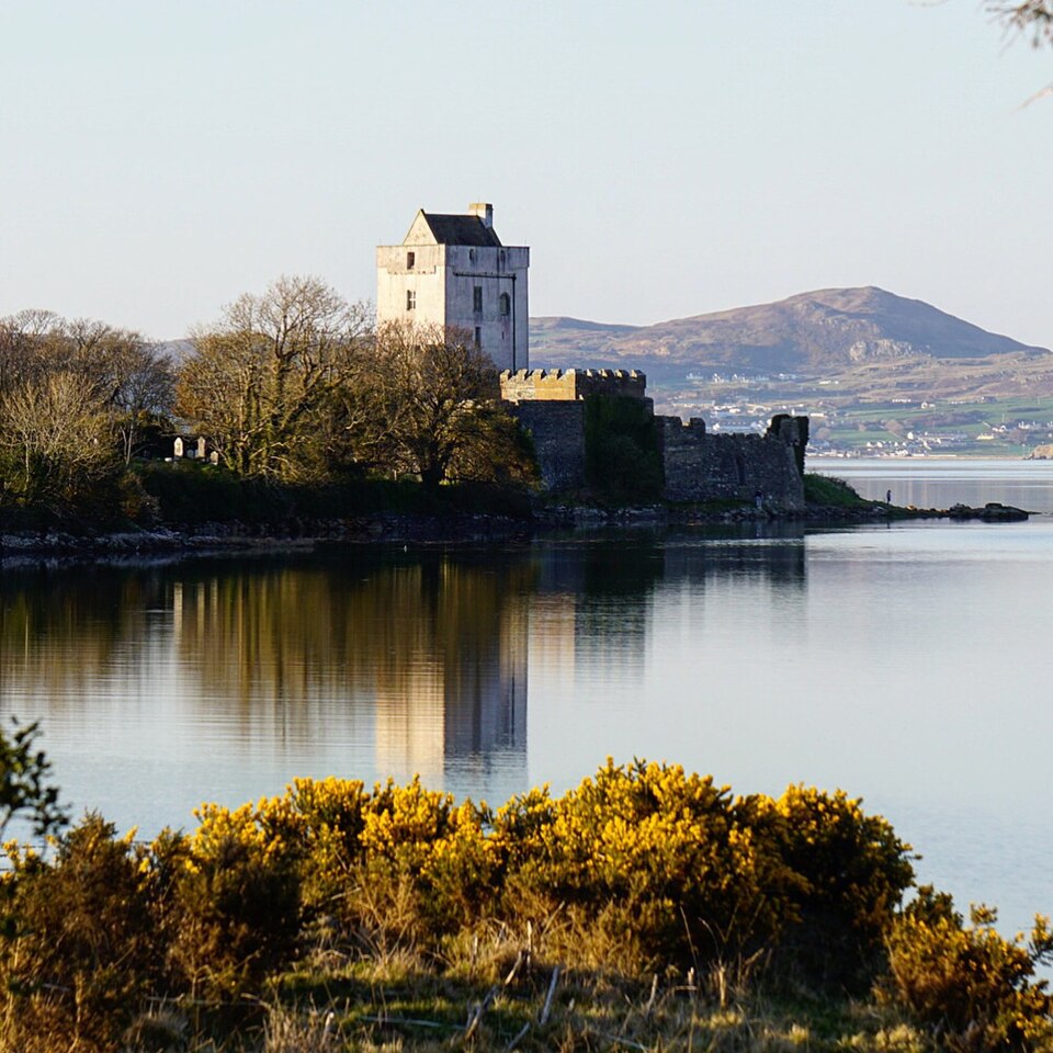
@Heritage Places, Castles & Architecture
01-Nov-2025 08 pm
01-Nov-2025 08 pm
This article uses text information from the Wikipedia article -- Lismore_Castle -- [Wikipedia-Article-Link: https://en.wikipedia.org/wiki/Lismore_Castle ] which is released under the -- Creative Commons Attribution-ShareAlike 4.0 License – [License-Link: https://creativecommons.org/licenses/by-sa/4.0/deed.en ( https://en.wikipedia.org/wiki/Wikipedia:Text_of_the_Creative_Commons_Attribution-ShareAlike_4.0_International_License )] [List of Principal Authors (5 or less) of the Wikipedia-Article on the date of this Article being Created in this Website: - Flozu, Financefactz, Drow69, Engleham, 109.76.90.79] [Use the following Authorship tool to find out the author contributions:- https://xtools.wmcloud.org/authorship ] [The Current Article on this Website has been paraphrased from the above linked corresponding Wikipedia-Article and You may redistribute this, verbatim or modified, provided that you comply with the terms of the Creative Commons Attribution-ShareAlike 4.0 License] [License-Link: https://creativecommons.org/licenses/by-sa/4.0/deed.en ( https://en.wikipedia.org/wiki/Wikipedia:Text_of_the_Creative_Commons_Attribution-ShareAlike_4.0_International_License )]
This article also uses an image from the Wikipedia article -- Lismore_Castle -- [Wikipedia-Article-Link: https://en.wikipedia.org/wiki/Lismore_Castle ] [Image: Lismore Castle, located in the town of Lismore, in County Waterford, Ireland; Wikipedia-Image-Author: Raúl Corral] [Wikipedia-Image-Link: https://en.wikipedia.org/wiki/File:Lismore_Castle_(Lismore,_Co._Waterford).jpg ] [Image Availed Under Creative Commons Attribution-Share Alike 3.0 Unported license] [License-Link: https://creativecommons.org/licenses/by-sa/3.0/deed.en ] [You may copy, distribute and transmit the work (image) or share (alike) the work (image), provided that you comply with the terms of the Creative Commons Attribution-Share Alike 3.0 Unported license or other compatible license in distribution] [License-Link: https://creativecommons.org/licenses/by-sa/3.0/deed.en ] [Please Also Relate to Original Individual Text and Image URLs for More Usage Property and Sharing, Remixing or Attributing the Contents]
[Contents on Wikipedia is covered by – Disclaimer – Wikipedia-Disclaimer-Link: https://en.wikipedia.org/wiki/Wikipedia:General_disclaimer ] [Contents in this Website is also covered by Disclaimer linked at the bottom of the Page] [This website article means no intellectual appropriation by any way and only wishes to contribute in sharing of knowledge]
.jpg)
@Heritage Places, Castles & Architecture
28-Oct-2025 11 pm
28-Oct-2025 11 pm
This article uses text information from the Wikipedia article – Scaligero_Castle_(Sirmione) – [Wikipedia-Article-Link: https://en.wikipedia.org/wiki/Scaligero_Castle_(Sirmione) ] which is released under the -- Creative Commons Attribution-ShareAlike 4.0 License – [License-Link: https://en.wikipedia.org/wiki/Wikipedia:Text_of_the_Creative_Commons_Attribution-ShareAlike_4.0_International_License ] [List of Principal Authors (5 or less) of the Wikipedia-Article on the date of this Article being Created in this Website: - Julio Santos Monteiro, Dexcel, 91.142.236.37, Naddy555, Broichmore] [Use the following Authorship tool to find out the author contributions:- https://xtools.wmcloud.org/authorship ] [The Current Article on this Website has been paraphrased from the above linked corresponding Wikipedia-Article and You may redistribute this, verbatim or modified, provided that you comply with the terms of the Creative Commons Attribution-ShareAlike 4.0 License] [License-Link: https://en.wikipedia.org/wiki/Wikipedia:Text_of_the_Creative_Commons_Attribution-ShareAlike_4.0_International_License ]
[Image: Scaligero Castle Facade, Italy; Image-Author: Natalia Yefremova][Image-Source-Link: https://www.pexels.com/photo/scaligero-castle-facade-italy-8986604/ ] [License-Link: https://www.pexels.com/license/ ] [Please Also Relate to Original Individual Text and Image URLs for More Usage Property and Sharing, Remixing or Attributing the Contents]
[Contents on Wikipedia is covered by – Disclaimer – [Wikipedia-Disclaimer-Link : https://en.wikipedia.org/wiki/Wikipedia:General_disclaimer ] [Contents in this Website is also covered by Disclaimer linked at the bottom of the Page] [This website article means no intellectual appropriation by any way and only wishes to contribute in sharing of knowledge]
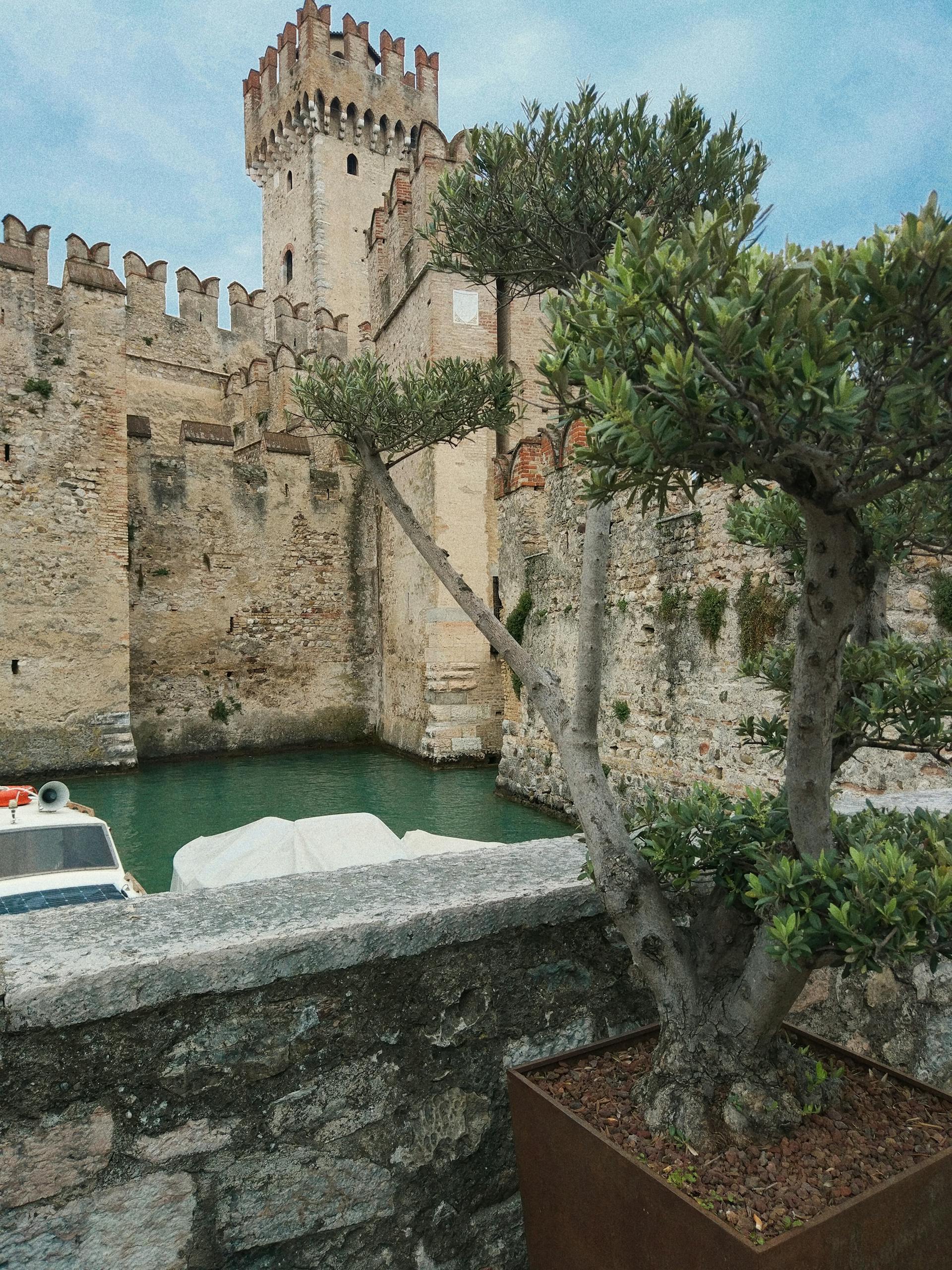
@Heritage Places, Castles & Architecture
27-Oct-2025 09 pm
27-Oct-2025 09 pm
This article uses text information from the Wikipedia article -- Ross_Castle -- [Wikipedia-Article-Link: https://en.wikipedia.org/wiki/Ross_Castle ] which is released under the -- Creative Commons Attribution-ShareAlike 4.0 License – [License-Link: https://en.wikipedia.org/wiki/Wikipedia:Text_of_the_Creative_Commons_Attribution-ShareAlike_4.0_International_License ] [List of Principal Authors (5 or less) of the Wikipedia-Article on the date of this Article being Created in this Website: - Rackmount-guy, Guliolopez, Plucas58, Castlerosse, Opera hat] [Use the following Authorship tool to find out the author contributions:- https://xtools.wmcloud.org/authorship ] [The Current Article on this Website has been paraphrased from the above linked corresponding Wikipedia-Article and You may redistribute this, verbatim or modified, provided that you comply with the terms of the Creative Commons Attribution-ShareAlike 4.0 License] [License-Link: https://en.wikipedia.org/wiki/Wikipedia:Text_of_the_Creative_Commons_Attribution-ShareAlike_4.0_International_License ]
This article also uses an image from the Wikipedia article -- Ross_Castle -- [Wikipedia-Article-Link: https://en.wikipedia.org/wiki/Ross_Castle ] [Image: Ross Castle; Wikipedia-Image-Author: Dumphasizer] [Wikipedia-Image-Link: https://en.wikipedia.org/wiki/File:Ross_Castle_on_Lough_Leane_(15242590587).jpg ] [Image Availed Under Creative Commons Attribution-Share Alike 2.0 Generic license] [License-Link: https://creativecommons.org/licenses/by-sa/2.0/deed.en ] [You may copy, distribute and transmit the work (image) or share (alike) the work (image), provided that you comply with the terms of the Creative Commons Attribution-Share Alike 2.0 Generic license or other compatible license in distribution] [License-Link: https://creativecommons.org/licenses/by-sa/2.0/deed.en ] [Please Also Relate to Original Individual Text and Image URLs for More Usage Property and Sharing, Remixing or Attributing the Contents]
[Contents on Wikipedia is covered by – Disclaimer – Wikipedia-Disclaimer-Link: https://en.wikipedia.org/wiki/Wikipedia:General_disclaimer ] [Contents in this Website is also covered by Disclaimer linked at the bottom of the Page] [This website article means no intellectual appropriation by any way and only wishes to contribute in sharing of knowledge]
.jpg)
@Heritage Places, Castles & Architecture
27-Oct-2025 03 am
27-Oct-2025 03 am
This article uses text information from the Wikipedia article -- Chillon_Castle -- [Wikipedia-Article-Link: https://en.wikipedia.org/wiki/Chillon_Castle ] which is released under the -- Creative Commons Attribution-ShareAlike 4.0 License – [License-Link: https://en.wikipedia.org/wiki/Wikipedia:Text_of_the_Creative_Commons_Attribution-ShareAlike_4.0_International_License ] [List of Principal Authors (5 or less) of the Wikipedia-Article on the date of this Article being Created in this Website: - 2A00:23C5:B66E:AA01:C43A:A6DD:CA64:DF7F, Wik0524, David. cormier, Esme Shepherd, Zacharie Grossen] [Use the following Authorship tool to find out the author contributions:- https://xtools.wmcloud.org/authorship ] [The Current Article on this Website has been paraphrased from the above linked corresponding Wikipedia-Article and You may redistribute this, verbatim or modified, provided that you comply with the terms of the Creative Commons Attribution-ShareAlike 4.0 License] [License-Link: https://en.wikipedia.org/wiki/Wikipedia:Text_of_the_Creative_Commons_Attribution-ShareAlike_4.0_International_License ]
This article also uses an image from the Wikipedia article -- Chillon_Castle -- [Wikipedia-Article-Link: https://en.wikipedia.org/wiki/Chillon_Castle ] [Image: Veytaux, Schloss Chillon; Wikipedia-Image-Photographer: Werner Friedli (1910–1996); Wikipedia-Image-Source: E-Pics Bildarchiv online http://doi.org/10.3932/ethz-a-000353222 ] [Wikipedia-Image-Link: https://en.wikipedia.org/wiki/File:ETH-BIB-Veytaux,_Schloss_Chillon-LBS_H1-011115.tif ] [Image Availed Under Creative Commons Attribution-Share Alike 4.0 International license] [License-Link: https://creativecommons.org/licenses/by-sa/4.0/deed.en ] [You may copy, distribute and transmit the work (image) or share (alike) the work (image), provided that you comply with the terms of the Creative Commons Attribution-Share Alike 4.0 International license or other compatible license in distribution] [License-Link: https://creativecommons.org/licenses/by-sa/4.0/deed.en ] [Please Also Relate to Original Individual Text and Image URLs for More Usage Property and Sharing, Remixing or Attributing the Contents]
[Contents on Wikipedia is covered by -- Disclaimer – Wikipedia-Disclaimer-Link: https://en.wikipedia.org/wiki/Wikipedia:General_disclaimer ] [Contents in this Website is also covered by Disclaimer linked at the bottom of the Page] [This website article means no intellectual appropriation by any way and only wishes to contribute in sharing of knowledge]
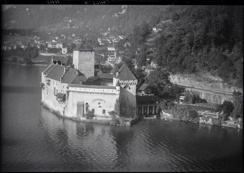
@Heritage Places, Castles & Architecture
23-Oct-2025 08 pm
23-Oct-2025 08 pm
This article uses text information from the Wikipedia article -- Čachtice_Castle -- [Wikipedia-Article-Link: https://en.wikipedia.org/wiki/%C4%8Cachtice_Castle ] which is released under the -- Creative Commons Attribution-ShareAlike 4.0 License – [License-Link: https://en.wikipedia.org/wiki/Wikipedia:Text_of_the_Creative_Commons_Attribution-ShareAlike_4.0_International_License ] [List of Principal Authors (5 or less) of the Wikipedia-Article on the date of this Article being Created in this Website: - Chitt66, Juro, Richard Nevell, Vlendert, 201.156.6.47] [Use the following Authorship tool to find out the author contributions:- https://xtools.wmcloud.org/authorship ] [The Current Article on this Website has been paraphrased from the above linked corresponding Wikipedia-Article and You may redistribute this, verbatim or modified, provided that you comply with the terms of the Creative Commons Attribution-ShareAlike 4.0 License] [License-Link: https://en.wikipedia.org/wiki/Wikipedia:Text_of_the_Creative_Commons_Attribution-ShareAlike_4.0_International_License ]
This article also uses an image from the Wikipedia article -- Čachtice_Castle -- [Wikipedia-Article-Link: https://en.wikipedia.org/wiki/%C4%8Cachtice_Castle ] [Image: Čachtice Castle, Slovakia, aerial photography; Wikipedia-Image-Author: Civertan] [Wikipedia-Image-Link: https://en.wikipedia.org/wiki/File:Csejtecivertanlegi1.jpg ] [Image Availed Under Creative Commons Attribution-Share Alike 3.0 Unported license] [License-Link: https://creativecommons.org/licenses/by-sa/3.0/deed.en ] [You may copy, distribute and transmit the work (image) or share (alike) the work (image), provided that you comply with the terms of the Creative Commons Attribution-Share Alike 3.0 Unported license or other compatible license in distribution] [License-Link: https://creativecommons.org/licenses/by-sa/3.0/deed.en ] [Please Also Relate to Original Individual Text and Image URLs for More Usage Property and Sharing, Remixing or Attributing the Contents]
[Contents on Wikipedia is covered by – Disclaimer – Wikipedia-Disclaimer-Link: https://en.wikipedia.org/wiki/Wikipedia:General_disclaimer ] [Contents in this Website is also covered by Disclaimer linked at the bottom of the Page] [This website article means no intellectual appropriation by any way and only wishes to contribute in sharing of knowledge]
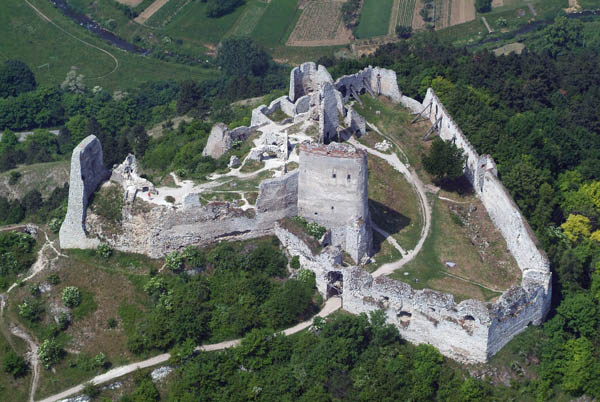
@Heritage Places, Castles & Architecture
17-Oct-2025 10 am
17-Oct-2025 10 am
This article uses text information from the Wikipedia article -- Corvin_Castle -- [Wikipedia-Article-Link: https://en.wikipedia.org/wiki/Corvin_Castle ] which is released under the -- Creative Commons Attribution-ShareAlike 4.0 License – [License-Link: https://en.wikipedia.org/wiki/Wikipedia:Text_of_the_Creative_Commons_Attribution-ShareAlike_4.0_International_License ] [List of Principal Authors (5 or less) of the Wikipedia-Article on the date of this Article being Created in this Website: - Alexandru M., Waxworker, Crista303, Nergaal, Di (they-them)] [Use the following Authorship tool to find out the author contributions:- https://xtools.wmcloud.org/authorship ] [The Current Article on this Website has been paraphrased from the above linked corresponding Wikipedia-Article and You may redistribute this, verbatim or modified, provided that you comply with the terms of the Creative Commons Attribution-ShareAlike 4.0 License] [License-Link: https://en.wikipedia.org/wiki/Wikipedia:Text_of_the_Creative_Commons_Attribution-ShareAlike_4.0_International_License ]
This article also uses an image from the Wikipedia article -- Corvin_Castle -- [Wikipedia-Article-Link: https://en.wikipedia.org/wiki/Corvin_Castle ] [Image: Hunedoara castle; Wikipedia-Image-Author: Paszczur01] [Wikipedia-Image-Link: https://en.wikipedia.org/wiki/File:Hunedoara_castle.jpg ] [Image Availed Creative Commons Attribution-Share Alike 3.0 Romania license] [License-Link: https://creativecommons.org/licenses/by-sa/3.0/ro/deed.en ] [You may copy, distribute and transmit the work (image) or share (alike) the work (image), provided that you comply with the terms of the Creative Commons Attribution-Share Alike 3.0 Romania license or other compatible license as the original in distribution] [License-Link: https://creativecommons.org/licenses/by-sa/3.0/ro/deed.en ] [Please Also Relate to Original Individual Text and Image URLs for More Usage Property and Sharing, Remixing or Attributing the Contents]
[Contents on Wikipedia is covered by -- Disclaimer – Wikipedia-Disclaimer-Link: https://en.wikipedia.org/wiki/Wikipedia:General_disclaimer ] [Contents in this Website is also covered by Disclaimer linked at the bottom of the Page] [This website article means no intellectual appropriation by any way and only wishes to contribute in sharing of knowledge]
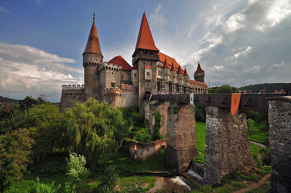
@Heritage Places, Castles & Architecture
05-Oct-2025 03 am
05-Oct-2025 03 am
This article uses text information from the Wikipedia article -- Bellver_Castle -- [Wikipedia-Article-Link: https://en.wikipedia.org/wiki/Bellver_Castle ] which is released under the -- Creative Commons Attribution-ShareAlike 4.0 License – [License-Link: https://creativecommons.org/licenses/by-sa/4.0/deed.en ( https://en.wikipedia.org/wiki/Wikipedia:Text_of_the_Creative_Commons_Attribution-ShareAlike_4.0_International_License )] [List of Principal Authors (5 or less) of the Wikipedia-Article on the date of this Article being Created in this Website:- Qasid, InternetArchiveBot, Vvven, Jabberjaw, GreenC bot] [Use the following Authorship tool to find out the author contributions :- https://xtools.wmcloud.org/authorship ] [The Current Article on this Website has been paraphrased from the above linked corresponding Wikipedia-Article and You may redistribute this, verbatim or modified, provided that you comply with the terms of the Creative Commons Attribution-ShareAlike 4.0 License] [License-Link: https://creativecommons.org/licenses/by-sa/4.0/deed.en ( https://en.wikipedia.org/wiki/Wikipedia:Text_of_the_Creative_Commons_Attribution-ShareAlike_4.0_International_License )]
This article also uses an image from the Wikipedia article -- Bellver_Castle -- [Wikipedia-Article-Link: https://en.wikipedia.org/wiki/Bellver_Castle ] [Image: Castillo de Bellver, Palma de Mallorca, Islas Baleares, España; Wikipedia-Image-Author: Poniol60] [Wikipedia-Image-Link: https://en.wikipedia.org/wiki/File:Castillo_de_Bellver.jpg ] [The copyright holder of the work (Image), has released this work into the public domain. This applies worldwide; In some countries this may not be legally possible; if so: The copyright holder has granted anyone the right to use this work for any purpose, without any conditions, unless such conditions are required by law.] [Please Also Relate to Original Individual Text and Image URLs for More Usage Property and Sharing, Remixing or Attributing the Contents]
[Contents on Wikipedia is covered by -- Disclaimer – Wikipedia-Disclaimer-Link: https://en.wikipedia.org/wiki/Wikipedia:General_disclaimer ] [Contents in this Website is also covered by Disclaimer linked at the bottom of the Page] [This website article means no intellectual appropriation by any way and only wishes to contribute in sharing of knowledge]
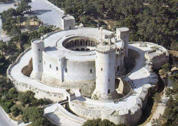
@Heritage Places, Castles & Architecture
02-Oct-2025 10 pm
02-Oct-2025 10 pm
This article uses text information from the Wikipedia article -- Lancaster_Castle -- [Wikipedia-Article-Link: https://en.wikipedia.org/wiki/Lancaster_Castle ] which is released under the -- Creative Commons Attribution-ShareAlike 4.0 License – [License-Link: https://en.wikipedia.org/wiki/Wikipedia:Text_of_the_Creative_Commons_Attribution-ShareAlike_4.0_International_License ] [List of Principal Authors (5 or less) of the Wikipedia-Article on the date of this Article being Created in this Website : - Nev1, Plucas58, Bazonka, Bleaney, Bellowhead678] [Use the following Authorship tool to find out the author contributions :- https://xtools.wmcloud.org/authorship ] [The Current Article on this Website has been paraphrased from the above linked corresponding Wikipedia-Article and You may redistribute this, verbatim or modified, provided that you comply with the terms of the Creative Commons Attribution-ShareAlike 4.0 License] [License-Link: https://en.wikipedia.org/wiki/Wikipedia:Text_of_the_Creative_Commons_Attribution-ShareAlike_4.0_International_License ]
[Image: Majestic Lancaster Castle Under Blue Sky; Image-Author: Michael D Beckwith][Image_Source-Link: https://www.pexels.com/photo/majestic-lancaster-castle-under-blue-sky-31268814/ ] [License-Link: https://www.pexels.com/license/ ] [Please Also Relate to Original Individual Text and Image URLs for More Usage Property and Sharing, Remixing or Attributing the Contents] [Contents on Wikipedia is covered by -- Disclaimer – [Wikipedia-Disclaimer-Link : https://en.wikipedia.org/wiki/Wikipedia:General_disclaimer ] [Contents in this Website is also covered by Disclaimer linked at the bottom of the Page] [This website article means no intellectual appropriation by any way and only wishes to contribute in sharing of knowledge]
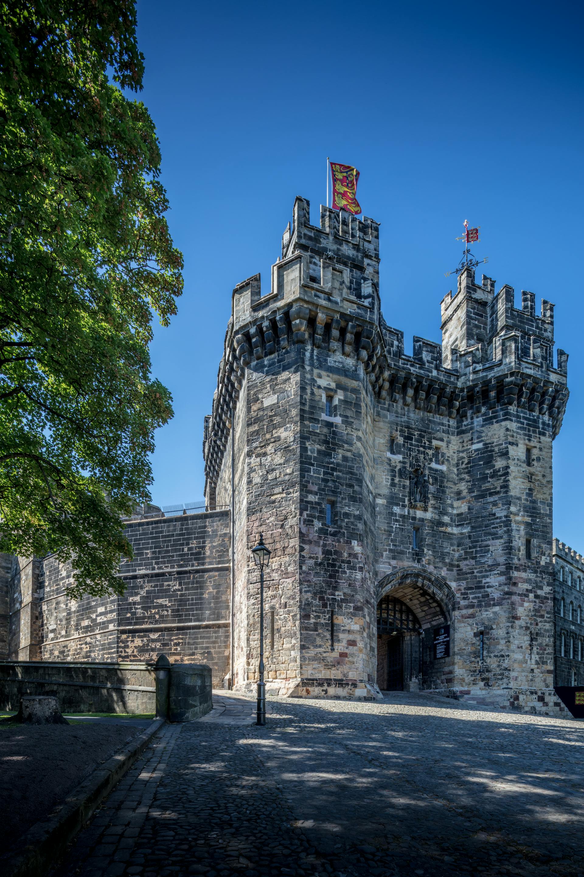
@Heritage Places, Castles & Architecture
02-Oct-2025 07 am
02-Oct-2025 07 am
This article uses text information from the Wikipedia article -- Olavinlinna -- [Wikipedia-Article-Link: https://en.wikipedia.org/wiki/Olavinlinna ] which is released under the -- Creative Commons Attribution-ShareAlike 4.0 License – [License-Link: https://en.wikipedia.org/wiki/Wikipedia:Text_of_the_Creative_Commons_Attribution-ShareAlike_4.0_International_License ] [List of Principal Authors (5 or less) of the Wikipedia-Article on the date of this Article being Created in this Website: - PiercingEyes, Reywas92, Catsmeat, Ghirlandajo, 2001:99A:80E:3A00:64F5:7AAF:497C:44B1] [Use the following Authorship tool to find out the author contributions:- https://xtools.wmcloud.org/authorship ] [The Current Article on this Website has been paraphrased from the above linked corresponding Wikipedia-Article and You may redistribute this, verbatim or modified, provided that you comply with the terms of the Creative Commons Attribution-ShareAlike 4.0 License] [License-Link: https://en.wikipedia.org/wiki/Wikipedia:Text_of_the_Creative_Commons_Attribution-ShareAlike_4.0_International_License ]
This article also uses an image from the Wikipedia article -- Olavinlinna -- [Wikipedia-Article-Link: https://en.wikipedia.org/wiki/Olavinlinna ] [Image: The castle has three towers remaining; Wikipedia-Image-Author: Miraceti https://commons.wikimedia.org/wiki/User:Miraceti ] [Wikipedia-Image-Link: https://en.wikipedia.org/wiki/File:Olavinlinna2.jpg ] [Image Availed Under Creative Commons Attribution-Share Alike 3.0 Unported license] [License-Link: https://creativecommons.org/licenses/by-sa/3.0/deed.en ] [You may copy, distribute and transmit the work (image) or share (alike) the work (image), provided that you comply with the terms of the Creative Commons Attribution-Share Alike 3.0 Unported license or other compatible license in distribution] [License-Link: https://creativecommons.org/licenses/by-sa/3.0/deed.en ] [Please Also Relate to Original Individual Text and Image URLs for More Usage Property and Sharing, Remixing or Attributing the Contents]
[Contents on Wikipedia is covered by -- Disclaimer – Wikipedia-Disclaimer-Link: https://en.wikipedia.org/wiki/Wikipedia:General_disclaimer ] [Contents in this Website is also covered by Disclaimer linked at the bottom of the Page] [This website article means no intellectual appropriation by any way and only wishes to contribute in sharing of knowledge]
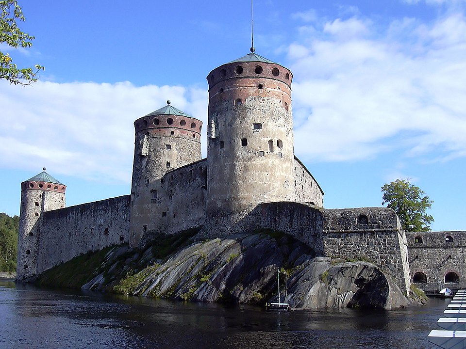
@Heritage Places, Castles & Architecture
01-Oct-2025 02 am
01-Oct-2025 02 am
This article uses text information from the Wikipedia article -- Malbork_Castle -- [Wikipedia-Article-Link: https://en.wikipedia.org/wiki/Malbork_Castle ] which is released under the -- Creative Commons Attribution-ShareAlike 4.0 License – [License-Link: https://creativecommons.org/licenses/by-sa/4.0/deed.en ( https://en.wikipedia.org/wiki/Wikipedia:Text_of_the_Creative_Commons_Attribution-ShareAlike_4.0_International_License )] [List of Principal Authors (5 or less) of the Wikipedia-Article on the date of this Article being Created in this Website: - Merangs, Pko, Babia Góra, Nev1, Dbamy] [Use the following Authorship tool to find out the author contributions:- https://xtools.wmcloud.org/authorship ] [The Current Article on this Website has been paraphrased from the above linked corresponding Wikipedia-Article and You may redistribute this, verbatim or modified, provided that you comply with the terms of the Creative Commons Attribution-ShareAlike 4.0 License] [License-Link: https://creativecommons.org/licenses/by-sa/4.0/deed.en ( https://en.wikipedia.org/wiki/Wikipedia:Text_of_the_Creative_Commons_Attribution-ShareAlike_4.0_International_License )]
This article also uses an image from the Wikipedia article -- Malbork_Castle -- [Wikipedia-Article-Link: https://en.wikipedia.org/wiki/Malbork_Castle ] [Image: Malbork Castle from across the Nogat; Wikipedia-Image-Author: Gregy] [Wikipedia-Image-Link: https://en.wikipedia.org/wiki/File:Zesp%C3%B3%C5%82_Zamku_Krzy%C5%BCackiego_MALBORK_01.jpg ] [Image Availed Under Creative Commons Attribution-Share Alike 3.0 Poland license] [License-Link: https://creativecommons.org/licenses/by-sa/3.0/pl/deed.en ] [You may copy, distribute and transmit the work (image) or share (alike) the work (image), provided that you comply with the terms of the Creative Commons Attribution-Share Alike 3.0 Poland license or other compatible license in distribution] [License-Link: https://creativecommons.org/licenses/by-sa/3.0/pl/deed.en ] [Please Also Relate to Original Individual Text and Image URLs for More Usage Property and Sharing, Remixing or Attributing the Contents]
[Contents on Wikipedia is covered by -- Disclaimer – Wikipedia-Disclaimer-Link: https://en.wikipedia.org/wiki/Wikipedia:General_disclaimer ] [Contents in this Website is also covered by Disclaimer linked at the bottom of the Page] [This website article means no intellectual appropriation by any way and only wishes to contribute in sharing of knowledge]
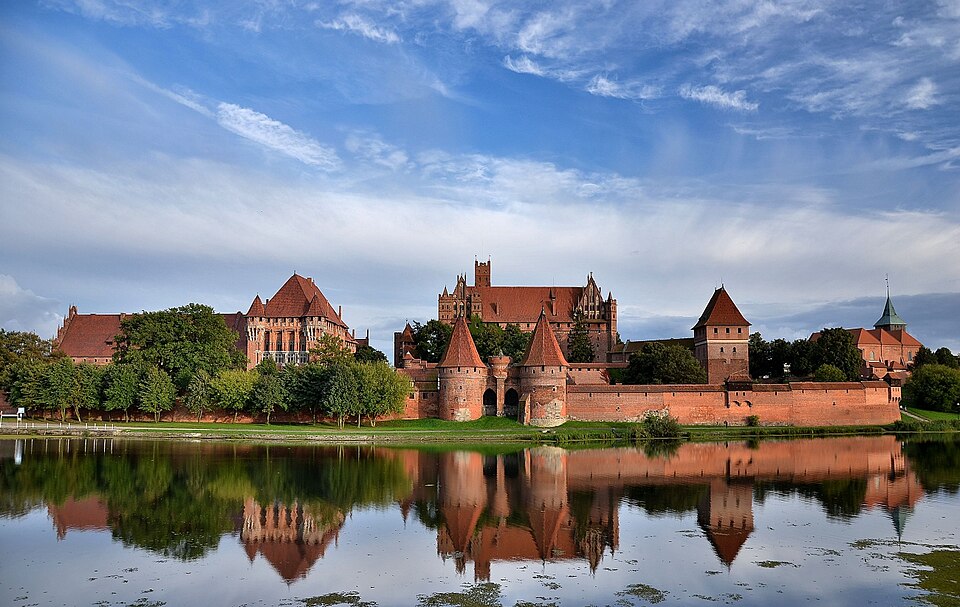
@Heritage Places, Castles & Architecture
27-Sep-2025 10 pm
27-Sep-2025 10 pm
This article uses text information from the Wikipedia article -- Conwy_Castle -- [Wikipedia-Article-Link: https://en.wikipedia.org/wiki/Conwy_Castle ] which is released under the -- Creative Commons Attribution-ShareAlike 4.0 License – [License-Link: https://en.wikipedia.org/wiki/Wikipedia:Text_of_the_Creative_Commons_Attribution-ShareAlike_4.0_International_License ] [List of Principal Authors (5 or less) of the Wikipedia-Article on the date of this Article being Created in this Website: - Hchc2009, Cltjames, Danni243, InternetArchiveBot, Bridgetfox] [Use the following Authorship tool to find out the author contributions:- https://xtools.wmcloud.org/authorship ] [The Current Article on this Website has been paraphrased from the above linked corresponding Wikipedia-Article and You may redistribute this, verbatim or modified, provided that you comply with the terms of the Creative Commons Attribution-ShareAlike 4.0 License] [License-Link: https://en.wikipedia.org/wiki/Wikipedia:Text_of_the_Creative_Commons_Attribution-ShareAlike_4.0_International_License ]
This article also uses an image from the Wikipedia article -- Conwy_Castle -- [Wikipedia-Article-Link: https://en.wikipedia.org/wiki/Conwy_Castle ] [Image: Conwy Castle from the river; Wikipedia-Image-Author: Andrew Woodvine] [Wikipedia-Image-Link: https://en.wikipedia.org/wiki/File:Conwy_Castle,_water_view1.jpg ] [Image Availed Under Creative Commons Attribution-Share Alike 2.0 Generic license] [License-Link: https://creativecommons.org/licenses/by-sa/2.0/deed.en ] [You may copy, distribute and transmit the work (image) or share (alike) the work (image), provided that you comply with the terms of the Creative Commons Attribution-Share Alike 2.0 Generic license or other compatible license in distribution] [License-Link: https://creativecommons.org/licenses/by-sa/2.0/deed.en ] [Please Also Relate to Original Individual Text and Image URLs for More Usage Property and Sharing, Remixing or Attributing the Contents]
[Contents on Wikipedia is covered by -- Disclaimer – Wikipedia-Disclaimer-Link: https://en.wikipedia.org/wiki/Wikipedia:General_disclaimer ] [Contents in this Website is also covered by Disclaimer linked at the bottom of the Page] [This website article means no intellectual appropriation by any way and only wishes to contribute in sharing of knowledge]
@Heritage Places, Castles & Architecture
22-Sep-2025 12 am
22-Sep-2025 12 am
This article uses text information from the Wikipedia article -- Bratislava_Castle -- [Wikipedia-Article-Link: https://en.wikipedia.org/wiki/Bratislava_Castle ] which is released under the -- Creative Commons Attribution-ShareAlike 4.0 License – [License-Link: https://en.wikipedia.org/wiki/Wikipedia:Text_of_the_Creative_Commons_Attribution-ShareAlike_4.0_International_License ] [List of Principal Authors (5 or less) of the Wikipedia-Article on the date of this Article being Created in this Website: - Juro, Nmate, Revirvlkodlaku, Goldnpuppy, Brutalhovno] [Use the following Authorship tool to find out the author contributions:- https://xtools.wmcloud.org/authorship ] [The Current Article on this Website has been paraphrased from the above linked corresponding Wikipedia-Article and You may redistribute this, verbatim or modified, provided that you comply with the terms of the Creative Commons Attribution-ShareAlike 4.0 License] [License-Link: https://en.wikipedia.org/wiki/Wikipedia:Text_of_the_Creative_Commons_Attribution-ShareAlike_4.0_International_License ]
[Image: Bratislava Castle; Image Credit and Attribution: Dr. Debabrata Chakrabarti (Personal Image Collection of Dr. Debabrata Chakrabarti who has given sole permission for the Image to be published by this website)] [Please Also Relate to Original Individual Text and/or Image URLs (if available) for More Usage Property and Sharing, Remixing or Attributing the Contents] [Contents on Wikipedia is covered by -- Disclaimer – Wikipedia-Disclaimer-Link: https://en.wikipedia.org/wiki/Wikipedia:General_disclaimer ] [Contents in this Website is also covered by Disclaimer linked at the bottom of the Page] [This website article means no intellectual appropriation by any way and only wishes to contribute in sharing of knowledge]
@Heritage Places, Castles & Architecture
17-Sep-2025 04 am
17-Sep-2025 04 am
This article uses text information from the Wikipedia article -- Château_de_Gisors -- [Wikipedia-Article-Link: https://en.wikipedia.org/wiki/Ch%C3%A2teau_de_Gisors ] which is released under the -- Creative Commons Attribution-ShareAlike 4.0 License – [License-Link: https://en.wikipedia.org/wiki/Wikipedia:Text_of_the_Creative_Commons_Attribution-ShareAlike_4.0_International_License ] [List of Principal Authors (5 or less) of the Wikipedia-Article on the date of this Article being Created in this Website: - Nev1, Emeraude, CJ DUB, Tickery, Kebeta] [Use the following Authorship tool to find out the author contributions:- https://xtools.wmcloud.org/authorship ] [The Current Article on this Website has been paraphrased from the above linked corresponding Wikipedia-Article and You may redistribute this, verbatim or modified, provided that you comply with the terms of the Creative Commons Attribution-ShareAlike 4.0 License] [License-Link: https://en.wikipedia.org/wiki/Wikipedia:Text_of_the_Creative_Commons_Attribution-ShareAlike_4.0_International_License ]
This article also uses an image from the Wikipedia article -- Château_de_Gisors -- [Wikipedia-Article-Link: https://en.wikipedia.org/wiki/Ch%C3%A2teau_de_Gisors ] [Image: The original octagonal keep and chemise of Gisors; Wikipedia-Image-Author: Nitot https://commons.wikimedia.org/wiki/User:Nitot ] [Wikipedia-Image-Link: https://en.wikipedia.org/wiki/File:Chateau-de-Gisors.jpg ] [Image Availed Under Creative Commons Attribution-Share Alike 3.0 Unported license] [License-Link: https://creativecommons.org/licenses/by-sa/3.0/deed.en ] [You may copy, distribute and transmit the work (image) or share (alike) the work (image), provided that you comply with the terms of the Creative Commons Attribution-Share Alike 3.0 Unported license or other compatible license in distribution] [License-Link: https://creativecommons.org/licenses/by-sa/3.0/deed.en ] [Please Also Relate to Original Individual Text and Image URLs for More Usage Property and Sharing, Remixing or Attributing the Contents]
[Contents on Wikipedia is covered by -- Disclaimer – Wikipedia-Disclaimer-Link: https://en.wikipedia.org/wiki/Wikipedia:General_disclaimer ] [Contents in this Website is also covered by Disclaimer linked at the bottom of the Page] [This website article means no intellectual appropriation by any way and only wishes to contribute in sharing of knowledge]
@Heritage Places, Castles & Architecture
13-Sep-2025 06 pm
13-Sep-2025 06 pm
This article uses text information from the Wikipedia article -- Gradara_Castle -- [Wikipedia-Article-Link: https://en.wikipedia.org/wiki/Gradara_Castle ] which is released under the -- Creative Commons Attribution-ShareAlike 4.0 License – [License-Link: https://en.wikipedia.org/wiki/Wikipedia:Text_of_the_Creative_Commons_Attribution-ShareAlike_4.0_International_License ] [List of Principal Authors (5 or less) of the Wikipedia-Article on the date of this Article being Created in this Website: - MrNiceGuy1113, Brianza2008, 109.154.8.225, GreenC bot, The Anomebot2] [Use the following Authorship tool to find out the author contributions:- https://xtools.wmcloud.org/authorship ] [The Current Article on this Website has been paraphrased from the above linked corresponding Wikipedia-Article and You may redistribute this, verbatim or modified, provided that you comply with the terms of the Creative Commons Attribution-ShareAlike 4.0 License] [License-Link: https://en.wikipedia.org/wiki/Wikipedia:Text_of_the_Creative_Commons_Attribution-ShareAlike_4.0_International_License ]
This article also uses an image from the Wikipedia article -- Gradara_Castle -- [Wikipedia-Article-Link: https://en.wikipedia.org/wiki/Gradara_Castle ] [Image: Veduta della rocca di Gradara; Wikipedia-Image-Author: Enrico90p] [Wikipedia-Image-Link: https://en.wikipedia.org/wiki/File:Gradara.jpg ] [The copyright holder of the work (Image), released the work into the public domain. This applies worldwide. In some countries this may not be legally possible; if so: the copyright holder grants anyone the right to use this work for any purpose, without any conditions, unless such conditions are required by law.] [Please Also Relate to Original Individual Text and Image URLs for More Usage Property and Sharing, Remixing or Attributing the Contents]
[Contents on Wikipedia is covered by -- Disclaimer – Wikipedia-Disclaimer-Link: https://en.wikipedia.org/wiki/Wikipedia:General_disclaimer ] [Contents in this Website is also covered by Disclaimer linked at the bottom of the Page] [This website article means no intellectual appropriation by any way and only wishes to contribute in sharing of knowledge]
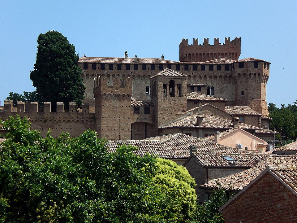
@Heritage Places, Castles & Architecture
08-Sep-2025 03 am
08-Sep-2025 03 am
This article uses text information from the Wikipedia article -- Dunguaire_Castle -- [Wikipedia-Article-Link: https://en.wikipedia.org/wiki/Dunguaire_Castle ] which is released under the -- Creative Commons Attribution-ShareAlike 4.0 License – [License-Link: https://en.wikipedia.org/wiki/Wikipedia:Text_of_the_Creative_Commons_Attribution-ShareAlike_4.0_International_License ] [List of Principal Authors (5 or less) of the Wikipedia-Article on the date of this Article being Created in this Website: - Drow69, Seefin, Guliolopez, LegalSmeagolian, Postdlf] [Use the following Authorship tool to find out the author contributions:- https://xtools.wmcloud.org/authorship ] [The Current Article on this Website has been paraphrased from the above linked corresponding Wikipedia-Article and You may redistribute this, verbatim or modified, provided that you comply with the terms of the Creative Commons Attribution-ShareAlike 4.0 License] [License-Link: https://en.wikipedia.org/wiki/Wikipedia:Text_of_the_Creative_Commons_Attribution-ShareAlike_4.0_International_License ]
This article also uses an image from the Wikipedia article -- Dunguaire_Castle -- [Wikipedia-Article-Link: https://en.wikipedia.org/wiki/Dunguaire_Castle ] [Image: Dunguaire Castle exterior; Wikipedia-Image-Author: Boomur https://commons.wikimedia.org/wiki/User:Boomur ] [Wikipedia-Image-Link: https://en.wikipedia.org/wiki/File:Dunguaire_Castle,_Galway,_Ireland.png ] [Image Availed Under Creative Commons Attribution-Share Alike 3.0 Unported license.] [License-Link: https://creativecommons.org/licenses/by-sa/3.0/deed.en ] [You may copy, distribute and transmit the work (image) or share (alike) the work (image), provided that you comply with the terms of the Creative Commons Attribution-Share Alike 3.0 Unported license or other compatible license in distribution] [License-Link: https://creativecommons.org/licenses/by-sa/3.0/deed.en ] [Please Also Relate to Original Individual Text and Image URLs for More Usage Property and Sharing, Remixing or Attributing the Contents]
[Contents on Wikipedia is covered by -- Disclaimer – Wikipedia-Disclaimer-Link: https://en.wikipedia.org/wiki/Wikipedia:General_disclaimer ] [Contents in this Website is also covered by Disclaimer linked at the bottom of the Page] [This website article means no intellectual appropriation by any way and only wishes to contribute in sharing of knowledge]
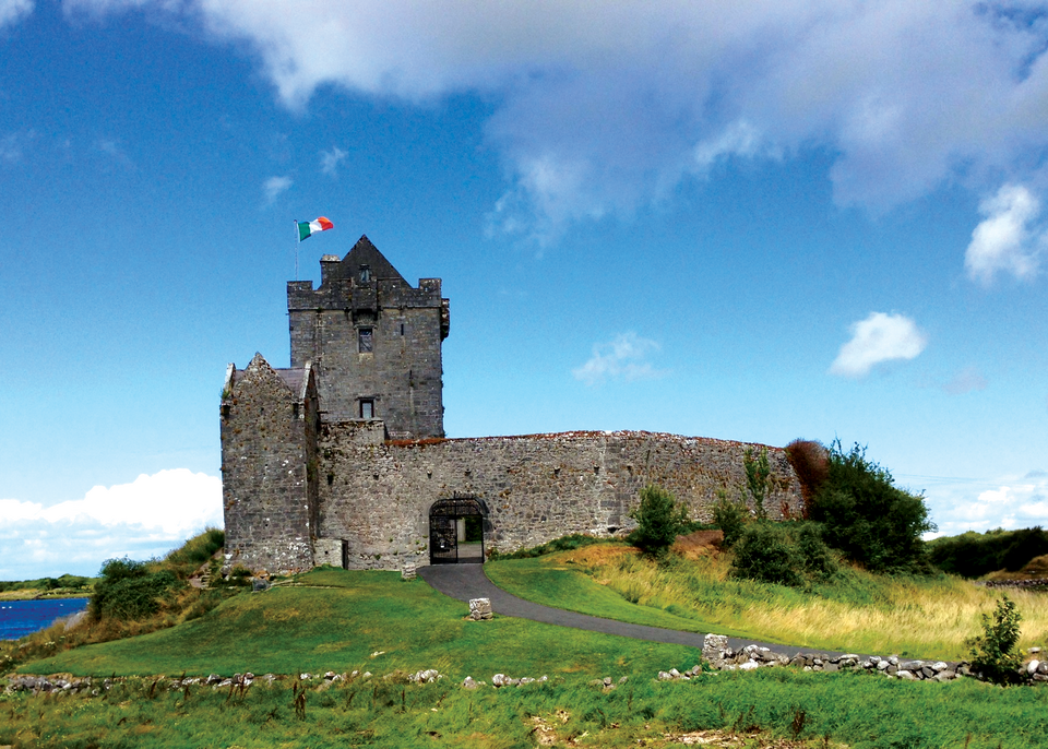
@Heritage Places, Castles & Architecture
03-Sep-2025 07 am
03-Sep-2025 07 am
This article uses text information from the Wikipedia article -- Castel_Nuovo -- [Wikipedia-Article-Link : https://en.wikipedia.org/wiki/Castel_Nuovo ] which is released under the -- Creative Commons Attribution-ShareAlike 4.0 License – [License-Link: https://en.wikipedia.org/wiki/Wikipedia:Text_of_the_Creative_Commons_Attribution-ShareAlike_4.0_International_License ] [List of Principal Authors (5 or less) of the Wikipedia-Article on the date of this Article being Created in this Website: - BrugesFR, Rococo1700, Attilios, Naddy555, 42° South] [Use the following Authorship tool to find out the author contributions:- https://xtools.wmcloud.org/authorship ] [The Current Article on this Website has been paraphrased from the above linked corresponding Wikipedia-Article and You may redistribute this, verbatim or modified, provided that you comply with the terms of the Creative Commons Attribution-ShareAlike 4.0 License] [License-Link: https://en.wikipedia.org/wiki/Wikipedia:Text_of_the_Creative_Commons_Attribution-ShareAlike_4.0_International_License ]
This article also uses an image from the Wikipedia article -- List_of_World_Heritage_Sites_in_Italy -- [Wikipedia-Article-Link: https://en.wikipedia.org/wiki/List_of_World_Heritage_Sites_in_Italy ] [Image: Castel Nuovo seem from the northwest in 2014; Wikipedia-Image-Author: Richard Nevell from London, United Kingdom] [Wikipedia-Image-Link: https://en.wikipedia.org/wiki/File:Castel_Nuovo_(29)_(15584302832).jpg ] [Image Availed Under Creative Commons Attribution-Share Alike 2.0 Generic license;] [License-Link: https://creativecommons.org/licenses/by-sa/2.0/deed.en ] [You may copy, distribute and transmit the work (image) or share (alike) the work (image), provided that you comply with the terms of the Creative Commons Attribution-Share Alike 2.0 Generic license or other compatible license in distribution] [License-Link: https://creativecommons.org/licenses/by-sa/2.0/deed.en ] [Please Also Relate to Original Individual Text and Image URLs for More Usage Property and Sharing, Remixing or Attributing the Contents]
[Contents on Wikipedia is covered by -- Disclaimer – Wikipedia-Disclaimer-Link: https://en.wikipedia.org/wiki/Wikipedia:General_disclaimer ] [Contents in this Website is also covered by Disclaimer linked at the bottom of the Page] [This website article means no intellectual appropriation by any way and only wishes to contribute in sharing of knowledge]
_(15584302832).jpg)
@Heritage Places, Castles & Architecture
28-Aug-2025 03 am
28-Aug-2025 03 am
This article uses text information from the Wikipedia article -- Château_de_Montségur -- [Wikipedia-Article-Link: https://en.wikipedia.org/wiki/Ch%C3%A2teau_de_Monts%C3%A9gur ] which is released under the -- Creative Commons Attribution-ShareAlike 4.0 License – [License-Link: https://en.wikipedia.org/wiki/Wikipedia:Text_of_the_Creative_Commons_Attribution-ShareAlike_4.0_International_License ] [List of Principal Authors (5 or less) of the Wikipedia-Article on the date of this Article being Created in this Website: - Ceesharp, Ekem, 188.141.25.160, Daisybug42, Emeraude] [Use the following Authorship tool to find out the author contributions:- https://xtools.wmcloud.org/authorship ] [The Current Article on this Website has been paraphrased from the above linked corresponding Wikipedia-Article and You may redistribute this, verbatim or modified, provided that you comply with the terms of the Creative Commons Attribution-ShareAlike 4.0 License] [License-Link: https://en.wikipedia.org/wiki/Wikipedia:Text_of_the_Creative_Commons_Attribution-ShareAlike_4.0_International_License ]
This article also uses an image from the Wikipedia article -- Château_de_Montségur -- [Wikipedia-Article-Link : https://en.wikipedia.org/wiki/Ch%C3%A2teau_de_Monts%C3%A9gur ] [Image: The Fortress of Montségur; Wikipedia-Image-Author: MDanis] [Wikipedia-Image-Link: https://en.wikipedia.org/wiki/File:Ch%C3%A2teau_de_Monts%C3%A9gur_-_vue_a%C3%A9rienne.jpg ] [Image Availed Under Creative Commons Attribution-Share Alike 3.0 Unported license;] [License-Link: https://creativecommons.org/licenses/by-sa/3.0/deed.en ] [You may copy, distribute and transmit the work (image) or share (alike) the work (image), provided that you comply with the terms of the Creative Commons Attribution-Share Alike 3.0 Unported license or other compatible license in distribution] [License-Link: https://creativecommons.org/licenses/by-sa/3.0/deed.en ] [Please Also Relate to Original Individual Text and Image URLs for More Usage Property and Sharing, Remixing or Attributing the Contents]
[Contents on Wikipedia is covered by -- Disclaimer – Wikipedia-Disclaimer-Link: https://en.wikipedia.org/wiki/Wikipedia:General_disclaimer ] [Contents in this Website is also covered by Disclaimer linked at the bottom of the Page] [This website article means no intellectual appropriation by any way and only wishes to contribute in sharing of knowledge]
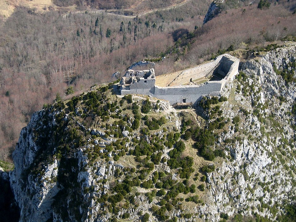
@Heritage Places, Castles & Architecture
23-Aug-2025 03 am
23-Aug-2025 03 am
This article uses text information from the Wikipedia article -- Beaumaris_Castle -- [Wikipedia-Article-Link : https://en.wikipedia.org/wiki/Beaumaris_Castle ] which is released under the -- Creative Commons Attribution-ShareAlike 4.0 License – [License-Link: https://en.wikipedia.org/wiki/Wikipedia:Text_of_the_Creative_Commons_Attribution-ShareAlike_4.0_International_License ] [List of Principal Authors (5 or less) of the Wikipedia-Article on the date of this Article being Created in this Website: - Hchc2009, Nev1, RobinLeicester, InternetArchiveBot, Bencherlite] [Use the following Authorship tool to find out the author contributions:- https://xtools.wmcloud.org/authorship ] [The Current Article on this Website has been paraphrased from the above linked corresponding Wikipedia-Article and You may redistribute this, verbatim or modified, provided that you comply with the terms of the Creative Commons Attribution-ShareAlike 4.0 License] [License-Link: https://en.wikipedia.org/wiki/Wikipedia:Text_of_the_Creative_Commons_Attribution-ShareAlike_4.0_International_License ]
This article also uses an image from the Wikipedia article -- Beaumaris_Castle -- [Wikipedia-Article-Link: https://en.wikipedia.org/wiki/Beaumaris_Castle ] [Image: Beaumaris Castle seen from a drone; Wikipedia-Image-Author: Llywelyn2000 https://commons.wikimedia.org/wiki/User:Llywelyn2000 ] [Wikipedia-Image-Link: https://en.wikipedia.org/wiki/File:Castell_Beaumaris_Castle,_Ynys_Mon_(Anglesey),_Wales_45.png ] [Image Availed Under Creative Commons Attribution-Share Alike 4.0 International license;] [License-Link: https://creativecommons.org/licenses/by-sa/4.0/deed.en ] [You may copy, distribute and transmit the work (image) or share (alike) the work (image), provided that you comply with the terms of the Creative Commons Attribution-Share Alike 4.0 International license or other compatible license in distribution] [License-Link: https://creativecommons.org/licenses/by-sa/4.0/deed.en ] [Please Also Relate to Original Individual Text and Image URLs for More Usage Property and Sharing, Remixing or Attributing the Contents]
[Contents on Wikipedia is covered by -- Disclaimer – Wikipedia-Disclaimer-Link: https://en.wikipedia.org/wiki/Wikipedia:General_disclaimer ] [Contents in this Website is also covered by Disclaimer linked at the bottom of the Page] [This website article means no intellectual appropriation by any way and only wishes to contribute in sharing of knowledge]
,_Wales_45.png)
@Heritage Places, Castles & Architecture
21-Aug-2025 03 am
21-Aug-2025 03 am
This article uses text information from the Wikipedia article -- De_Haar_Castle -- [Wikipedia-Article-Link : https://en.wikipedia.org/wiki/De_Haar_Castle ] which is released under the -- Creative Commons Attribution-ShareAlike 4.0 License – [License-Link: https://en.wikipedia.org/wiki/Wikipedia:Text_of_the_Creative_Commons_Attribution-ShareAlike_4.0_International_License ] [List of Principal Authors (5 or less) of the Wikipedia-Article on the date of this Article being Created in this Website: - Wereldburger758, Zoeperkoe, APK, Black Orchid, Sffcorgi] [Use the following Authorship tool to find out the author contributions:- https://xtools.wmcloud.org/authorship ] [The Current Article on this Website has been paraphrased from the above linked corresponding Wikipedia-Article and You may redistribute this, verbatim or modified, provided that you comply with the terms of the Creative Commons Attribution-ShareAlike 4.0 License] [License-Link: https://en.wikipedia.org/wiki/Wikipedia:Text_of_the_Creative_Commons_Attribution-ShareAlike_4.0_International_License ]
This article also uses an image from the Wikipedia article -- De_Haar_Castle -- [Wikipedia-Article-Link : https://en.wikipedia.org/wiki/De_Haar_Castle ] [Image: De Haar castle; Wikipedia-Image-Author : Rafa . rivero] [Wikipedia-Image-Link: https://en.wikipedia.org/wiki/File:De_Haar_castlle.jpg ] [Image Availed Under Creative Commons Attribution-Share Alike 4.0 International license;] [License-Link: https://creativecommons.org/licenses/by-sa/4.0/deed.en ] [You may copy, distribute and transmit the work (image) or share (alike) the work (image), provided that you comply with the terms of the Creative Commons Attribution-Share Alike 4.0 International license or other compatible license in distribution] [License-Link: https://creativecommons.org/licenses/by-sa/4.0/deed.en ] [Please Also Relate to Original Individual Text and Image URLs for More Usage Property and Sharing, Remixing or Attributing the Contents]
[Contents on Wikipedia is covered by -- Disclaimer – Wikipedia-Disclaimer-Link: https://en.wikipedia.org/wiki/Wikipedia:General_disclaimer ] [Contents in this Website is also covered by Disclaimer linked at the bottom of the Page] [This website article means no intellectual appropriation by any way and only wishes to contribute in sharing of knowledge]
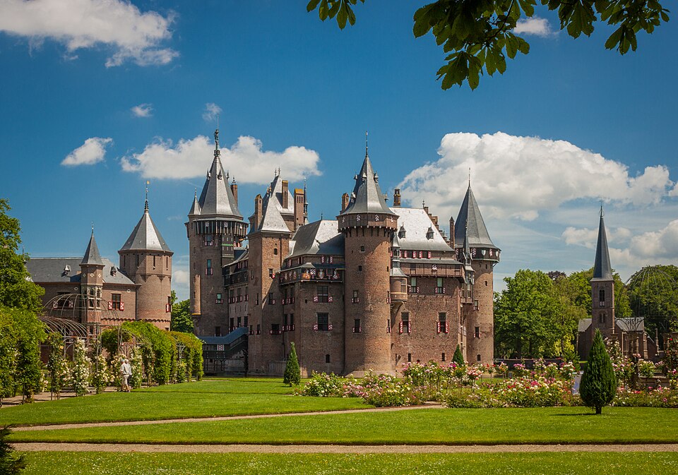
@Heritage Places, Castles & Architecture
19-Aug-2025 02 am
19-Aug-2025 02 am
This article uses text information from the Wikipedia article -- Srebrenik_Castle -- [Wikipedia-Article-Link : https://en.wikipedia.org/wiki/Srebrenik_Castle ] which is released under the -- Creative Commons Attribution-ShareAlike 4.0 License – [License-Link: https://creativecommons.org/licenses/by-sa/4.0/deed.en ( https://en.wikipedia.org/wiki/Wikipedia:Text_of_the_Creative_Commons_Attribution-ShareAlike_4.0_International_License )] [List of Principal Authors (5 or less) of the Wikipedia-Article on the date of this Article being Created in this Website: - Salihbasicm, Santasa99, Surix321, Kebeta, Smooth O] [Use the following Authorship tool to find out the author contributions:- https://xtools.wmcloud.org/authorship ] [The Current Article on this Website has been paraphrased from the above linked corresponding Wikipedia-Article and You may redistribute this, verbatim or modified, provided that you comply with the terms of the Creative Commons Attribution-ShareAlike 4.0 License] [License-Link: https://creativecommons.org/licenses/by-sa/4.0/deed.en ( https://en.wikipedia.org/wiki/Wikipedia:Text_of_the_Creative_Commons_Attribution-ShareAlike_4.0_International_License )]
This article also uses an image from the Wikipedia article – Srebrenik_Castle -- [Wikipedia-Article-Link : https://en.wikipedia.org/wiki/Srebrenik_Castle ] [Image: Srebrenik Fortress - view from air, northern side; Wikipedia-Image-Author: Martin Brož] [Wikipedia-Image-Link: https://en.wikipedia.org/wiki/File:Let_vrtulnikem11_-_hrad_Srebrenik_(13.-18._stol.)_jeste_lepe.jpg ] [Image Availed Under Creative Commons Attribution 3.0 Unported license;] [License-Link: https://creativecommons.org/licenses/by/3.0/deed.en ] [You may copy, distribute and transmit the work (image) or remix the work (image) and attribute the work (image) with proper license link, complying with the terms of the Creative Commons Attribution 3.0 Unported License in distribution] [License-Link: https://creativecommons.org/licenses/by/3.0/deed.en ] [Please Also Relate to Original Individual Text and Image URLs for More Usage Property and Sharing, Remixing or Attributing the Contents]
[Contents on Wikipedia is covered by -- Disclaimer – Wikipedia-Disclaimer-Link: https://en.wikipedia.org/wiki/Wikipedia:General_disclaimer ] [Contents in this Website is also covered by Disclaimer linked at the bottom of the Page] [This website article means no intellectual appropriation by any way and only wishes to contribute in sharing of knowledge]
_jeste_lepe.jpg)
@Heritage Places, Castles & Architecture
18-Aug-2025 12 am
18-Aug-2025 12 am
This article uses text information from the Wikipedia article – Castle_Rising_Castle -- [Wikipedia-Article-Link : https://en.wikipedia.org/wiki/Castle_Rising_Castle ] which is released under the -- Creative Commons Attribution-ShareAlike 4.0 License – [License-Link: https://en.wikipedia.org/wiki/Wikipedia:Text_of_the_Creative_Commons_Attribution-ShareAlike_4.0_International_License ] [List of Principal Authors (5 or less) of the Wikipedia-Article on the date of this Article being Created in this Website: - Hchc2009, BG19bot, InternetArchiveBot, Nev1, Mr Stephen] [Use the following Authorship tool to find out the author contributions:- https://xtools.wmcloud.org/authorship ] [The Current Article on this Website has been paraphrased from the above linked corresponding Wikipedia-Article and You may redistribute this, verbatim or modified, provided that you comply with the terms of the Creative Commons Attribution-ShareAlike 4.0 License] [License-Link: https://en.wikipedia.org/wiki/Wikipedia:Text_of_the_Creative_Commons_Attribution-ShareAlike_4.0_International_License ]
This article also uses an image from the Wikipedia article -- Castle_Rising_Castle -- [Wikipedia-Article-Link: https://en.wikipedia.org/wiki/Castle_Rising_Castle ] [Image: Engraving of the ruined keep in 1782, by William Byrne; Wikipedia-Image-Author: William Bryne (1743 – 1805), published 1782] [Wikipedia-Image-Link: https://en.wikipedia.org/wiki/File:Engraving_of_Castle_Rising.jpg ] [This media file is in the public domain in the United States. This applies to U.S. works where the copyright has expired, often because its first publication occurred prior to January 1, 1930, and if not then due to lack of notice or renewal. This work is in the public domain in its country of origin and other countries and areas where the copyright term is the life of author plus 100 years or fewer.] [Please Also Relate to Original Individual Text and Image URLs for More Usage Property and Sharing, Remixing or Attributing the Contents]
[Contents on Wikipedia is covered by -- Disclaimer – [Wikipedia-Disclaimer-Link : https://en.wikipedia.org/wiki/Wikipedia:General_disclaimer ] [Contents in this Website is also covered by Disclaimer linked at the bottom of the Page] [This website article means no intellectual appropriation by any way and only wishes to contribute in sharing of knowledge]
@Heritage Places, Castles & Architecture
13-Aug-2025 04 pm
13-Aug-2025 04 pm
This article uses text information from the Wikipedia article -- Château_de_Vincennes -- [Wikipedia-Article-Link : https://en.wikipedia.org/wiki/Ch%C3%A2teau_de_Vincennes ] which is released under the -- Creative Commons Attribution-ShareAlike 4.0 License – [License-Link: https://en.wikipedia.org/wiki/Wikipedia:Text_of_the_Creative_Commons_Attribution-ShareAlike_4.0_International_License ] [List of Principal Authors (5 or less) of the Wikipedia-Article on the date of this Article being Created in this Website: - SiefkinDR, Wetman, Ecrm87, CJ DUB, Dr Dobeaucoup] [Use the following Authorship tool to find out the author contributions:- https://xtools.wmcloud.org/authorship ] [The Current Article on this Website has been paraphrased from the above linked corresponding Wikipedia-Article and You may redistribute this, verbatim or modified, provided that you comply with the terms of the Creative Commons Attribution-ShareAlike 4.0 License] [License-Link: https://en.wikipedia.org/wiki/Wikipedia:Text_of_the_Creative_Commons_Attribution-ShareAlike_4.0_International_License ]
This article also uses an image from the Wikipedia article -- Château_de_Vincennes -- [Wikipedia-Article-Link : https://en.wikipedia.org/wiki/Ch%C3%A2teau_de_Vincennes ] [Image: Donjon of the Château de Vincennes; Wikipedia-Image-Author: Selbymay https://commons.wikimedia.org/wiki/User:Selbymay ] [Wikipedia-Image-Link: https://en.wikipedia.org/wiki/File:Vincennes_-_Chateau_02.jpg ] [Image Availed Under Creative Commons Attribution-Share Alike 3.0 Unported license;] [License-Link: https://creativecommons.org/licenses/by-sa/3.0/deed.en ] [You may copy, distribute and transmit the work (image) or share (alike) the work (image), provided that you comply with the terms of the Creative Commons Attribution-Share Alike 3.0 Unported license or other compatible license in distribution] [License-Link: https://creativecommons.org/licenses/by-sa/3.0/deed.en ] [Please Also Relate to Original Individual Text and Image URLs for More Usage Property and Sharing, Remixing or Attributing the Contents]
[Contents on Wikipedia is covered by -- Disclaimer – Wikipedia-Disclaimer-Link: https://en.wikipedia.org/wiki/Wikipedia:General_disclaimer ] [Contents in this Website is also covered by Disclaimer linked at the bottom of the Page] [This website article means no intellectual appropriation by any way and only wishes to contribute in sharing of knowledge]
@Heritage Places, Castles & Architecture
04-Aug-2025 11 pm
04-Aug-2025 11 pm
This article uses text information from the Wikipedia article – Schwerin_Castle -- [Wikipedia-Article-Link : https://en.wikipedia.org/wiki/Schwerin_Castle ] which is released under the -- Creative Commons Attribution-ShareAlike 4.0 License – [License-Link: https://en.wikipedia.org/wiki/Wikipedia:Text_of_the_Creative_Commons_Attribution-ShareAlike_4.0_International_License ] [List of Principal Authors (5 or less) of the Wikipedia-Article on the date of this Article being Created in this Website: - Sky, Horst-schlaemma, 217.83.213.184, Ehrenkater, Kamilla Ralf] [Use the following Authorship tool to find out the author contributions:- https://xtools.wmcloud.org/authorship ] [The Current Article on this Website has been paraphrased from the above linked corresponding Wikipedia-Article and You may redistribute this, verbatim or modified, provided that you comply with the terms of the Creative Commons Attribution-ShareAlike 4.0 License] [License-Link: https://en.wikipedia.org/wiki/Wikipedia:Text_of_the_Creative_Commons_Attribution-ShareAlike_4.0_International_License ]
[Image: Schwerin Castle in Germany; Image-Author: Omar Ramadan] [Image_Source-Link: https://www.pexels.com/photo/schwerin-castle-in-germany-5571698/ ] [License-Link: https://www.pexels.com/license/ ] [Please Also Relate to Original Individual Text and Image URLs for More Usage Property and Sharing, Remixing or Attributing the Contents]
[Contents on Wikipedia is covered by -- Disclaimer – Wikipedia-Disclaimer-Link: https://en.wikipedia.org/wiki/Wikipedia:General_disclaimer ] [Contents in this Website is also covered by Disclaimer linked at the bottom of the Page] [This website article means no intellectual appropriation by any way and only wishes to contribute in sharing of knowledge]
@Heritage Places, Castles & Architecture
01-Aug-2025 03 pm
01-Aug-2025 03 pm
This article uses text information from the Wikipedia article – Mehrangarh -- [Wikipedia-Article-Link : https://en.wikipedia.org/wiki/Mehrangarh ] which is released under the -- Creative Commons Attribution-ShareAlike 4.0 License – [License-Link: https://en.wikipedia.org/wiki/Wikipedia:Text_of_the_Creative_Commons_Attribution-ShareAlike_4.0_International_License ] [List of Principal Authors (5 or less) of the Wikipedia-Article on the date of this Article being Created in this Website: - Surendra mohnot, Pyaaz Kachori, John Prattley, Shankar Raman, Alto 800] [Use the following Authorship tool to find out the author contributions:- https://xtools.wmcloud.org/authorship ] [The Current Article on this Website has been paraphrased from the above linked corresponding Wikipedia-Article and You may redistribute this, verbatim or modified, provided that you comply with the terms of the Creative Commons Attribution-ShareAlike 4.0 License] [License-Link: https://en.wikipedia.org/wiki/Wikipedia:Text_of_the_Creative_Commons_Attribution-ShareAlike_4.0_International_License ]
[Image: Imposing Mehrangarh Fort against a Clear Blue Sky; Image-Author: Mehul Soni][Image_Source-Link: https://www.pexels.com/photo/imposing-mehrangarh-fort-against-a-clear-blue-sky-32858950/ ] [License-Link: https://www.pexels.com/license/ ] [Please Also Relate to Original Individual Text and Image URLs for More Usage Property and Sharing, Remixing or Attributing the Contents]
[Contents on Wikipedia is covered by -- Disclaimer – Wikipedia-Disclaimer-Link: https://en.wikipedia.org/wiki/Wikipedia:General_disclaimer ] [Contents in this Website is also covered by Disclaimer linked at the bottom of the Page] [This website article means no intellectual appropriation by any way and only wishes to contribute in sharing of knowledge]
@Heritage Places, Castles & Architecture
28-Jul-2025 07 am
28-Jul-2025 07 am
This article uses text information from the Wikipedia article – Castel_Sant%27Angelo -- [Wikipedia-Article-Link : https://en.wikipedia.org/wiki/Castel_Sant%27Angelo ] which is released under the -- Creative Commons Attribution-ShareAlike 4.0 License – [License-Link: https://en.wikipedia.org/wiki/Wikipedia:Text_of_the_Creative_Commons_Attribution-ShareAlike_4.0_International_License ] [List of Principal Authors (5 or less) of the Wikipedia-Article on the date of this Article being Created in this Website: - BoschA, Neddyseagoon, InternetArchiveBot, Mlouns, Rococo1700] [Use the following Authorship tool to find out the author contributions:- https://xtools.wmcloud.org/authorship ] [The Current Article on this Website has been paraphrased from the above linked corresponding Wikipedia-Article and You may redistribute this, verbatim or modified, provided that you comply with the terms of the Creative Commons Attribution-ShareAlike 4.0 License] [License-Link: https://en.wikipedia.org/wiki/Wikipedia:Text_of_the_Creative_Commons_Attribution-ShareAlike_4.0_International_License ]
[Image: St. Angelo Bridge and a Castle in Rome; Image-Author: Ilia Bronskiy][Image_Source-Link: https://www.pexels.com/photo/st-angelo-bridge-and-a-castle-in-rome-20888056/ ] [License-Link: https://www.pexels.com/license/ ] [Please Also Relate to Original Individual Text and Image URLs for More Usage Property and Sharing, Remixing or Attributing the Contents]
[Contents on Wikipedia is covered by -- Disclaimer – Wikipedia-Disclaimer-Link: https://en.wikipedia.org/wiki/Wikipedia:General_disclaimer ] [Contents in this Website is also covered by Disclaimer linked at the bottom of the Page] [This website article means no intellectual appropriation by any way and only wishes to contribute in sharing of knowledge]
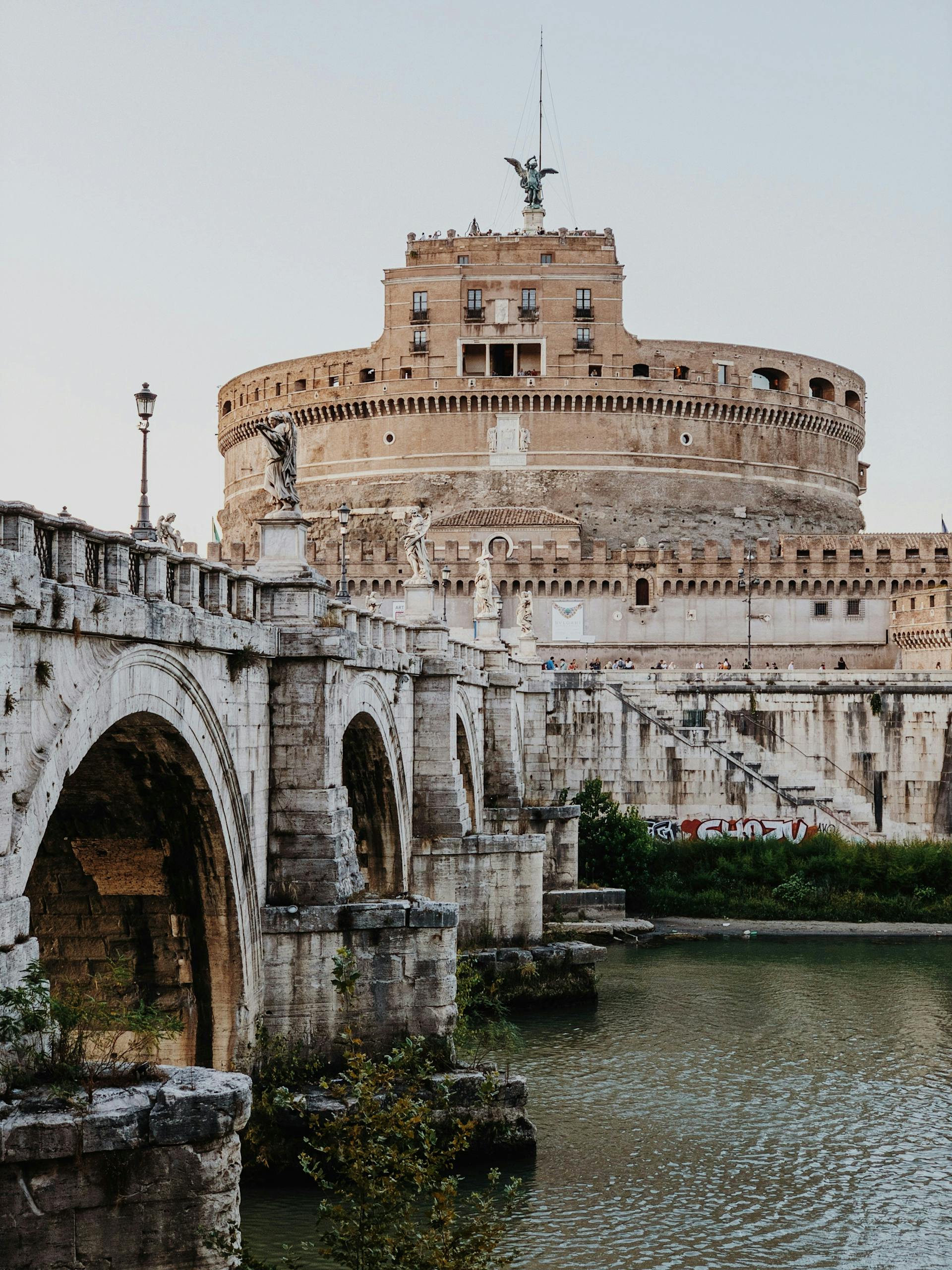
@Heritage Places, Castles & Architecture
25-Jul-2025 07 am
25-Jul-2025 07 am
This article uses text information from the Wikipedia article – Castle_of_Loarre -- [Wikipedia-Article-Link : https://en.wikipedia.org/wiki/Castle_of_Loarre ] which is released under the -- Creative Commons Attribution-ShareAlike 4.0 License – [License-Link: https://en.wikipedia.org/wiki/Wikipedia:Text_of_the_Creative_Commons_Attribution-ShareAlike_4.0_International_License ] [List of Principal Authors (5 or less) of the Wikipedia-Article on the date of this Article being Created in this Website: - 68.228.61.129, Vami IV, Nev1, Zhmr, Garcilaso] [Use the following Authorship tool to find out the author contributions:- https://xtools.wmcloud.org/authorship ] [The Current Article on this Website has been paraphrased from the above linked corresponding Wikipedia-Article and You may redistribute this, verbatim or modified, provided that you comply with the terms of the Creative Commons Attribution-ShareAlike 4.0 License] [License-Link: https://en.wikipedia.org/wiki/Wikipedia:Text_of_the_Creative_Commons_Attribution-ShareAlike_4.0_International_License ]
This article also uses an image from the Wikipedia article -- Castle_of_Loarre -- [Wikipedia-Article-Link: https://en.wikipedia.org/wiki/Castle_of_Loarre ] [Image: Castillo de Loarre; Wikipedia-Image-Author: Samueloku] [Wikipedia-Image-Link: https://en.wikipedia.org/wiki/File:El_famoso_castillo_de_Loarre.jpg ] [Image Availed Under Creative Commons Attribution-Share Alike 3.0 Unported license;] [License-Link: https://creativecommons.org/licenses/by-sa/3.0/deed.en ] [You may copy, distribute and transmit the work (image) or share (alike) the work (image), provided that you comply with the terms of the Creative Commons Attribution-Share Alike 3.0 Unported license or other compatible license in distribution] [License-Link: https://creativecommons.org/licenses/by-sa/3.0/deed.en ] [Please Also Relate to Original Individual Text and Image URLs for More Usage Property and Sharing, Remixing or Attributing the Contents]
[Contents on Wikipedia is covered by -- Disclaimer – Wikipedia-Disclaimer-Link: https://en.wikipedia.org/wiki/Wikipedia:General_disclaimer ] [Contents in this Website is also covered by Disclaimer linked at the bottom of the Page] [This website article means no intellectual appropriation by any way and only wishes to contribute in sharing of knowledge]
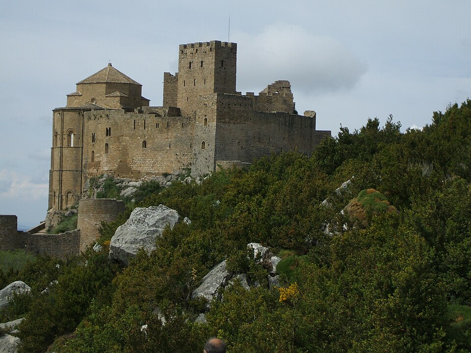
@Heritage Places, Castles & Architecture
20-Jul-2025 10 am
20-Jul-2025 10 am
This article uses text information from the Wikipedia article – Hampton_Court_Castle -- [Wikipedia-Article-Link : https://en.wikipedia.org/wiki/Hampton_Court_Castle ] which is released under the -- Creative Commons Attribution-ShareAlike 4.0 License – [License-Link: https://creativecommons.org/licenses/by-sa/4.0/deed.en ( https://en.wikipedia.org/wiki/Wikipedia:Text_of_the_Creative_Commons_Attribution-ShareAlike_4.0_International_License )] [List of Principal Authors (5 or less) of the Wikipedia-Article on the date of this Article being Created in this Website: - Wimstead, Adam37, Peter K Burian, Pigsonthewing, Plucas58] [Use the following Authorship tool to find out the author contributions:- https://xtools.wmcloud.org/authorship ] [The Current Article on this Website has been paraphrased from the above linked corresponding Wikipedia-Article and You may redistribute this, verbatim or modified, provided that you comply with the terms of the Creative Commons Attribution-ShareAlike 4.0 License] [License-Link: https://creativecommons.org/licenses/by-sa/4.0/deed.en ( https://en.wikipedia.org/wiki/Wikipedia:Text_of_the_Creative_Commons_Attribution-ShareAlike_4.0_International_License )]
This article also uses an image from the Wikipedia article -- Hampton_Court_Castle -- [Wikipedia-Article-Link : https://en.wikipedia.org/wiki/Hampton_Court_Castle ] [Image: File:Hampton Court, Herefordshire (1795) by J.M.W. Turner (cropped); Wikipedia-Image-Author: JMW Turner] [Wikipedia-Image-Link: https://en.wikipedia.org/wiki/File:Hampton_Court,_Herefordshire_by_JMW_Turner_(part).webp ] [This work is in the public domain in the United States because it was published (or registered with the U.S. Copyright Office) before January 1, 1931. This work is in the public domain in its country of origin and other countries and areas where the copyright term is the life of author plus 70 years or fewer.] [Please Also Relate to Original Individual Text and Image URLs for More Usage Property and Sharing, Remixing or Attributing the Contents]
[Contents on Wikipedia is covered by -- Disclaimer – [Wikipedia-Disclaimer-Link : https://en.wikipedia.org/wiki/Wikipedia:General_disclaimer ] [Contents in this Website is also covered by Disclaimer linked at the bottom of the Page] [This website article means no intellectual appropriation by any way and only wishes to contribute in sharing of knowledge]
.webp.png)
@Heritage Places, Castles & Architecture
22-Jun-2025 12 am
22-Jun-2025 12 am
This article uses text information from the Wikipedia article -- Library_of_Celsus -- [Wikipedia-Article-Link : https://en.wikipedia.org/wiki/Library_of_Celsus ] which is released under the -- Creative Commons Attribution-ShareAlike 4.0 License – [License-Link: https://en.wikipedia.org/wiki/Wikipedia:Text_of_the_Creative_Commons_Attribution-ShareAlike_4.0_International_License ] [List of Principal Authors (5 or less) of the Wikipedia-Article on the date of this Article being Created in this Website: - Mar. nw, Babymel418, Runselit, GenoV84, Zagoury] [Use the following Authorship tool to find out the author contributions:- https://xtools.wmcloud.org/authorship ] [The Current Article on this Website has been paraphrased from the above linked corresponding Wikipedia-Article and You may redistribute this, verbatim or modified, provided that you comply with the terms of the Creative Commons Attribution-ShareAlike 4.0 License] [License-Link: https://en.wikipedia.org/wiki/Wikipedia:Text_of_the_Creative_Commons_Attribution-ShareAlike_4.0_International_License ]
[Image: Celsus Library Facade in Ephesus under Clear Sky; Image-Author : metin cengiz][Image_Source-Link: https://www.pexels.com/photo/celsus-library-facade-in-ephesus-under-clear-sky-32604537/ ] [License-Link: https://www.pexels.com/license/ ] [Please Also Relate to Original Individual Text and Image URLs for More Usage Property and Sharing, Remixing or Attributing the Contents]
[Contents on Wikipedia is covered by -- Disclaimer – [Wikipedia-Disclaimer-Link : https://en.wikipedia.org/wiki/Wikipedia:General_disclaimer ] [Contents in this Website is also covered by Disclaimer linked at the bottom of the Page] [This website article means no intellectual appropriation by any way and only wishes to contribute in sharing of knowledge]
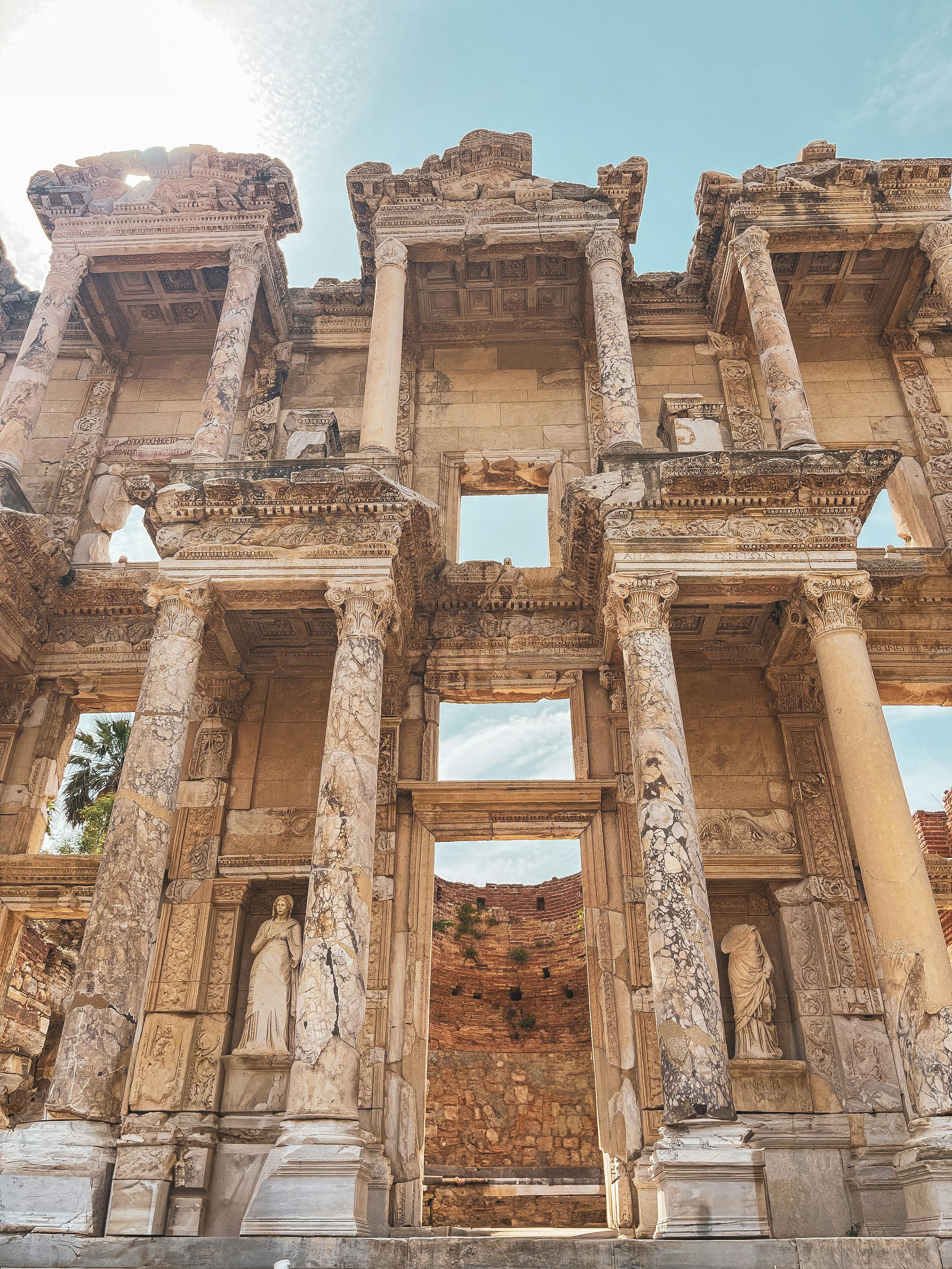
@Heritage Places, Castles & Architecture
16-Jun-2025 04 am
16-Jun-2025 04 am
This article uses text information from the Wikipedia article -- Burgalimar_Castle -- [Wikipedia-Article-Link : https://en.wikipedia.org/wiki/Burgalimar_Castle ] which is released under the -- Creative Commons Attribution-ShareAlike 4.0 License – [License-Link: https://en.wikipedia.org/wiki/Wikipedia:Text_of_the_Creative_Commons_Attribution-ShareAlike_4.0_International_License ] [List of Principal Authors (5 or less) of the Wikipedia-Article on the date of this Article being Created in this Website: - R Prazeres, InternetArchiveBot, Rlink2, Citation bot, Monkbot] [Use the following Authorship tool to find out the author contributions:- https://xtools.wmcloud.org/authorship ] [The Current Article on this Website has been paraphrased from the above linked corresponding Wikipedia-Article and You may redistribute this, verbatim or modified, provided that you comply with the terms of the Creative Commons Attribution-ShareAlike 4.0 License] [License-Link: https://en.wikipedia.org/wiki/Wikipedia:Text_of_the_Creative_Commons_Attribution-ShareAlike_4.0_International_License ]
This article also uses an image from the Wikipedia article -- Burgalimar_Castle -- [Wikipedia-Article-Link : https://en.wikipedia.org/wiki/Burgalimar_Castle ] [Image: Burgalimar Castle seen from afar; Wikipedia-Image-Author : Kordas https://commons.wikimedia.org/wiki/User:Kordas ] [Wikipedia-Image-Link: https://en.wikipedia.org/wiki/File:Castillo_de_Burgalimar_K34b.jpg ] [Image Availed Under Creative Commons Attribution-Share Alike 3.0 Unported license;] [License-Link: https://creativecommons.org/licenses/by-sa/3.0/deed.en ] [You may copy, distribute and transmit the work (image) or share (alike) the work (image), provided that you comply with the terms of the Creative Commons Attribution-Share Alike 3.0 Unported license or other compatible license in distribution] [License-Link: https://creativecommons.org/licenses/by-sa/3.0/deed.en ] [Please Also Relate to Original Individual Text and Image URLs for More Usage Property and Sharing, Remixing or Attributing the Contents]
[Contents on Wikipedia is covered by -- Disclaimer – Wikipedia-Disclaimer-Link: https://en.wikipedia.org/wiki/Wikipedia:General_disclaimer ] [Contents in this Website is also covered by Disclaimer linked at the bottom of the Page] [This website article means no intellectual appropriation by any way and only wishes to contribute in sharing of knowledge]
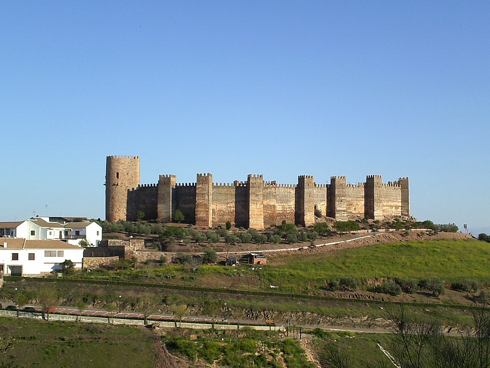
@Heritage Places, Castles & Architecture
08-Jun-2025 06 pm
08-Jun-2025 06 pm
This article uses text information from the Wikipedia article -- Alcázar_of_Segovia -- [Wikipedia-Article-Link : https://en.wikipedia.org/wiki/Alc%C3%A1zar_of_Segovia ] which is released under the -- Creative Commons Attribution-ShareAlike 4.0 License – [License-Link: https://en.wikipedia.org/wiki/Wikipedia:Text_of_the_Creative_Commons_Attribution-ShareAlike_4.0_International_License ] [List of Principal Authors (5 or less) of the Wikipedia-Article on the date of this Article being Created in this Website: - McmLuvr13, ILoveCaracas, Lifeboatt, Ministrillo, Slann] [Use the following Authorship tool to find out the author contributions:- https://xtools.wmcloud.org/authorship ] [The Current Article on this Website has been paraphrased from the above linked corresponding Wikipedia-Article and You may redistribute this, verbatim or modified, provided that you comply with the terms of the Creative Commons Attribution-ShareAlike 4.0 License] [License-Link: https://en.wikipedia.org/wiki/Wikipedia:Text_of_the_Creative_Commons_Attribution-ShareAlike_4.0_International_License ]
This article also uses an image from the Wikipedia article -- Alcázar_of_Segovia -- [Wikipedia-Article-Link : https://en.wikipedia.org/wiki/Alc%C3%A1zar_of_Segovia ] [Image: Alcazar of Segovia; Wikipedia-Image-Author : Ángel Sanz de Andrés] [Wikipedia-Image-Link: https://en.wikipedia.org/wiki/File:Panor%C3%A1mica_Oto%C3%B1o_Alc%C3%A1zar_de_Segovia.jpg ] [Image Availed Under Creative Commons Attribution-Share Alike 4.0 International license;] [License-Link: https://creativecommons.org/licenses/by-sa/4.0/deed.en ] [You may copy, distribute and transmit the work (image) or share (alike) the work (image), provided that you comply with the terms of the Creative Commons Attribution-Share Alike 4.0 International license or other compatible license in distribution] [License-Link: https://creativecommons.org/licenses/by-sa/4.0/deed.en ] [Please Also Relate to Original Individual Text and Image URLs for More Usage Property and Sharing, Remixing or Attributing the Contents]
[Contents on Wikipedia is covered by -- Disclaimer – Wikipedia-Disclaimer-Link: https://en.wikipedia.org/wiki/Wikipedia:General_disclaimer ] [Contents in this Website is also covered by Disclaimer linked at the bottom of the Page] [This website article means no intellectual appropriation by any way and only wishes to contribute in sharing of knowledge]
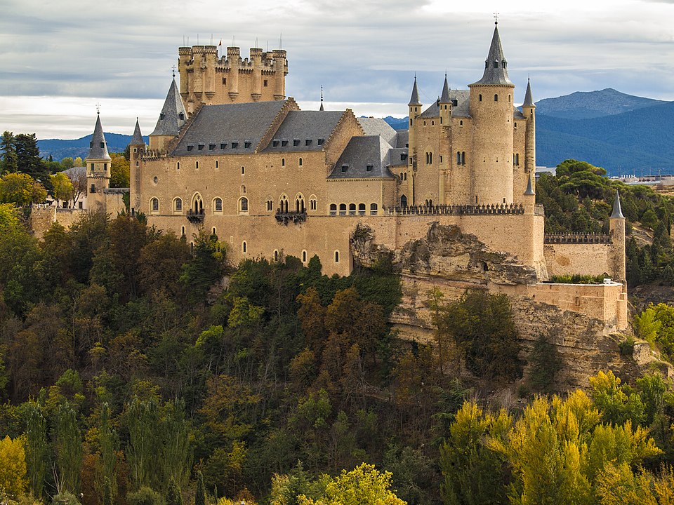
@Heritage Places, Castles & Architecture
06-Jun-2025 08 pm
06-Jun-2025 08 pm
This article uses text information from the Wikipedia article -- Château_du_Haut-Koenigsbourg -- [Wikipedia-Article-Link : https://en.wikipedia.org/wiki/Ch%C3%A2teau_du_Haut-Koenigsbourg ] which is released under the -- Creative Commons Attribution-ShareAlike 4.0 License – [License-Link: https://en.wikipedia.org/wiki/Wikipedia:Text_of_the_Creative_Commons_Attribution-ShareAlike_4.0_International_License ] [List of Principal Authors (5 or less) of the Wikipedia-Article on the date of this Article being Created in this Website: - 85.179.136.88, Peregrine981, Emeraude, Nmusic, AnnHK67] [Use the following Authorship tool to find out the author contributions:- https://xtools.wmcloud.org/authorship ] [The Current Article on this Website has been paraphrased from the above linked corresponding Wikipedia-Article and You may redistribute this, verbatim or modified, provided that you comply with the terms of the Creative Commons Attribution-ShareAlike 4.0 License] [License-Link: https://en.wikipedia.org/wiki/Wikipedia:Text_of_the_Creative_Commons_Attribution-ShareAlike_4.0_International_License ]
This article also uses an image from the Wikipedia article -- Château_du_Haut-Koenigsbourg -- [Wikipedia-Article-Link : https://en.wikipedia.org/wiki/Ch%C3%A2teau_du_Haut-Koenigsbourg ] [Image: A view of the Black Forest and the Alsatian plain from the castle; Wikipedia-Image Author : Drew de F Fawkes] [Wikipedia-Image-Link: https://en.wikipedia.org/wiki/File:Ch%C3%A2teau_du_Haut-K%C5%93nigsbourg,_Alsace.jpg ] [Image Availed Under Creative Commons Attribution 2.0 Generic license;] [License-Link: https://creativecommons.org/licenses/by/2.0/deed.en ] [You may copy, distribute and transmit the work (image) or remix the work (image) and attribute the work (image) with proper license link, complying with the terms of the Creative Commons Attribution 2.0 Generic license in distribution] [License-Link: https://creativecommons.org/licenses/by/2.0/deed.en ] [Please Also Relate to Original Individual Text and Image URLs for More Usage Property and Sharing, Remixing or Attributing the Contents]
[Contents on Wikipedia is covered by -- Disclaimer – [Wikipedia-Disclaimer-Link: https://en.wikipedia.org/wiki/Wikipedia:General_disclaimer ] [Contents in this Website is also covered by Disclaimer linked at the bottom of the Page] [This website article means no intellectual appropriation by any way and only wishes to contribute in sharing of knowledge]
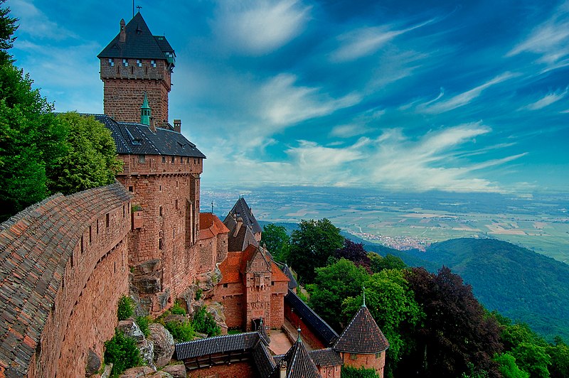
@Heritage Places, Castles & Architecture
05-Jun-2025 07 pm
05-Jun-2025 07 pm
This article uses text information from the Wikipedia article -- Buda_Castle -- [Wikipedia-Article-Link : https://en.wikipedia.org/wiki/Buda_Castle ] which is released under the -- Creative Commons Attribution-ShareAlike 4.0 License – [License-Link: https://en.wikipedia.org/wiki/Wikipedia:Text_of_the_Creative_Commons_Attribution-ShareAlike_4.0_International_License ] [List of Principal Authors (5 or less) of the Wikipedia-Article on the date of this Article being Created in this Website: - Gryffindor, Zello, Diannaa, 31.46.242.118, Matty. 007] [Use the following Authorship tool to find out the author contributions:- https://xtools.wmcloud.org/authorship ] [The Current Article on this Website has been paraphrased from the above linked corresponding Wikipedia-Article and You may redistribute this, verbatim or modified, provided that you comply with the terms of the Creative Commons Attribution-ShareAlike 4.0 License] [License-Link: https://en.wikipedia.org/wiki/Wikipedia:Text_of_the_Creative_Commons_Attribution-ShareAlike_4.0_International_License ]
This article also uses an image from the Wikipedia article -- List_of_castles_in_Hungary -- [Wikipedia-Article-Link : https://en.wikipedia.org/wiki/List_of_castles_in_Hungary ] [Image: Buda Castle; Wikipedia-Image Author : Marc Ryckaert (MJJR) https://commons.wikimedia.org/wiki/User:MJJR ] [Wikipedia-Image-Link: https://en.wikipedia.org/wiki/File:Budapest_Castle_R02.jpg ] [Image Availed Under Creative Commons Attribution 3.0 Unported license;] [License-Link: https://creativecommons.org/licenses/by/3.0/deed.en ] [You may copy, distribute and transmit the work (image) or remix the work (image) and attribute the work (image) with proper license link, complying with the terms of the Creative Commons Attribution 3.0 Unported license in distribution] [License-Link: https://creativecommons.org/licenses/by/3.0/deed.en ] [Please Also Relate to Original Individual Text and Image URLs for More Usage Property and Sharing, Remixing or Attributing the Contents]
[Contents on Wikipedia is covered by -- Disclaimer – [Wikipedia-Disclaimer-Link: https://en.wikipedia.org/wiki/Wikipedia:General_disclaimer ] [Contents in this Website is also covered by Disclaimer linked at the bottom of the Page] [This website article means no intellectual appropriation by any way and only wishes to contribute in sharing of knowledge]
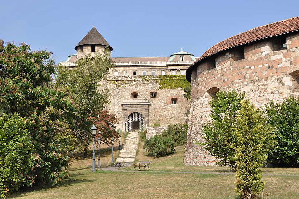
@Heritage Places, Castles & Architecture
31-May-2025 04 am
31-May-2025 04 am
This article uses text information from the Wikipedia article -- Albrechtsburg -- [Wikipedia-Article-Link : https://en.wikipedia.org/wiki/Albrechtsburg ] which is released under the -- Creative Commons Attribution-ShareAlike 4.0 License – [License-Link: https://en.wikipedia.org/wiki/Wikipedia:Text_of_the_Creative_Commons_Attribution-ShareAlike_4.0_International_License ] [List of Principal Authors (5 or less) of the Wikipedia-Article on the date of this Article being Created in this Website: - StephanHoppe, DocWatson42, 78.52.201.219, TiltuM, Perigrinator] [Use the following Authorship tool to find out the author contributions:- https://xtools.wmcloud.org/authorship ] [The Current Article on this Website has been paraphrased from the above linked corresponding Wikipedia-Article and You may redistribute this, verbatim or modified, provided that you comply with the terms of the Creative Commons Attribution-ShareAlike 4.0 License] [License-Link: https://en.wikipedia.org/wiki/Wikipedia:Text_of_the_Creative_Commons_Attribution-ShareAlike_4.0_International_License ]
This article also uses an image from the Wikipedia article – Albrechtsburg -- [Wikipedia-Article-Link : https://en.wikipedia.org/wiki/Albrechtsburg ] [Image : Albrechtsburg and Meissen Cathedral on the Elbe river; Wikipedia-Image-Author: Stephan Hoppe] [Wikipedia-Image-Link: https://en.wikipedia.org/wiki/File:Albrechtsburg-2007.jpg ] [Image Availed Under Creative Commons Attribution-Share Alike 3.0 Unported license.] [License-Link: https://creativecommons.org/licenses/by-sa/3.0/deed.en ] [You may copy, distribute and transmit the work (image) or share (alike) the work (image), provided that you comply with the terms of the Creative Commons Attribution-Share Alike 3.0 Unported license or other compatible license in distribution] [License-Link: https://creativecommons.org/licenses/by-sa/3.0/deed.en ] [Please Also Relate to Original Individual Text and Image URLs for More Usage Property and Sharing, Remixing or Attributing the Contents]
[Contents on Wikipedia is covered by -- Disclaimer – Wikipedia-Disclaimer-Link: https://en.wikipedia.org/wiki/Wikipedia:General_disclaimer ] [Contents in this Website is also covered by Disclaimer linked at the bottom of the Page] [This website article means no intellectual appropriation by any way and only wishes to contribute in sharing of knowledge]
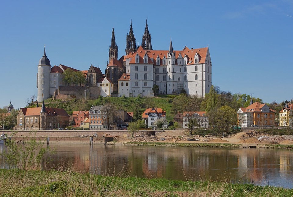
@Heritage Places, Castles & Architecture
29-May-2025 06 am
29-May-2025 06 am
This article uses text information from the Wikipedia article -- Eltz_Castle -- [Wikipedia-Article-Link : https://en.wikipedia.org/wiki/Eltz_Castle ] which is released under the -- Creative Commons Attribution-ShareAlike 4.0 License – [License-Link: https://en.wikipedia.org/wiki/Wikipedia:Text_of_the_Creative_Commons_Attribution-ShareAlike_4.0_International_License ] [List of Principal Authors (5 or less) of the Wikipedia-Article on the date of this Article being Created in this Website: - 68.204.79.237, 146.199.128.161, 217.226.229.54, ZH2010, David. cormier] [Use the following Authorship tool to find out the author contributions:- https://xtools.wmcloud.org/authorship ] [The Current Article on this Website has been paraphrased from the above linked corresponding Wikipedia-Article and You may redistribute this, verbatim or modified, provided that you comply with the terms of the Creative Commons Attribution-ShareAlike 4.0 License] [License-Link: https://en.wikipedia.org/wiki/Wikipedia:Text_of_the_Creative_Commons_Attribution-ShareAlike_4.0_International_License ]
[Image: Eltz Castle on a Misty Day; Image-Author : Taylor Marx][Image_Source-Link: https://www.pexels.com/photo/eltz-castle-on-a-misty-day-11448182/ ] [License-Link: https://www.pexels.com/license/ ] [Please Also Relate to Original Individual Text and Image URLs for More Usage Property and Sharing, Remixing or Attributing the Contents]
[Contents on Wikipedia is covered by -- Disclaimer – [Wikipedia-Disclaimer-Link : https://en.wikipedia.org/wiki/Wikipedia:General_disclaimer ] [Contents in this Website is also covered by Disclaimer linked at the bottom of the Page] [This website article means no intellectual appropriation by any way and only wishes to contribute in sharing of knowledge]
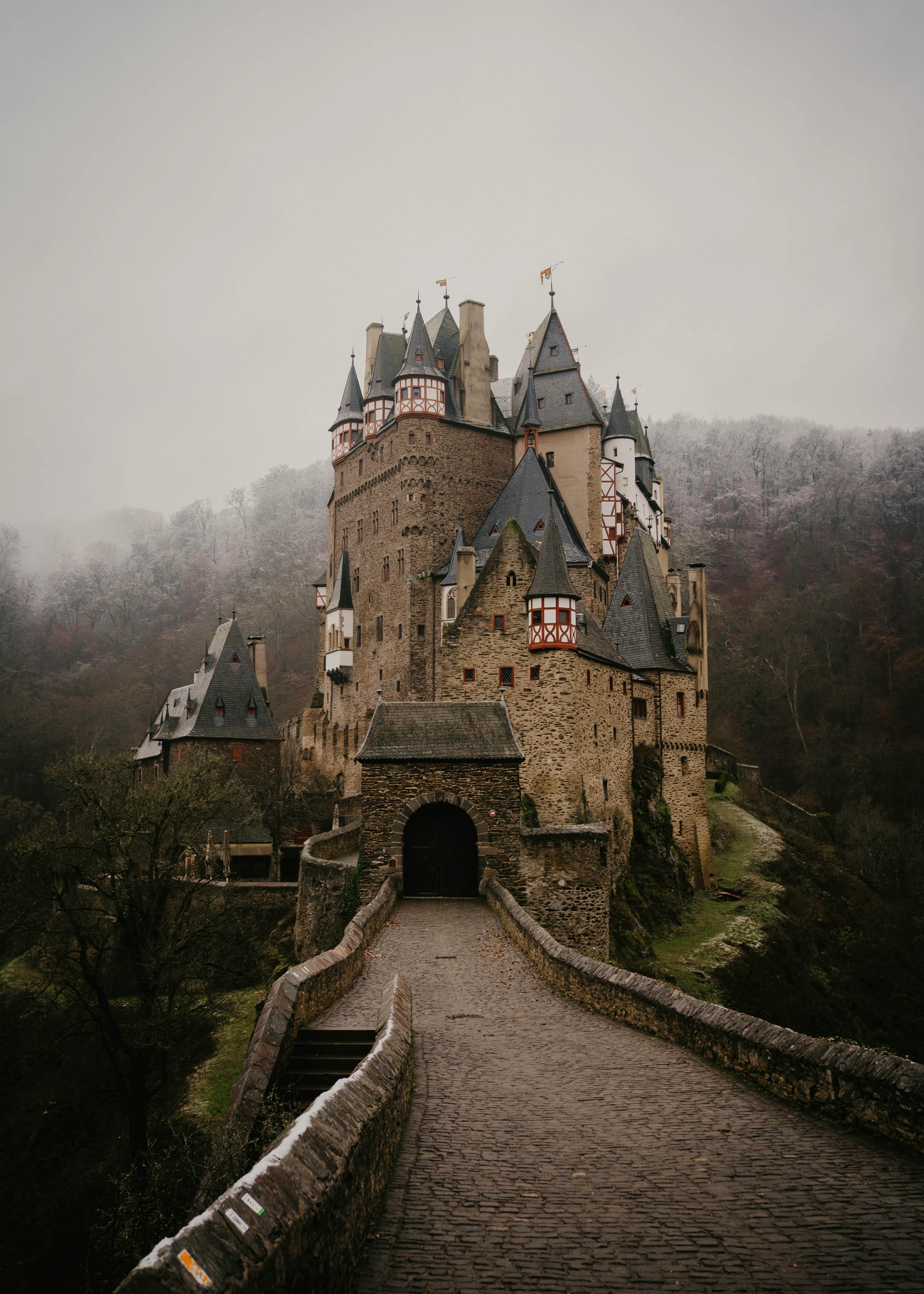
@Heritage Places, Castles & Architecture
24-May-2025 04 am
24-May-2025 04 am
This article uses text information from the Wikipedia article -- Maison_carrée -- [Wikipedia-Article-Link : https://en.wikipedia.org/wiki/Maison_carr%C3%A9e `] which is released under the -- Creative Commons Attribution-ShareAlike 4.0 License – [License-Link: https://en.wikipedia.org/wiki/Wikipedia:Text_of_the_Creative_Commons_Attribution-ShareAlike_4.0_International_License ] [List of Principal Authors (5 or less) of the Wikipedia-Article on the date of this Article being Created in this Website: - Wetman, ChrisO~enwiki, 2A02:908:4E3:9520:89DA:C3AC:3331:92CC, James Arboghast, Emilyhooge] [Use the following Authorship tool to find out the author contributions:- https://xtools.wmcloud.org/authorship ] [The Current Article on this Website has been paraphrased from the above linked corresponding Wikipedia-Article and You may redistribute this, verbatim or modified, provided that you comply with the terms of the Creative Commons Attribution-ShareAlike 4.0 License] [License-Link: https://en.wikipedia.org/wiki/Wikipedia:Text_of_the_Creative_Commons_Attribution-ShareAlike_4.0_International_License ]
This article also uses an image from the Wikipedia article -- Maison_carrée -- [Wikipedia-Article-Link : https://en.wikipedia.org/wiki/Maison_carr%C3%A9e ] [Image: Front view of Maison_carrée; Wikipedia-Image-Author: Fabhuard] [Wikipedia-Image-Link: https://en.wikipedia.org/wiki/File:Maison_carr%C3%A9e_(3).jpg ] [Image Availed Under Creative Commons Attribution-Share Alike 4.0 International license;] [License-Link: https://creativecommons.org/licenses/by-sa/4.0/deed.en ] [You may copy, distribute and transmit the work (image) or share (alike) the work (image), provided that you comply with the terms of the Creative Commons Attribution-Share Alike 4.0 International license or other compatible license in distribution] [License-Link: https://creativecommons.org/licenses/by-sa/4.0/deed.en ] [Please Also Relate to Original Individual Text and Image URLs for More Usage Property and Sharing, Remixing or Attributing the Contents]
[Contents on Wikipedia is covered by -- Disclaimer – Wikipedia-Disclaimer-Link: https://en.wikipedia.org/wiki/Wikipedia:General_disclaimer ] [Contents in this Website is also covered by Disclaimer linked at the bottom of the Page] [This website article means no intellectual appropriation by any way and only wishes to contribute in sharing of knowledge]
.jpg)
@Heritage Places, Castles & Architecture
23-May-2025 05 am
23-May-2025 05 am
This article uses text information from the Wikipedia article -- Kriebstein_Castle -- [Wikipedia-Article-Link : https://en.wikipedia.org/wiki/Kriebstein_Castle ] which is released under the -- Creative Commons Attribution-ShareAlike 4.0 License – [License-Link: https://en.wikipedia.org/wiki/Wikipedia:Text_of_the_Creative_Commons_Attribution-ShareAlike_4.0_International_License ] [List of Principal Authors (5 or less) of the Wikipedia-Article on the date of this Article being Created in this Website: - Bermicourt, Andrewrabbott, BD2412, Tim!, William Avery] [Use the following Authorship tool to find out the author contributions:- https://xtools.wmcloud.org/authorship ] [The Current Article on this Website has been paraphrased from the above linked corresponding Wikipedia-Article and You may redistribute this, verbatim or modified, provided that you comply with the terms of the Creative Commons Attribution-ShareAlike 4.0 License] [License-Link: https://en.wikipedia.org/wiki/Wikipedia:Text_of_the_Creative_Commons_Attribution-ShareAlike_4.0_International_License ]
This article also uses an image from the Wikipedia article -- Kriebstein_Castle -- [Wikipedia-Article-Link : https://en.wikipedia.org/wiki/Kriebstein_Castle ] [Image: Kriebstein Castle; Wikipedia-Image Author : Maja Dumat from Deutschland (Germany)] [Wikipedia-Image-Link: https://en.wikipedia.org/wiki/File:Burg_Kriebstein.jpg ] [Image Availed Under Creative Commons Attribution 2.0 Generic License;] [License-Link: https://creativecommons.org/licenses/by/2.0/deed.en ] [You may copy, distribute and transmit the work (image) or remix the work (image) and attribute the work (image) with proper license link, complying with the terms of the Creative Commons Attribution 2.0 Generic License in distribution] [License-Link: https://creativecommons.org/licenses/by/2.0/deed.en ] [Please Also Relate to Original Individual Text and Image URLs for More Usage Property and Sharing, Remixing or Attributing the Contents]
[Contents on Wikipedia is covered by -- Disclaimer – [Wikipedia-Disclaimer-Link: https://en.wikipedia.org/wiki/Wikipedia:General_disclaimer ] [Contents in this Website is also covered by Disclaimer linked at the bottom of the Page] [This website article means no intellectual appropriation by any way and only wishes to contribute in sharing of knowledge]
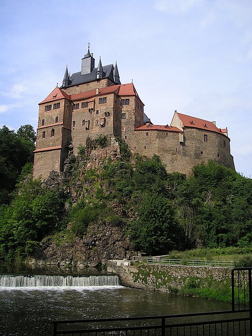
@Heritage Places, Castles & Architecture
19-May-2025 05 am
19-May-2025 05 am
This article uses text information from the Wikipedia article -- Frederiksborg_Castle -- [Wikipedia-Article-Link : https://en.wikipedia.org/wiki/Frederiksborg_Castle ] which is released under the -- Creative Commons Attribution-ShareAlike 4.0 License – [License-Link: https://creativecommons.org/licenses/by-sa/4.0/deed.en ( https://en.wikipedia.org/wiki/Wikipedia:Text_of_the_Creative_Commons_Attribution-ShareAlike_4.0_International_License )] [List of Principal Authors (5 or less) of the Wikipedia-Article on the date of this Article being Created in this Website: - Ipigott, InternetArchiveBot, Nyxion303, Ramblersen, Sfdan] [Use the following Authorship tool to find out the author contributions:- https://xtools.wmcloud.org/authorship ] [The Current Article on this Website has been paraphrased from the above linked corresponding Wikipedia-Article and You may redistribute this, verbatim or modified, provided that you comply with the terms of the Creative Commons Attribution-ShareAlike 4.0 License] [License-Link: https://creativecommons.org/licenses/by-sa/4.0/deed.en ( https://en.wikipedia.org/wiki/Wikipedia:Text_of_the_Creative_Commons_Attribution-ShareAlike_4.0_International_License )]
[Image : Green Water near the Frederiksborg Castle; Image-Author : Ivan Dražić][Image_Source-Link: https://www.pexels.com/photo/green-water-near-the-frederiksborg-castle-8892072/ ] [License-Link: https://www.pexels.com/license/ ] [Please Also Relate to Original Individual Text and Image URLs for More Usage Property and Sharing, Remixing or Attributing the Contents] [Contents on Wikipedia is covered by -- Disclaimer – [Wikipedia-Disclaimer-Link : https://en.wikipedia.org/wiki/Wikipedia:General_disclaimer ] [Contents in this Website is also covered by Disclaimer linked at the bottom of the Page] [This website article means no intellectual appropriation by any way and only wishes to contribute in sharing of knowledge]
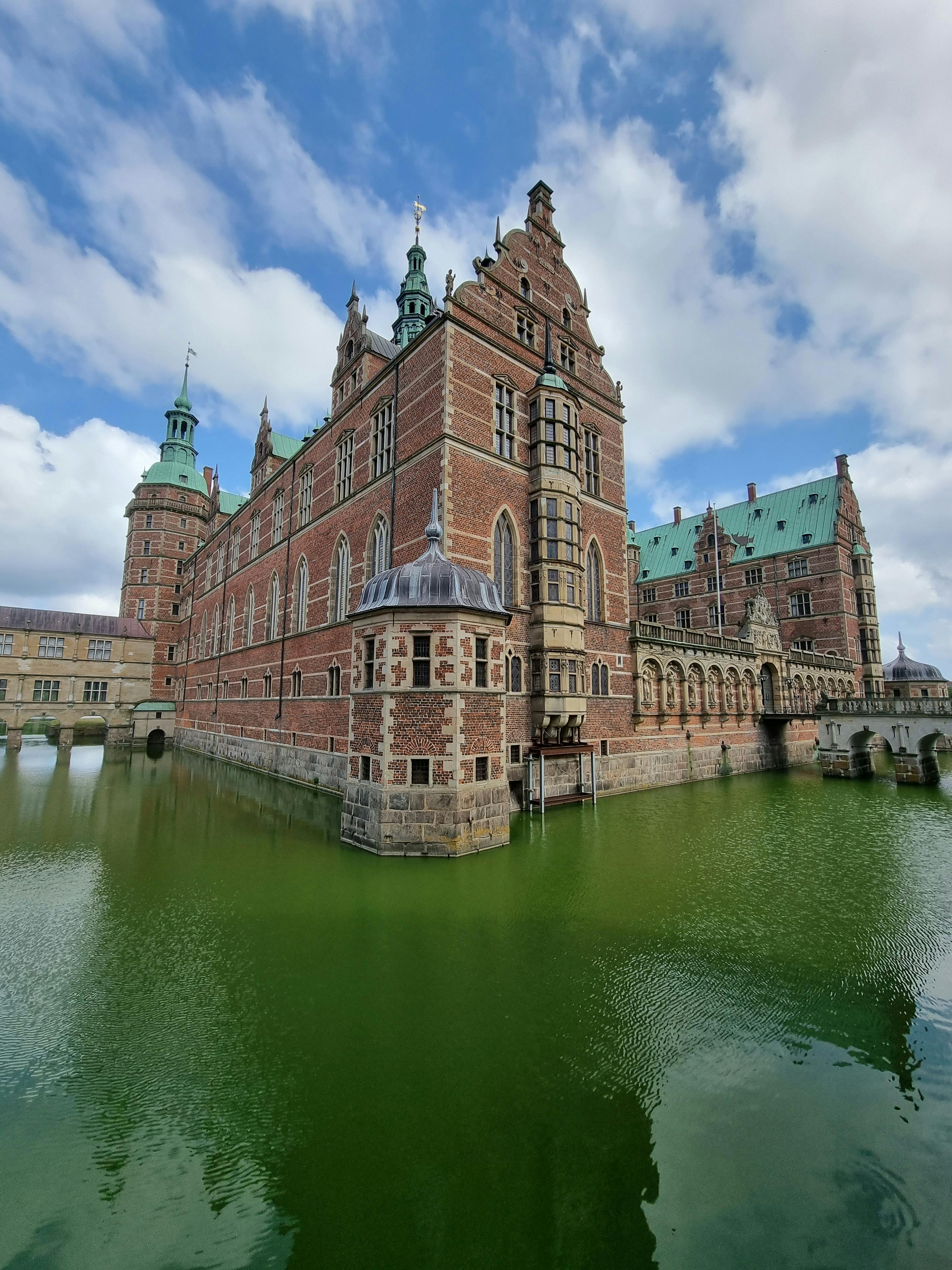
@Heritage Places, Castles & Architecture
18-May-2025 02 am
18-May-2025 02 am
This article uses text information from the Wikipedia article -- Gravensteen -- [Wikipedia-Article-Link : https://en.wikipedia.org/wiki/Gravensteen ] which is released under the -- Creative Commons Attribution-ShareAlike 4.0 License – [License-Link: https://creativecommons.org/licenses/by-sa/4.0/deed.en ( https://en.wikipedia.org/wiki/Wikipedia:Text_of_the_Creative_Commons_Attribution-ShareAlike_4.0_International_License )] [List of Principal Authors (5 or less) of the Wikipedia-Article on the date of this Article being Created in this Website: - Brigade Piron, EditorOnOccasion, Dithy, Menacinghat, Lordelicht] [Use the following Authorship tool to find out the author contributions:- https://xtools.wmcloud.org/authorship )] [The Current Article on this Website has been paraphrased from the above linked corresponding Wikipedia-Article and You may redistribute this, verbatim or modified, provided that you comply with the terms of the Creative Commons Attribution-ShareAlike 4.0 License] [License-Link: https://creativecommons.org/licenses/by-sa/4.0/deed.en ( https://en.wikipedia.org/wiki/Wikipedia:Text_of_the_Creative_Commons_Attribution-ShareAlike_4.0_International_License )]
This article also uses an image from the Wikipedia article – Gravensteen -- [Wikipedia-Article-Link : https://en.wikipedia.org/wiki/Gravensteen ] [Image: The Gravensteen, seen from the south-east; Wikipedia-Image-Author : Marc Ryckaert (MJJR) https://commons.wikimedia.org/wiki/User:MJJR ] [Wikipedia-Image-Link: https://en.wikipedia.org/wiki/File:Gent_Gravensteen_R01.jpg ] [Image Availed Under Creative Commons Attribution 3.0 Unported license;] [License-Link: https://creativecommons.org/licenses/by/3.0/deed.en ] [You may copy, distribute and transmit the work (image) or remix the work (image) and attribute the work (image) with proper license link, complying with the terms of the Creative Commons Attribution 3.0 Unported License in distribution] [License-Link: https://creativecommons.org/licenses/by/3.0/deed.en ] [Please Also Relate to Original Individual Text and Image URLs for More Usage Property and Sharing, Remixing or Attributing the Contents]
[Contents on Wikipedia is covered by -- Disclaimer – Wikipedia-Disclaimer-Link: https://en.wikipedia.org/wiki/Wikipedia:General_disclaimer ] [Contents in this Website is also covered by Disclaimer linked at the bottom of the Page] [This website article means no intellectual appropriation by any way and only wishes to contribute in sharing of knowledge]
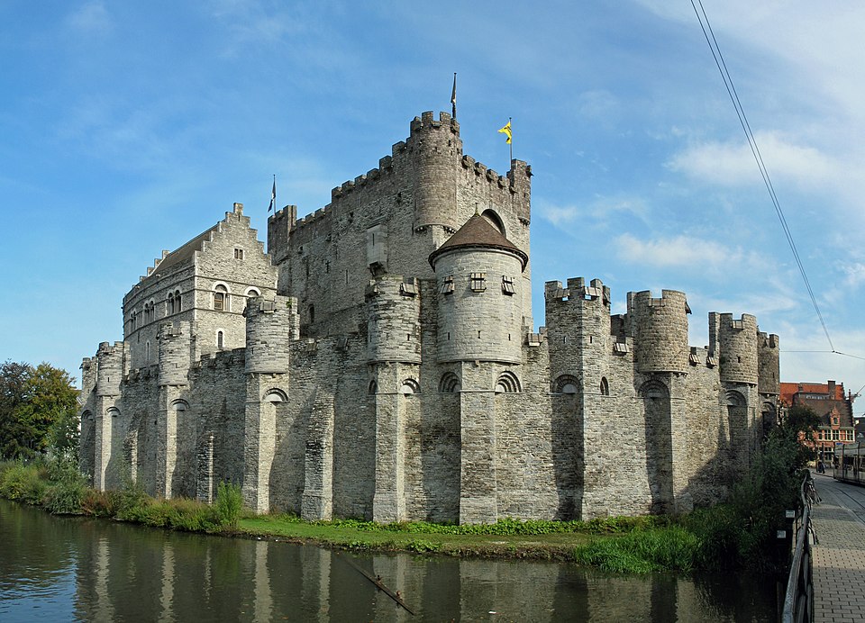
@Heritage Places, Castles & Architecture
16-May-2025 09 am
16-May-2025 09 am
This article uses text information from the Wikipedia article -- Bojnice_Castle -- [Wikipedia-Article-Link : https://en.wikipedia.org/wiki/Bojnice_Castle ] which is released under the -- Creative Commons Attribution-ShareAlike 4.0 License – [License-Link: https://en.wikipedia.org/wiki/Wikipedia:Text_of_the_Creative_Commons_Attribution-ShareAlike_4.0_International_License ] [List of Principal Authors (5 or less) of the Wikipedia-Article on the date of this Article being Created in this Website: - ItsMeaow, Juro, Brutalhovno, Contributor jr, 31.46.248.191] [Use the following Authorship tool to find out the author contributions:- https://xtools.wmcloud.org/authorship ] [The Current Article on this Website has been paraphrased from the above linked corresponding Wikipedia-Article and You may redistribute this, verbatim or modified, provided that you comply with the terms of the Creative Commons Attribution-ShareAlike 4.0 License] [License-Link: https://en.wikipedia.org/wiki/Wikipedia:Text_of_the_Creative_Commons_Attribution-ShareAlike_4.0_International_License ]
This article also uses an image from the Wikipedia article -- Bojnice_Castle -- [Wikipedia-Article-Link : https://en.wikipedia.org/wiki/Bojnice_Castle ] [Image : Bojnice Castle, 2007; Wikipedia-Image-Author: Pufacz https://commons.wikimedia.org/wiki/User:Pufacz ] [Wikipedia-Image-Link: https://en.wikipedia.org/wiki/File:Castle_Bojnice_SK.jpg ] [The copyright holder of this work, released this work into the public domain. This applies worldwide; In some countries this may not be legally possible; if so: the copyright holder grant anyone the right to use this work for any purpose, without any conditions, unless such conditions are required by law.] [Please Also Relate to Original Individual Text and Image URLs for More Usage Property and Sharing, Remixing or Attributing the Contents]
[Contents on Wikipedia is covered by -- Disclaimer – [Wikipedia-Disclaimer-Link: https://en.wikipedia.org/wiki/Wikipedia:General_disclaimer ] [Contents in this Website is also covered by Disclaimer linked at the bottom of the Page] [This website article means no intellectual appropriation by any way and only wishes to contribute in sharing of knowledge]